Zeri
Zeri | |
|---|---|
| Comune di Zeri | |
 | |
 Coat of arms | |
Location of Zeri  | |
 Zeri Location of Zeri in Italy | |
| Coordinates: 44°21′N 09°46′E / 44.350°N 9.767°ECoordinates: 44°21′N 09°46′E / 44.350°N 9.767°E | |
| Country | Italy |
| Region | Tuscany |
| Province | Massa and Carrara (MS) |
| Frazioni | Adelano, Antara, Bosco di Rossano, Bergugliara, Castello, Codolo, Coloretta, Ferdana, Fichi, La Dolce, Noce, Paretola, Patigno, Rossano, Serralunga, Valditermine, Villaggio Aracci, Villaggio Passo del Rastrello |
| Government | |
| • Mayor | Cristian Petacchi |
| Area | |
| • Total | 73 km2 (28 sq mi) |
| Elevation | 708 m (2,323 ft) |
| Population (31 December 2015)[2] | |
| • Total | 1,094 |
| • Density | 15/km2 (39/sq mi) |
| Demonym(s) | Zeraschi |
| Time zone | UTC+1 (CET) |
| • Summer (DST) | UTC+2 (CEST) |
| Postal code | 54029 |
| Dialing code | 0187 |
| Website | Official website |


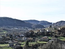
Zeri is a comune in the province of Massa and Carrara, Tuscany, central Italy. It is located in the Lunigiana traditional region.
References[]
- ^ "Superficie di Comuni Province e Regioni italiane al 9 ottobre 2011". Italian National Institute of Statistics. Retrieved 16 March 2019.
- ^ "Popolazione Residente al 1° Gennaio 2018". Italian National Institute of Statistics. Retrieved 16 March 2019.
| Wikimedia Commons has media related to Zeri. |
Categories:
- Cities and towns in Tuscany
- Municipalities of the Province of Massa-Carrara
- Province of Massa-Carrara geography stubs