Zillertal Alps
| Zillertal Alps | |
|---|---|
 The Zillertal Alps | |
| Highest point | |
| Peak | Hochfeiler |
| Elevation | 3,510 m (11,520 ft) |
| Coordinates | 46°58′22″N 11°43′34″E / 46.97278°N 11.72611°E |
| Geography | |
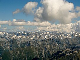
 Zillertal Alps (in red) within the Alps
| |
| Countries | Austria and Italy |
| States | Tyrol, Salzburg and South Tyrol |
| Range coordinates | 47°00′N 11°55′E / 47.000°N 11.917°ECoordinates: 47°00′N 11°55′E / 47.000°N 11.917°E |
| Parent range | Central Eastern Alps |

The Zillertal Alps (Italian: Alpi Aurine; German: Zillertaler Alpen) are a mountain range of the Central Eastern Alps on the border of Austria and Italy.
Name[]
The range is named after the Zillertal (Ziller river valley) on its north.
Geography[]
The range is bounded by the Tuxerjoch mountain pass to the north (separating it from the Tux Alps); the Birnlücke - Forcella del Picco pass to the east (separating it from the Hohe Tauern); the Eisack and its tributary the Rienz to the south (separating it from the Southern Limestone Alps); and the Brenner Pass to the west (separating it from the Stubai Alps).
Sub-groups[]
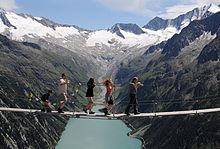
Simple suspension bridge in the Zillertal Alps

The Große Löffler (3,376 m) seen from the Gigalitz
The Zillertal Alps are divided into the following sub-groups:
- Tux main ridge (Tuxer Hauptkamm)
- Zillertal main ridge (Zillertaler Hauptkamm) and side ridges
This is further sub-divided as follows: Hauptkamm, Hochstellerkamm, Greinerkamm, Mörchen and Igentkamm, Floitenkamm, Ahornkamm, Riblerkamm, Magnerkamm. - Reichenspitze Group and eastern Ziller ridges
This is further subdivided as follows: Reichenspitzkamm, Gerloskamm, Schönachkamm, Wimmerkamm, Schwarzachkamm, Zillerkamm, Klockerkarstock. - Pfunderer Mountains (Pfunderer Berge)
This is further subdivided as follows: Kreuzspitzkamm, Plattspitzkamm, Wurmaulkamm, Grubbachkamm, Mühlwalder Kamm.
Peaks[]
The main peaks of the Zillertal Alps are:
| Peak | Elevation (m/ft) | |
|---|---|---|
| Hochfeiler | 3,510 | 11,515 |
| Großer Möseler | 3,486 | 11,438 |
| Olperer | 3,480 | 11,418 |
| Hochfernerspitze | 3,463 | 11,362 |
| Schrammacher | 3,410 | 11,190 |
| Turnerkamp | 3,422 | 11,228 |
| Großer Löffler | 3,382 | 11,096 |
| 3,380 | 11,090 | |
| Hoher Weißzint | 3,371 | 11,060 |
| Schwarzenstein | 3,370 | 11,057 |
| Reichenspitze | 3,305 | 10,844 |
| 3,287 | 10,785 | |
| Rauhkofel | 3,251 | 10,666 |
| Hoher Riffler | 3,231 | 10,600 |
| 3,225 | 10,581 | |
| 3,148 | 10,328 | |
| Napfspitze | 3,144 | 10,314 |
| Wilde Kreuzspitze | 3,135 | 10,286 |
| 3,085 | 10,122 | |
| Gitschberg | 2,510 | 8,230 |

Passes[]
The main mountain passes of the Zillertal Alps are:
| Mountain pass | Location | Type | Elevation (m/ft) | |
|---|---|---|---|---|
| to Sand in Taufers | snow | 3130 | 10,270 | |
| Floiten Valley to Sand in Taufers | snow | 3054 | 10,020 | |
| Zemmtal to Wipptal | footpath | 2960 | 9712 | |
| Mayrhofen to Ahrntal | footpath | 2868 | 9410 | |
| Mayrhofen to Ahrntal | footpath | 2658 | 8721 | |
| Krimml to Ahrntal | footpath | 2634 | 8642 | |
| Mayrhofen to Ahrntal | footpath | 2555 | 8383 | |
| Lappach to Ahrntal | footpath | 2366 | 7763 | |
| Tuxertal to Wipptal | footpath | 2346 | 7697 | |
| Pfitscherjoch | Zemmtal to Sterzing | footpath | 2248 | 7376 |
External links[]
| Wikimedia Commons has media related to Zillertaler Alpen. |
| show Mountain ranges of the Central Eastern Alps according to the AVE |
|---|

| show Authority control |
|---|
Categories:
- Mountain ranges of the Alps
- Zillertal Alps
- Mountain ranges of Tyrol (state)
- Rieserferner-Ahrn Nature Park