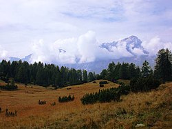
Zoldo Alto
Zoldo Alto | |
|---|---|
 | |
 Zoldo Alto Location of Zoldo Alto in Italy | |
| Coordinates: 46°22′31″N 12°7′35″E / 46.37528°N 12.12639°ECoordinates: 46°22′31″N 12°7′35″E / 46.37528°N 12.12639°E | |
| Country | |
| Region | Veneto |
| Province | Belluno (BL) |
| Comune | Val di Zoldo |
| Area | |
| • Total | 619 km2 (239 sq mi) |
| Elevation | 1,177 m (3,862 ft) |
| Population | |
| • Total | 1,183 |
| • Density | 1.9/km2 (4.9/sq mi) |
| Demonym(s) | Zoldani |
| Time zone | UTC+1 (CET) |
| • Summer (DST) | UTC+2 (CEST) |
| Postal code | 32010 |
| Dialing code | 0437 |
| Patron saint | |
| Saint day | 6 December |
| Website | Official website |

Zoldo Alto is a town in the province of Belluno, Veneto, Italy. It's a frazione of Val di Zoldo since 2016. It is noted for its ski resort. A boarding school was established in the 1950s which was used by the children during spring and autumn and senior citizens during the winter months.[2] On 31 January 1991 the municipality was affected by the Ru Duelle Roe landslide, which affected the right flank of the Ru delle Roe stream in the dolomitic slopes of and .[3] The region is a producer of fresh and mature cheeses.[4]
References[]
- ^ All demographics and other statistics from the Italian statistical institute (Istat)
- ^ Lubinski, Christina; Fear, Jeffrey; Pérez, Paloma Fernández (18 July 2013). Family Multinationals: Entrepreneurship, Governance, and Pathways to Internationalization. Routledge. p. 1. ISBN 978-1-135-04492-3.
- ^ Casale, Riccardo; Margottini, Claudio (1 January 1999). Floods and Landslides: Integrated Risk Assessment: Integrated Risk Assessment ; with 30 Tables. Springer Science & Business Media. p. 298. ISBN 978-3-540-64981-6.
- ^ The Italian Food Guide: The Ultimate Guide to the Regional Foods of Italy. Touring Editore. 2002. p. 171. ISBN 978-88-365-2538-6.
External links[]
| Wikimedia Commons has media related to Zoldo Alto. |
| Authority control |
|
|---|
This article on a location in Veneto is a stub. You can help Wikipedia by . |
Categories:
- Cities and towns in Veneto
- Veneto geography stubs