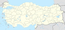
Cıfıtkalesi Islet
Native name: Cıfıtkalesi Adası | |
|---|---|
 Cıfıtkalesi | |
 Cıfıtkalesi Islet | |
| Geography | |
| Coordinates | 38°02′44″N 26°51′18″E / 38.04556°N 26.85500°E |
| Administration | |
| İl (province) | İzmir Province |
| İlçe | Seferihisar |
Çıfıtkalesi Islet (literally "Jewish Castle Island") is an uninhabited Aegean islet in Turkey.
The islet at 38°02′44″N 26°51′18″E / 38.04556°N 26.85500°E [1] is administratively a part of Seferihisar ilçe (district) of İzmir Province. It is very close to mainland (Anatolia); the closest point to mainland is less than 100 metres (330 ft). The longest dimension of the islet is about 250 metres (820 ft).[2]
In antiquity the islet was connected to the mainland (Myonnesos). Currently, the connection has been broken, but the sea level is shallow and it is possible to walk to the islet. There are some ruins on the islet.[citation needed]
References[]
Categories:
- Aegean islands
- Islands of Turkey
- Islands of İzmir Province
- Seferihisar District
