Élise-Daucourt
Élise-Daucourt | |
|---|---|
 St. Nicholas' Church in Daucourt | |
show Location of Élise-Daucourt | |
 Élise-Daucourt | |
| Coordinates: 49°02′48″N 4°52′04″E / 49.0467°N 4.8678°ECoordinates: 49°02′48″N 4°52′04″E / 49.0467°N 4.8678°E | |
| Country | France |
| Region | Grand Est |
| Department | Marne |
| Arrondissement | Châlons-en-Champagne |
| Canton | Argonne Suippe et Vesle |
| Intercommunality | Argonne Champenoise |
| Government | |
| • Mayor (2020–2026) | Guillaume Achard-Corompt |
| Area 1 | 15.32 km2 (5.92 sq mi) |
| Population (Jan. 2018)[1] | 90 |
| • Density | 5.9/km2 (15/sq mi) |
| Time zone | UTC+01:00 (CET) |
| • Summer (DST) | UTC+02:00 (CEST) |
| INSEE/Postal code | 51228 /51800 |
| 1 French Land Register data, which excludes lakes, ponds, glaciers > 1 km2 (0.386 sq mi or 247 acres) and river estuaries. | |


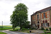
Élise-Daucourt is a commune in the Marne department in north-eastern France. The commune consists of 2 villages, Élise and Daucourt, which are 1 mile apart. Both villages were separate communes until 1965, when they merged. Since the merger Élise is often called Élise-Daucourt. Both villages lie about 6 km south of Sainte-Menehould, the nearest regional town.
See also[]

Church of St. Julian in Élise
Former town hall of Élise

Rural corner in Élise


References[]
- ^ "Populations légales 2018". INSEE. 28 December 2020.
External links[]
| Wikimedia Commons has media related to Élise-Daucourt. |
This Marne geographical article is a stub. You can help Wikipedia by . |
Categories:
- Communes of Marne (department)
- Marne (department) geography stubs