Øyslebø (municipality)
Øyslebø herred | |
|---|---|
 Vest-Agder within Norway | |
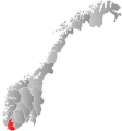
 Øyslebø within Vest-Agder | |
| Coordinates: 58°10′10″N 07°33′15″E / 58.16944°N 7.55417°ECoordinates: 58°10′10″N 07°33′15″E / 58.16944°N 7.55417°E | |
| Country | Norway |
| County | Vest-Agder |
| District | Sørlandet |
| Established | 1 Jan 1899 |
| Disestablished | 1 Jan 1964 |
| Administrative centre | Øyslebø |
| Area | |
| • Total | 157 km2 (61 sq mi) |
| *Area at municipal dissolution. | |
| Population (1964) | |
| • Total | 1,098 |
| • Density | 7.0/km2 (18/sq mi) |
| Time zone | UTC+01:00 (CET) |
| • Summer (DST) | UTC+02:00 (CEST) |
| ISO 3166 code | NO-1021 |
| Preceded by | Øyslebø og Laudal in 1899 |
| Succeeded by | Marnardal in 1964 |

Øyslebø is a former municipality that was located in the old Vest-Agder county in Norway. The 157-square-kilometre (61 sq mi) municipality existed from 1899 until its dissolution in 1964. The administrative centre was the village of Øyslebø where Øyslebø Church is located. Øyslebø municipality was located in part of the present-day municipality of Lindesnes in Agder county.[1]
History[]

The municipality of Øyslebø was established on 1 January 1899 when the old municipality of Øyslebø og Laudal was split into two separate municipalities: Laudal and Øyslebø (population: 991). During the 1960s, there were many municipal mergers across Norway due to the work of the Schei Committee. On 1 January 1964, the Brunvatne area of Øyslebø (population: 44) was transferred to the neighboring municipality of Søgne. Also on that date, the rest of Øyslebø was merged with the neighboring municipalities of Laudal and Bjelland as well as a portion of Finsland to form the new municipality of Marnardal. Prior to the merger, Øyslebø had a population of 1,068.[2]
Name[]
The municipality (originally the parish) of Øyslebø (Old Norse: Øyðslubœr) is named after the old Øyslebø farm, where Øyslebø Church is located. The name is derived from the old river name, Øyðsla.[3] The name was previously spelled Øslebø or Øislebø.
Government[]
All municipalities in Norway, including Øyslebø, are responsible for primary education (through 10th grade), outpatient health services, senior citizen services, unemployment and other social services, zoning, economic development, and municipal roads. The municipality was governed by a municipal council of elected representatives, which in turn elected a mayor.[4]
Municipal council[]
The municipal council (Herredsstyre) of Øyslebø was made up of representatives that were elected to four year terms. The party breakdown of the final municipal council was as follows:
| Party Name (in Norwegian) | Number of representatives | |
|---|---|---|
| Labour Party (Arbeiderpartiet) | 6 | |
| Christian Democratic Party (Kristelig Folkeparti) | 1 | |
| Centre Party (Senterpartiet) | 6 | |
| Liberal Party (Venstre) | 4 | |
| Total number of members: | 17 | |
| Party Name (in Norwegian) | Number of representatives | |
|---|---|---|
| Labour Party (Arbeiderpartiet) | 6 | |
| Farmers' Party (Bondepartiet) | 8 | |
| Liberal Party (Venstre) | 3 | |
| Total number of members: | 17 | |
| Party Name (in Norwegian) | Number of representatives | |
|---|---|---|
| Labour Party (Arbeiderpartiet) | 6 | |
| Joint List(s) of Non-Socialist Parties (Borgerlige Felleslister) | 10 | |
| Total number of members: | 16 | |
| Party Name (in Norwegian) | Number of representatives | |
|---|---|---|
| Labour Party (Arbeiderpartiet) | 6 | |
| Joint List(s) of Non-Socialist Parties (Borgerlige Felleslister) | 10 | |
| Total number of members: | 16 | |
| Party Name (in Norwegian) | Number of representatives | |
|---|---|---|
| Labour Party (Arbeiderpartiet) | 7 | |
| Joint List(s) of Non-Socialist Parties (Borgerlige Felleslister) | 9 | |
| Total number of members: | 16 | |
| Party Name (in Norwegian) | Number of representatives | |
|---|---|---|
| Labour Party (Arbeiderpartiet) | 7 | |
| Joint list of the Farmers' Party (Bondepartiet) and the Liberal Party (Venstre) | 9 | |
| Total number of members: | 16 | |
See also[]
References[]
- ^ Store norske leksikon. "Øyslebø" (in Norwegian). Retrieved 6 December 2016.
- ^ Jukvam, Dag (1999). "Historisk oversikt over endringer i kommune- og fylkesinndelingen" (PDF) (in Norwegian). Statistisk sentralbyrå.
- ^ Rygh, Oluf (1912). Norske gaardnavne: Lister og Mandals amt (in Norwegian) (9 ed.). Kristiania, Norge: W. C. Fabritius & sønners bogtrikkeri. p. 107.
- ^ Hansen, Tore, ed. (12 May 2016). "kommunestyre". Store norske leksikon (in Norwegian). Kunnskapsforlaget. Retrieved 22 November 2020.
- ^ "Kommunevalgene og Ordførervalgene 1959" (PDF) (in Norwegian). Oslo: Statistisk sentralbyrå. 1960. Retrieved 22 November 2020.
- ^ "Kommunevalgene og Ordførervalgene 1955" (PDF) (in Norwegian). Oslo: Statistisk sentralbyrå. 1957. Retrieved 22 November 2020.
- ^ "Kommunevalgene og Ordførervalgene 1951" (PDF) (in Norwegian). Oslo: Statistisk sentralbyrå. 1952. Retrieved 22 November 2020.
- ^ "Kommunevalgene og Ordførervalgene 1947" (PDF) (in Norwegian). Oslo: Statistisk sentralbyrå. 1948. Retrieved 22 November 2020.
- ^ "Kommunevalgene og Ordførervalgene 1945" (PDF) (in Norwegian). Oslo: Statistisk sentralbyrå. 1947. Retrieved 22 November 2020.
- ^ "Kommunevalgene og Ordførervalgene 1937" (PDF) (in Norwegian). Oslo: Statistisk sentralbyrå. 1938. Retrieved 22 November 2020.
| |||
 | Towns and cities |
|  |
| Municipalities | |||
- Lindesnes
- Kristiansand
- Former municipalities of Norway
- 1899 establishments in Norway
- 1964 disestablishments in Norway