Čalovec
Čalovec
Megyercs | |
|---|---|
Village | |
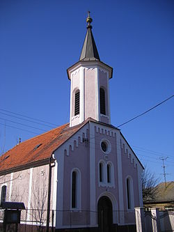 Reformed church | |
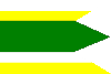 Flag  Coat of arms | |
 Čalovec Location of Čalovec in Slovakia | |
| Coordinates: 47°48′N 17°59′E / 47.800°N 17.983°ECoordinates: 47°48′N 17°59′E / 47.800°N 17.983°E | |
| Country | Slovakia |
| Region | Nitra |
| District | Komárno |
| First mentioned | 1268 |
| Area | |
| • Total | 23.21 km2 (8.96 sq mi) |
| Elevation | 112 m (367 ft) |
| Population (2004-12-31) | |
| • Total | 1,177 |
| • Density | 51/km2 (130/sq mi) |
| Postal code | 946 02 |
| Car plate | KN |
| Website | http://www.calovec.sk/ |

Čalovec, formerly Mederč (Hungarian: Megyercs, Hungarian pronunciation:[ˈmɛɟɛrtʃ]) is a village and municipality in the Komárno District in the Nitra Region of south-west Slovakia.
Geography[]
The village lies at an altitude of 112 metres and covers an area of 23.209 km². It has a population of about 1,185 people.
History[]
In the 9th century, the territory of Čalovec became part of the Kingdom of Hungary. The village was first mentioned in 1268 After the Austro-Hungarian army disintegrated in November 1918, Czechoslovak troops occupied the area, later acknowledged internationally by the Treaty of Trianon. Between 1938 and 1945 Čalovec once more became part of Miklós Horthy's Hungary through the First Vienna Award. From 1945 until the Velvet Divorce, it was part of Czechoslovakia. Since then it has been part of Slovakia.
Demographics[]
The village is about 84% Hungarian, 16% Slovak.
Facilities[]
The village has a public library and a football pitch.
Genealogical resources[]
The records for genealogical research are available at the state archive "Statny Archiv in Nitra, Slovakia"
- Reformated church records (births/marriages/deaths): 1828-1900 (parish A)
See also[]
External links[]
This Nitra Region geography article is a stub. You can help Wikipedia by . |
- Villages and municipalities in the Komárno District
- Hungarian communities in Slovakia
- Nitra Region geography stubs