Bodzianske Lúky
Bodzianske Lúky
Bogyarét | |
|---|---|
Village | |
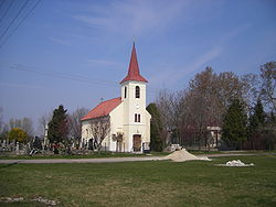 Church of Our Lady of the Rosary | |
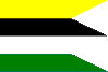 Flag | |
 Bodzianske Lúky Location of Bodzianske Lúky in Slovakia | |
| Coordinates: 47°53′14″N 17°53′51″E / 47.88722°N 17.89750°ECoordinates: 47°53′14″N 17°53′51″E / 47.88722°N 17.89750°E | |
| Country | Slovakia |
| Region | Nitra |
| District | Komárno |
| First mentioned | 1387 |
| Government | |
| • Mayor | Mónika Aradi (SMK-MKP) |
| Area | |
| • Total | 5.17 km2 (2.00 sq mi) |
| Elevation | 109 m (358 ft) |
| Population (31-12-2004) | |
| • Total | 223 |
| • Density | 43/km2 (110/sq mi) |
| Postal code | 946 16 |
| Area code(s) | 0 35 |
| Car plate | KN |
| Website | https://www.bodzianskeluky.sk/ |

Bodzianske Lúky (Hungarian: Bogyarét) is a village and municipality in the Komárno District in the Nitra Region of south-west Slovakia.
Geography[]
The village lies at an altitude of 109 metres and covers an area of 5.166 km². It has a population of about 220 people.
History[]
In the 9th century, the territory of Bodzianske Lúky became part of the Kingdom of Hungary. In historical records the village was first mentioned in 1387. After the Austro-Hungarian army disintegrated in November 1918, Czechoslovak troops occupied the area, later acknowledged internationally by the Treaty of Trianon. Between 1938 and 1945 Bodzianske Lúky once more became part of Miklós Horthy's Hungary through the First Vienna Award. From 1945 until the Velvet Divorce, it was part of Czechoslovakia. Since then it has been part of Slovakia.
Ethnicity[]
The village is about 95% Hungarian, 5% Slovak.
Facilities[]
The village has a public library, and a football pitch.
External links[]
| Authority control |
|
|---|
This Nitra Region geography article is a stub. You can help Wikipedia by . |
- Villages and municipalities in the Komárno District
- Hungarian communities in Slovakia
- Nitra Region geography stubs