Īle Parish
Īle Parish | |
|---|---|
parish of Latvia | |
 | |
| Country | Latvia |
| Area | |
| • Total | 76.71 km2 (29.62 sq mi) |
| • Land | 75.01 km2 (28.96 sq mi) |
| • Water | 1.7 km2 (0.7 sq mi) |
| Population (1 January 2021)[2] | |
| • Total | 341 |
| • Density | 4.4/km2 (12/sq mi) |

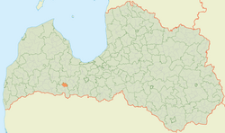
Īle Parish (Latvian: Īles pagasts) is an of Dobele Municipality, Latvia.
Towns, villages and settlements of Īle parish[]
There are three small settlements located in the Īle parish. These are Stirnas, Īle and Mūrīši. The largest of these three is Īle which is where the center of parish is located.
Stirnas has grown around an 18th or 19th century manor, which is now long abandoned. In the last decades Stirnas population's been waning. Stirnas is located on the coast of Lielauce Ezers, and at the opposite coast the Lielauce Castle stands erected.
This Semigallia location article is a stub. You can help Wikipedia by . |
- ^ https://data.stat.gov.lv/pxweb/lv/OSP_PUB/START__ENV__DR__DRT/DRT010/; Central Statistical Bureau of Latvia; retrieved: 26 February 2021.
- ^ https://data.stat.gov.lv/pxweb/lv/OSP_PUB/START__POP__IR__IRS/IRD060/; Central Statistical Bureau of Latvia; retrieved: 15 June 2021.
Categories:
- Parishes of Latvia
- Dobele Municipality
- Semigallia
- Zemgale geography stubs