Śródmieście, Gdańsk
Śródmieście | |
|---|---|
Gdańsk District | |
 View of Długi Targ and Gdańsk Town Hall | |
 Location of Brzeźno within Gdańsk | |
| Coordinates: 54°24′27″N 18°37′53″E / 54.40750°N 18.63139°E | |
| Country | |
| Voivodeship | Pomeranian |
| County/City | Gdańsk |
| Area | |
| • Total | 5.65 km2 (2.18 sq mi) |
| Population (2015) | |
| • Total | 29,630[1] |
| Time zone | UTC+1 (CET) |
| • Summer (DST) | UTC+2 (CEST) |
| Postal code | 80-500 |
| Area code(s) | +48 58 |

Śródmieście ([ɕrudˈmjeɕt͡ɕe]; means "city centre"; Kashubian: Westrzódgardzé) is a district (dzielnica) of the city of Gdańsk, Poland. Śródmieście is commonly referred to as Main City, Old City, or simply Gdańsk, since the quarter is equivalent to the traditional area of the city.
Location[]
The quarter is located in the centre-eastern part of Gdańsk, on the River Motława to its west and east. To its north-east, the quarter borders the Przeróbka quarter on Port Island by the Martwa Wisła River. To its south and east, the quarter is bordered by the , via which the quarter borders the quarters of Rudniki, Olszynka and Orunia-Św. Wojciech-Lipce. To the south-west of Śródmieście, via Biskupia Górka, the quarter borders Chełm, to the west with Siedlce. Śródmieście borders Aniołki and Młyniska to its north.
Quarter subdivisions[]


The following morphological units are located in Śródmieście:
| Division | Short description | Location in Śródmieście |
|---|---|---|
| Główne Miasto | The oldest borough of the Gdańsk agglomeration from the ninth-century. A fortified trade port between the tenth and thirteen-century. Municipal government based on Lübeck law between 1261–1263. | 
|
| Stare Miasto | Settled between 970–980, after 1433 surrounded by palisades and a motte. | 
|
| Stare Przedmieście | An unfortified subdivision of Główne Miasto. Since 1360, gardens and ship workshops. | 
|
| Wyspa Spichrzów | Around 1330, the first granaries were built, as well as a butcher, city folwark, Popielny Court (Dwór Popielny) and storehouses. | 
|
| Długie Ogrody | c. 1360 - meadows and rental gardens (patrimonium). An undefensed borough was built at the beginning of the fifteenth-century. | 
|
| Ołowianka | Between 1343–1454, property of the Teutonic Order. | 
|
| Dolne Miasto | Garden borough. | 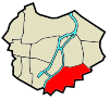
|
| Nowe Ogrody | Hospital and St. Gertrude's Church built in 1342. | 
|
| Grodzisko | Defensive gord built in the ninth-tenth-century. City fortifications built in 1656 and 1807. | 
|
| Biskupia Górka | Property of the Bishops of Wrocław, bishop's court. City fortifications built in the seventeenth-century. | 
|
| Zaroślak | Teutonic settlement from 1365. | 
|
| Sienna Grobla | Blockhouse on the from the eighteenth-century. | 
|
| Rudno | Part of the Długie Ogrody from the fifteenth and sixteenth-century. | 
|
External links[]
| Wikimedia Commons has media related to Śródmieście (Gdańsk). |
References[]
- ^ "Gdańsk - oficjalny portal miasta". www.gdansk.pl (in Polish). Retrieved 19 August 2017.

Coordinates: 54°21′06″N 18°39′21″E / 54.351678°N 18.655740°E
This Pomeranian Voivodeship location article is a stub. You can help Wikipedia by . |
- Districts of Gdańsk
- Pomeranian geography stubs