1894 Atlantic hurricane season
| 1894 Atlantic hurricane season | |
|---|---|
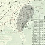
 Season summary map | |
| Seasonal boundaries | |
| First system formed | June 6, 1894 |
| Last system dissipated | October 29, 1894 |
| Strongest storm | |
| Name | Six |
| • Maximum winds | 130 mph (215 km/h) (1-minute sustained) |
| • Lowest pressure | 931 mbar (hPa; 27.49 inHg) |
| Seasonal statistics | |
| Total storms | 7 |
| Hurricanes | 5 |
| Major hurricanes (Cat. 3+) | 4 |
| Total fatalities | >200 direct |
| Total damage | At least $1 million (1894 USD) |
The 1894 Atlantic hurricane season ran through the summer and the first half of fall in 1894. The 1894 season was a fairly inactive one, with seven storms forming, five of which became hurricanes.
Timeline[]

Systems[]
Tropical Storm One[]
| Tropical storm (SSHWS) | |
 | |
| Duration | June 6 – June 9 |
|---|---|
| Peak intensity | 40 mph (65 km/h) (1-min) |
A tropical storm formed between Cuba and Jamaica on June 6. It moved westward, remaining weak until dissipating on June 9 over the Yucatán Channel. No damage or deaths were reported.
Tropical Storm Two[]
| Tropical storm (SSHWS) | |
 | |
| Duration | August 5 – August 9 |
|---|---|
| Peak intensity | 60 mph (95 km/h) (1-min) |
The second storm formed on August 5 in the Gulf of Mexico and drifted northward. After reaching a peak of 60 mph (97 km/h), it hit southern Alabama on August 8. It turned to the west-northwest, and dissipated on August 9, bringing very heavy rainfall and tornadoes.
Hurricane Three[]
| Category 3 hurricane (SSHWS) | |
 | |
| Duration | August 30 – September 9 |
|---|---|
| Peak intensity | 115 mph (185 km/h) (1-min) 948 mbar (hPa) |
A tropical storm developed on August 30 and lasted until September 9. It formed between Africa and South America, east of the Lesser Antilles. It stayed out at sea and did not hit any land. It dissipated in the North Atlantic. Its maximum sustained winds were at 115 mph (185 km/h).
Hurricane Four[]
| Category 3 hurricane (SSHWS) | |
  | |
| Duration | September 18 – October 1 |
|---|---|
| Peak intensity | 120 mph (195 km/h) (1-min) 975 mbar (hPa) |
On September 18 a tropical storm was first observed and lasted until September 30. It formed to the east-southeast of the Lesser Antilles. It hit the Lesser Antilles and then the Greater Antilles, later curving north and striking near Punta Rassa, Florida, with winds up to 105 mph (169 km/h). It then went back out to sea and hit South Carolina, tracked through North Carolina, and then made its way out to sea, where it eventually dissipated. On September 20, as the storm passed through the Lesser Antilles, it produced heavy rains and high winds over several islands. On Martinique, high winds and continuous, torrential rains impacted the island. Despite the intensity of the storm, there were no reports of damage in the Lesser Antilles. In Hispaniola, more than 500 homes and two churches were destroyed; numerous other structures sustained damage, mainly having their roofs blown off. The cyclone produced heavy rainfall in Florida, including 13.78 inches (350.01 mm) over a 54-hour period at Tampa; at Titusville, 7.72 inches (196.09 mm) fell in two days. Jacksonville registered a storm total of 11.11 inches (282.19 mm).[1] In southeast Florida, a bridge on the Lake Worth Lagoon was swept away[2] and thousands of dead fish beached at Jupiter,[3] but otherwise only gale-force winds and occurred and damage was insignificant.[4] The ship Jella was stranded at Hillsboro Inlet and the Emily II sank off Key West with a loss of all her crew. Many wine caskets and other debris were found on the beaches between the New River and the Lake Worth Lagoon.[5] In all, the cyclone was responsible for an estimated 200 deaths.
Hurricane Five[]
| Category 3 hurricane (SSHWS) | |
  | |
| Duration | October 1 – October 10 |
|---|---|
| Peak intensity | 120 mph (195 km/h) (1-min) 955 mbar (hPa) |
The Florida Panhandle Hurricane of 1894
The fifth storm formed on October 1 and lasted until October 12. It formed to the northwest of the Panama Canal, tracked northwest, and struck the Florida Panhandle with winds of 120 mph (190 km/h), equivalent to a major hurricane on the Saffir–Simpson hurricane scale. It tracked through Georgia, South Carolina, North Carolina, Connecticut, Massachusetts, New Hampshire, Maine, and Canada. The hurricane caused about $1,000,000 in damage (1894 USD). 10 people were killed and 15 injured in New York City when winds blew a partially constructed building onto a tenement. A girl died in her bed in Englewood, New Jersey, when the roof of her house collapsed upon her. Trees and telegraph wires were blown down and boats stranded in the New York City area.[6]
Hurricane Six[]
| Category 4 hurricane (SSHWS) | |
 | |
| Duration | October 11 – October 20 |
|---|---|
| Peak intensity | 130 mph (215 km/h) (1-min) 931 mbar (hPa) |
A tropical storm formed on October 11 southeast of the Lesser Antilles as a tropical storm. It traveled north through the Lesser Antilles and later peaked with winds of 130 mph (210 km/h) and an atmospheric pressure of 27.50 inches of mercury (931.26 mb) over the open Atlantic waters several hundred miles north of Puerto Rico. Continuing to head out to sea, the hurricane weakened, and was last plotted on October 20.
Hurricane Seven[]
| Category 2 hurricane (SSHWS) | |
 | |
| Duration | October 21 – October 29 |
|---|---|
| Peak intensity | 110 mph (175 km/h) (1-min) 955 mbar (hPa) |
The final storm formed on October 21 and lasted until October 31. It formed far north of the Lesser Antilles and traveled westward towards the Bahamas, but then swerved northeast and out to sea, threatening no land. Its maximum sustained winds peaked at 100 mph (161 km/h).
See also[]
References[]
- ^ "Observed Rainfall in Florida, Monthly Totals from Beginning of Records to 31 December 1947". Tallahassee, Florida: Division of Water Survey and Research, State of Florida, State Board of Conservation. 1948. Cite journal requires
|journal=(help) - ^ "We Sometimes Think That". Tropical Sun. Juno, Florida. October 4, 1894. p. 2.
- ^ "Jupiter Jottings". Tropical Sun. Juno, Florida. October 4, 1894. p. 1.
- ^ "Lantana". Tropical Sun. Juno, Florida. October 4, 1894. p. 1.
- ^ "Storm Pick-ups". Tropical Sun. Juno, Florida. October 4, 1894. p. 1.
- ^ "Death Dealing Storm". Patterson Daily News. Patterson, New Jersey. October 10, 1894. p. 1.
External links[]
- 1890s Atlantic hurricane seasons
- 1894 natural disasters
- 1894 meteorology