Englewood, New Jersey
Englewood, New Jersey | |
|---|---|
| City of Englewood | |
 Downtown Englewood, New Jersey | |
 Map highlighting Englewood's location within Bergen County. Inset: Bergen County's location within New Jersey | |
 | |
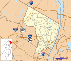 Englewood Location in Bergen County | |
| Coordinates: 40°53′28″N 73°58′21″W / 40.891197°N 73.972515°WCoordinates: 40°53′28″N 73°58′21″W / 40.891197°N 73.972515°W[1][2] | |
| Country | |
| State | |
| County | |
| Incorporated | March 17, 1899 |
| Named for | Engle family or "English Neighborhood" |
| Government | |
| • Type | Special Charter |
| • Body | City Council |
| • Mayor | Michael Wildes (D, term ends December 31, 2022)[3] |
| • Manager | Jewel Thompson-Chin (interim)[4] |
| • Municipal clerk | Yancy Wazirmas[5] |
| Area | |
| • Total | 4.95 sq mi (12.82 km2) |
| • Land | 4.93 sq mi (12.76 km2) |
| • Water | 0.02 sq mi (0.06 km2) 0.46% |
| Area rank | 279th of 565 in state 15th of 70 in county[1] |
| Elevation | 43 ft (13 m) |
| Population | |
| • Total | 27,147 |
| • Estimate (2019)[11] | 28,402 |
| • Rank | 88th of 566 in state 6th of 70 in county[12] |
| • Density | 5,524.6/sq mi (2,133.1/km2) |
| • Density rank | 96th of 566 in state 26th of 70 in county[12] |
| Time zone | UTC−05:00 (Eastern (EST)) |
| • Summer (DST) | UTC−04:00 (Eastern (EDT)) |
| ZIP Code | |
| Area code(s) | 201[15] |
| FIPS code | 3400321480[1][16][17] |
| GNIS feature ID | 0885209[1][18] |
| Website | www |


Englewood is a city in Bergen County, New Jersey, United States. As of the 2010 United States Census, the city had a total population of 27,147,[8][9][10] reflecting an increase of 944 (+3.6%) from the 26,203 counted in the 2000 Census, which had in turn increased by 1,353 (+5.4%) from the 24,850 counted in the 1990 Census.[19]
Englewood was incorporated as a city by an act of the New Jersey Legislature on March 17, 1899, from portions of Ridgefield Township and the remaining portions of Englewood Township. With the creation of the City of Englewood, Englewood Township was dissolved. An earlier referendum on March 10, 1896, was declared unconstitutional.[20]
History[]
Origin of name[]
Englewood Township, the city's predecessor, is believed to have been named in 1859 for the Engle family. The community had been called the "English Neighborhood", as the first primarily English-speaking settlement on the New Jersey side of the Hudson River after New Netherland was annexed by England in 1664, though other sources mention the Engle family and the heavily forested areas of the community as the derivation of the name.[21][22] Other sources indicate that the name is derived from "wood ingle", meaning "woody nook",[23] or that the name was coined anew.[24]
Numerous other settlements in the United States were named for Englewood as settlement in North America expanded westward. J. Wyman Jones is credited with convincing residents to choose Englewood for the city's name when it was incorporated over such alternatives as "Brayton" and "Paliscena".[22][25][26]
Pre-Colonial and Colonial era[]
Englewood, like the rest of New Jersey, was populated by Lenape Native Americans prior to European colonization. The Lenape who lived in the Englewood region were of the "turtle clan" which used a stylized turtle as its symbol. 2,000 Lenape originally lived in Englewood, but due to conflicts with the Europeans their population dwindled down to 50 by 1832.[22]
When Henry Hudson sailed up what would become known as the Hudson River in 1607, he claimed the entirety of the watershed of the river, including Englewood, for the Netherlands, making the future region of Englewood a part of New Netherland. However, the region remained largely unsettled under Dutch rule as the Dutch did little to encourage settlement north of modern Hudson County, as the imposing New Jersey Palisades blocked expansion on the west bank of the Hudson.[22]

In 1664, after the Dutch surrendered all of New Netherland to England, the rate of settlement picked up. The English were generous with land grants, and many families, not only English but also Dutch and Huguenot, settled the area, which during the colonial era was known as the English Neighborhood. Street names in Englewood still recall the relative diversity of its earliest settlers; Brinckerhoff, Van Brunt, Lydecker, Van Nostrand and Durie (Duryea), all Dutch; Demarest (de Marais), DeMott and Lozier (Le Sueur), French Huguenot; and Moore, Lawrence, Cole and Day, English.
Historical notes[]
From 1906 until March 16, 1907, when it burned down, Englewood was the site of Upton Sinclair's socialist-inflected intentional community, the Helicon Home Colony. Associated with the project were Charlotte Perkins Gilman and Sinclair Lewis.[27]
Direct distance dialing, which allowed callers to reach other users outside their local calling area without operator assistance, was introduced to the public in Englewood. On November 10, 1951, Englewood Mayor M. Leslie Denning made the first customer-dialed long-distance call, to Mayor Frank Osborne of Alameda, California. As of that date, customers of the ENglewood 3, ENglewood 4 and TEaneck 7 exchanges, who could already dial some exchanges in the New York City area, were able to dial 11 cities across the United States by dialing the three-digit area code preceding the local number.[28][29]
Two years after his graduation from Fordham University, Vince Lombardi began his football coaching career at Englewood's St. Cecilia High School, which closed in 1986.[30]
Historic sites[]
Sites in the city listed on the National Register of Historic Places include:[31]
- John G. Benson House (at 60 Grand Avenue; added January 9, 1983)[32]
- Thomas Demarest House (at 370 Grand Avenue; added January 9, 1983)[33]
- Garret Lydecker House (at 228 Grand Avenue; added January 9, 1983)[34]
- St. Paul's Episcopal Church (at 113 Engle Street; added May 5, 2014)
- Peter Westervelt House and Barn (at 290 Grand Avenue; added March 19, 1975)[35]
Geography[]
According to the United States Census Bureau, the city had a total area of 4.95 square miles (12.82 km2), including 4.93 square miles (12.76 km2) of land and 0.02 square miles (0.06 km2) of water (0.46%).[1][2]
Unincorporated communities, localities and place names located partially or completely within the city include Highwood.[36]
The city borders the Bergen County municipalities of Bergenfield, Englewood Cliffs, Fort Lee, Leonia, Teaneck and Tenafly.[37][38][39]
Demographics[]
| Historical population | |||
|---|---|---|---|
| Census | Pop. | %± | |
| 1900 | 6,253 | — | |
| 1910 | 9,924 | 58.7% | |
| 1920 | 11,627 | 17.2% | |
| 1930 | 17,805 | 53.1% | |
| 1940 | 18,966 | 6.5% | |
| 1950 | 23,145 | 22.0% | |
| 1960 | 26,057 | 12.6% | |
| 1970 | 24,985 | −4.1% | |
| 1980 | 23,701 | −5.1% | |
| 1990 | 24,850 | 4.8% | |
| 2000 | 26,203 | 5.4% | |
| 2010 | 27,147 | 3.6% | |
| 2019 (est.) | 28,402 | [11][40][41] | 4.6% |
| Population sources: 1900-1920[42] 1900-1910[43] 1900-1930[44] 1900-2010[45][46][47] 2000[48][49] 2010[8][9][10] | |||
2010 Census[]
The 2010 United States census counted 27,147 people, 10,057 households, and 6,788 families in the city. The population density was 5,524.6 per square mile (2,133.1/km2). There were 10,695 housing units at an average density of 2,176.5 per square mile (840.4/km2). The racial makeup was 45.28% (12,292) White, 32.58% (8,845) Black or African American, 0.54% (147) Native American, 8.10% (2,199) Asian, 0.04% (12) Pacific Islander, 9.73% (2,641) from other races, and 3.72% (1,011) from two or more races. Hispanic or Latino of any race were 27.48% (7,460) of the population.[8]
Of the 10,057 households, 28.7% had children under the age of 18; 45.1% were married couples living together; 17.1% had a female householder with no husband present and 32.5% were non-families. Of all households, 27.3% were made up of individuals and 9.6% had someone living alone who was 65 years of age or older. The average household size was 2.68 and the average family size was 3.24.[8]
22.2% of the population were under the age of 18, 7.7% from 18 to 24, 28.9% from 25 to 44, 27.0% from 45 to 64, and 14.2% who were 65 years of age or older. The median age was 38.9 years. For every 100 females, the population had 90.0 males. For every 100 females ages 18 and older there were 86.3 males.[8]
The Census Bureau's 2006-2010 American Community Survey showed that (in 2010 inflation-adjusted dollars) median household income was $69,915 (with a margin of error of +/- $7,291) and the median family income was $87,361 (+/- $9,616). Males had a median income of $58,776 (+/- $7,972) versus $48,571 (+/- $3,984) for females. The per capita income for the borough was $41,533 (+/- $2,981). About 6.9% of families and 10.0% of the population were below the poverty line, including 10.7% of those under age 18 and 15.8% of those age 65 or over.[50]
Same-sex couples headed 73 households in 2010, an increase from the 63 counted in 2000.[51]
2000 Census[]

As of the 2000 United States Census,[16] there were 26,203 people, 9,273 households, and 6,481 families residing in the city. The population density was 5,322.0 people per square mile (2,056.3/km2). There were 9,614 housing units at an average density of 1,952.7 per square mile (754.5/km2). The racial makeup of the city was 42.49% White, 38.98% African American, 0.27% Native American, 5.21% Asian, 0.05% Pacific Islander, 8.50% from other races, and 4.50% from two or more races. 21.76% of the population were Hispanic or Latino of any race.[48][49]
7.17% of Englewood residents identified themselves as being of Colombian American ancestry in the 2000 Census, the ninth-highest percentage of the population of any municipality in the United States.[52]
There were 9,273 households, out of which 31.0% had children under the age of 18 living with them, 47.9% were married couples living together, 17.4% had a female householder with no husband present, and 30.1% were non-families. 24.8% of all households were made up of individuals, and 9.0% had someone living alone who was 65 years of age or older. The average household size was 2.79 and the average family size was 3.29.[48][49]
In the city the population was spread out, with 23.9% under the age of 18, 7.4% from 18 to 24, 30.5% from 25 to 44, 24.9% from 45 to 64, and 13.3% who were 65 years of age or older. The median age was 37 years. For every 100 females, there were 88.7 males. For every 100 females age 18 and over, there were 84.2 males.[48][49]
The median income for a household in the city was $58,379, and the median income for a family was $67,194. Males had a median income of $41,909 versus $34,358 for females. The per capita income for the city was $35,275. 8.9% of the population and 6.6% of families were below the poverty line. 10.2% of those under the age of 18 and 8.6% of those 65 and older were living below the poverty line.[48][49]
Sports[]
Englewood Golf Club is a former golf club that was located between Englewood and Leonia. It hosted the 1909 U.S. Open tournament.[53]
Englewood Field Club[54] is a sports club that features tennis courts, a pool, and an outdoor hockey rink.[55]
Parks and recreation[]

MacKay Park, located on North Van Brunt Street, includes an ice hockey rink, a pool, a walking path, and athletic fields.[56]
Flat Rock Brook Nature Center, located at 433 Van Nostrand Avenue, is made up of the remnants of the Palisades Forest. The center, established in 1973, is a 150-acre (61 ha) preserve and education center that includes 3.6 miles (5.8 km) of walking trails and several gardens including the newly renovated Butterfly Garden. Flat Rock allows visitors to learn about the natural ecosystem preserved in the park through exhibits and tours available year-round.[57]
Government[]
Local government[]
Beginning in 1980, Englewood switched from a Mayor-Council form of government to a modified Council-Manager plan of government in accordance with a Special Charter granted by the New Jersey Legislature.[6] The city is one of 11 municipalities (of the 565) statewide that use a special charter granted by the Legislature.[58] The governing body is comprised of the Mayor and the City Council. Under this charter, the mayor has powers to appoint and veto, while the council functions as a legislative body, with some power to appoint and confirm appointments. The city is divided into four wards which are approximately equal in population. The City Council is comprised of five members, each elected for a three-year term. Four are elected from the individual wards in which they live and the other is elected by a citywide vote as an at-large member. Administrative functions are responsibilities of the City Manager. The six seats in the governing body are elected in a three-year cycle as part of the November general election, with wards two and four both up together, followed a year later by wards one and three, and then the at-large council and mayoral seats. Each ward votes in two of the three years in the cycle, once for its ward seat, in the other year for the two positions voted at-large and one year with no election.[59]
The mayor appoints members to the Planning Board, the Library Board of Trustees, and, with council confirmation, the Board of Adjustment. The mayor serves on the Planning Board. The mayor attends and may speak at council meetings, but only votes to break a tie for passage of an ordinance or resolution. The mayor has veto power over ordinances, but can be overridden with votes from four council members. The City Council is the legislative branch of government, deciding public policy, creating city ordinances and resolutions, passing the city budget, appropriating funds for city services, and hiring the City Manager. The City Council meets generally four times per month (except during summer months).
As of 2020, the Mayor of Englewood is Democrat Michael Wildes, whose term of office ends December 31, 2022.[60] Members of the City Council are Charles Cobb (D, 2021; At-Large), Michael D. Cohen (D, 2022; Ward 2), Katharine Glynn (D, 2020; Ward 3), C. Wayne Hamer (D, 2022; Ward 4) and Cheryl Weiner Rosenberg (D, 2020; Ward 1).[61][62][63][64][65][66]
Wayne Hamer was appointed by the City Council in September 2012 to fill the vacant seat of Jack Drakeford who had died the previous month, and won election in November 2012 to serve the balance of the term through year-end 2013.[67]
Fire Department[]
| Operational area | |
|---|---|
| State | New Jersey |
| City | Englewood |
| Address | 81 South Van Brunt Street |
| Agency overview | |
| Established | 1887 |
| Annual calls | ~2,200 |
| Employees | ~60 |
| EMS level | BLS First Responder |
| IAFF | L3260/3263 |
| Facilities and equipment | |
| Stations | 1 |
| Engines | 3 (including spare) |
| Trucks | 2 (including spare) |
| Rescues | 1 (cross-staffed) |
| HAZMAT | 1 |
| Website | |
| http://www.englewoodfirefighters.com | |

The Englewood Fire Association, a volunteer company established in 1887 as the city's first organized fire protection service, built a firehouse on North Van Brunt Street, near the site of Englewood's current city hall. A professional paid fire department was created in 1912 with the establishment of a Board of Fire Examiners. The fire headquarters constructed on William Street in 1926 was used for 90 years until its replacement by the Jack Drakeford Englewood Firehouse on South Van Brunt Street, which was dedicated on May 14, 2016. The department has a uniformed force of 57 members, including a Chief, Deputy Chief, 4 Captains, 9 Lieutenants and 42 firefighters.[68]
Police Department[]
The city has a 75-man police department.[69]
Federal, state and county representation[]
Englewood is located in the 9th Congressional District[70] and is part of New Jersey's 37th state legislative district.[9][71][72]
For the 117th United States Congress, New Jersey's Ninth Congressional District is represented by Bill Pascrell (D, Paterson).[73][74] New Jersey is represented in the United States Senate by Democrats Cory Booker (Newark, term ends 2027)[75] and Bob Menendez (Harrison, term ends 2025).[76][77]
For the 2020–2021 session (Senate, General Assembly), the 37th Legislative District of the New Jersey Legislature is represented in the State Senate by Loretta Weinberg (D, Teaneck) and in the General Assembly by Valerie Huttle (D, Englewood) and Gordon M. Johnson (D, Englewood).[78][79]
Bergen County is governed by a directly elected County Executive, with legislative functions performed by the seven-member Bergen County Board of County Commissioners (formerly the Bergen County Board of Chosen Freeholders). The freeholders are elected at-large in partisan elections on a staggered basis, with two or three seats coming up for election each year; a Chairman, Vice Chairman and Chairman Pro Tempore are selected from among its seven members at a reorganization meeting held every January. Other Bergen County Constitutional Offices include County Clerk, Sheriff, and Surrogate. These offices all have 3 year terms, and are elected on a partisan basis.
As of July 2021, the County Executive is Democrat James J. Tedesco III of Paramus, whose term of office ends December 31, 2022.[80] The current members of the Bergen County Board of Commissioners are Freeholder Chairman Steven A. Tanelli (D, North Arlington, 2021),[81] Freeholder Vice-Chairwoman Tracy Silna Zur (D, Franklin Lakes, 2021),[82] Freeholder Chairman Pro-Tempore Dr. Joan Voss (D, Fort Lee, 2023)[83] Mary J. Amoroso (D, Mahwah, term as freeholder ends 2022),[84] Germaine M. Ortiz (D, Emerson, term as freeholder ends 2022),[85] Ramon M. Hache, Sr. (D, Ridgewood, 2023),[86] and Thomas J. Sullivan Jr., (D, Montvale, term as freeholder ends 2022),[87]
Bergen County's constitutional officials are County Clerk John S. Hogan (D, Northvale, 2021),[88] Sheriff Anthony Cureton (D, Emerson, 2021)[89] and Surrogate Michael R. Dressler (D, Cresskill, 2021).[90]
Politics[]
As of March 23, 2011, there were a total of 15,033 registered voters in Englewood, of which 8,571 (57.0% vs. 31.7% countywide) were registered as Democrats, 1,215 (8.1% vs. 21.1%) were registered as Republicans and 5,240 (34.9% vs. 47.1%) were registered as Unaffiliated. There were 7 voters registered to other parties.[91] Among the city's 2010 Census population, 55.4% (vs. 57.1% in Bergen County) were registered to vote, including 71.2% of those ages 18 and over (vs. 73.7% countywide).[91][92]
In the 2012 presidential election, Democrat Barack Obama received 8,855 votes (76.8% vs. 54.8% countywide), ahead of Republican Mitt Romney with 2,502 votes (21.7% vs. 43.5%) and other candidates with 71 votes (0.6% vs. 0.9%), among the 11,533 ballots cast by the city's 16,586 registered voters, for a turnout of 69.5% (vs. 70.4% in Bergen County).[93][94] In the 2008 presidential election, Democrat Barack Obama received 9,412 votes (77.0% vs. 53.9% countywide), ahead of Republican John McCain with 2,625 votes (21.5% vs. 44.5%) and other candidates with 58 votes (0.5% vs. 0.8%), among the 12,221 ballots cast by the city's 16,065 registered voters, for a turnout of 76.1% (vs. 76.8% in Bergen County).[95][96] In the 2004 presidential election, Democrat John Kerry received 8,087 votes (73.6% vs. 51.7% countywide), ahead of Republican George W. Bush with 2,798 votes (25.5% vs. 47.2%) and other candidates with 65 votes (0.6% vs. 0.7%), among the 10,990 ballots cast by the city's 14,702 registered voters, for a turnout of 74.8% (vs. 76.9% in the whole county).[97]
In the 2013 gubernatorial election, Democrat Barbara Buono received 62.5% of the vote (3,367 cast), ahead of Republican Chris Christie with 36.6% (1,972 votes), and other candidates with 0.9% (49 votes), among the 5,557 ballots cast by the city's 15,615 registered voters (169 ballots were spoiled), for a turnout of 35.6%.[98][99] In the 2009 gubernatorial election, Democrat Jon Corzine received 5,304 ballots cast (73.8% vs. 48.0% countywide), ahead of Republican Chris Christie with 1,613 votes (22.5% vs. 45.8%), Independent Chris Daggett with 170 votes (2.4% vs. 4.7%) and other candidates with 20 votes (0.3% vs. 0.5%), among the 7,184 ballots cast by the city's 15,534 registered voters, yielding a 46.2% turnout (vs. 50.0% in the county).[100]
Education[]
Public schools[]
The Englewood Public School District serves students in pre-kindergarten through twelfth grade.[101] Students from Englewood Cliffs attend Dwight Morrow High School, as part of a sending/receiving relationship with the Englewood Cliffs Public Schools.[102][103]
As of the 2018–19 school year, the district, comprised of five schools, had an enrollment of 3,078 students and 247.0 classroom teachers (on an FTE basis), for a student–teacher ratio of 12.5:1.[104] Schools in the district (with 2018–19 enrollment data from the National Center for Education Statistics)[105] are D. A. Quarles Early Childhood Center[106] with 417 students in grades PreK-K, Dr. John Grieco Elementary School[107] with 394 students in grades 1-2, McCloud School[108] with 580 students in grades 3-5, Janis E. Dismus Middle School[109] with 563 students in grades 6-8 and Dwight Morrow High School[110] / Academies @ Englewood[111] with 1,063 students in grades 9-12.[112] In 2009, Cleveland School was renamed in memory of the district's first African-American principal, Dr. Leroy McCloud, who had a 50-year career in the district.[113]
Public school students from the city, and all of Bergen County, are eligible to attend the secondary education programs offered by the Bergen County Technical Schools, which include the Bergen County Academies in Hackensack, and the Bergen Tech campus in Teterboro or Paramus. The district offers programs on a shared-time or full-time basis, with admission based on a selective application process and tuition covered by the student's home school district.[114][115]
As an alternative to regular public education, the city is home of the Englewood on the Palisades Charter School,[116] which had an enrollment of 317 students in Kindergarten through fifth grade, as of the 2018–19 school year.[117] Shalom Academy, a charter school with a focus on Hebrew language immersion, had planned to open for grades K-5 in September 2011, serving students from both Englewood and Teaneck, but failed to receive final approval from the New Jersey Department of Education.[118]
Private schools[]
Englewood is the home to a number of private schools. Dwight-Englewood School, serves 900 students in pre-kindergarten through 12th grade, housed in three separate divisions.[119] Founded in 1930, Elisabeth Morrow School serves students in preschool through eighth grade.[120] Moriah School of Englewood, one of the county's largest, is a Jewish day school with an enrollment that had been as high as 1,000 students in preschool through eighth grade.[121] Yeshiva Ohr Simcha serves students in high school for grades 9-12 and offers a postgraduate yeshiva program.[122]
In the face of a declining enrollment, St. Cecilia Interparochial School was closed by the Roman Catholic Archdiocese of Newark at the end of the 2010–11 school year, with an expected student body of 85 students for K-8 in the following year constituting less than half of the number of students needed to keep the school financially viable. St. Cecilia High School, where Vince Lombardi coached football 1939–47, had been closed in 1986.[123]
Healthcare[]
Englewood Hospital and Medical Center, located on Engle Street, is known for its cardiac, bloodless surgery, and breast care programs.
Transportation[]
Roads and highways[]

As of May 2010, the city had a total of 75.06 miles (120.80 km) of roadways, of which 64.30 miles (103.48 km) were maintained by the municipality, 8.39 miles (13.50 km) by Bergen County, 1.94 miles (3.12 km) by the New Jersey Department of Transportation, and 0.43 miles (0.69 km) by the New Jersey Turnpike Authority.[124]
Interstate 95 is the most prominent highway serving Englewood. It travels through Englewood for 0.43 miles (0.69 km) near the city's southern border with Leonia.[125] Originally built by the New Jersey Department of Transportation, this section is now owned and operated as part of the New Jersey Turnpike, though it is not tolled.
Route 4, Route 93, County Route 501, and County Route 505 also directly serve Englewood. The northern terminus of Route 93 is at the intersection with Route 4, but the road continues north as CR 501.

Public transportation[]
Several NJ Transit bus lines serve Englewood. The 166 provides local and express service to and from the Port Authority Bus Terminal in Midtown Manhattan; the 171, 175, 178 and 186 provide service to / from the George Washington Bridge Bus Station in uptown Manhattan; and the 756 and 780 offer local service.[126][127] Rockland Coaches provides scheduled service to / from the Port Authority Bus Terminal on Routes 21T, 14ET, 11T, 11AT, 20, and 20T.[128] Saddle River Tours / Ameribus provides rush hour service on weekdays to / from the George Washington Bridge Bus Station on the 11C and 20/84 routes.[129][130]
Erie Railroad's suburban Northern Branch (NRRNJ) started passenger service in Englewood in 1859, at various stations including the still extant building at Depot Square. It originated/terminated at Pavonia Terminal on the Hudson River in Jersey City and was ended in September 1966 (by which time trains had been redirected to Hoboken Terminal).[131]
The Northern Branch Corridor Project is a proposed NJ Transit (NJT) project to extend the Hudson–Bergen Light Rail along the line providing service to newly built stations along the route.[132] The line would stop at Englewood Route 4 and Englewood Town Center and terminate at Englewood Hospital and Medical Center. A station stop at Depot Square is the city's much-preferred alternative to NJT's proposed new Englewood Town Center Station to the south.[133] Englewood Mayor Frank Huttle III has worked together with Jersey City Mayor Steven Fulop to advocate on behalf of the project and obtain the needed state and federal funding needed to proceed with the plan, with Huttle emphasizing the economic benefits from the project and that the city wanted to host the terminus, which would include a parking garage near Englewood Hospital and additional parking near Palisade Avenue in the commercial center of the city.[134]
Religion[]
Congregation Ahavath Torah is a Modern Orthodox synagogue in the city.
St. Paul's Episcopal Church is an Episcopal church in the city.
is one of the oldest churches in the city of Englewood and many of the City’s most notable residents were parishioners or attended their parochial school.
Notable people[]
References[]
- ^ Jump up to: a b c d e f 2019 Census Gazetteer Files: New Jersey Places, United States Census Bureau. Accessed July 1, 2020.
- ^ Jump up to: a b U.S. Gazetteer Files for 2000, 2010 and 2012-2016, United States Census Bureau. Accessed September 4, 2017.
- ^ 2020 New Jersey Mayors Directory, New Jersey Department of Community Affairs. Accessed February 1, 2020.
- ^ City Manager / Administration, City of Englewood. Accessed March 24, 2020.
- ^ Office of the City Clerk, City of Englewood. Accessed March 24, 2020.
- ^ Jump up to: a b 2012 New Jersey Legislative District Data Book, Rutgers University Edward J. Bloustein School of Planning and Public Policy, March 2013, p. 157.
- ^ "City of Englewood". Geographic Names Information System. United States Geological Survey. Retrieved March 5, 2013.
- ^ Jump up to: a b c d e f DP-1 - Profile of General Population and Housing Characteristics: 2010 for Englewood city, Bergen County, New Jersey, United States Census Bureau. Accessed February 13, 2012.
- ^ Jump up to: a b c d Municipalities Sorted by 2011-2020 Legislative District, New Jersey Department of State. Accessed February 1, 2020.
- ^ Jump up to: a b c Table DP-1. Profile of General Demographic Characteristics: 2010 for Englewood city Archived 2014-09-08 at the Wayback Machine, New Jersey Department of Labor and Workforce Development. Accessed February 13, 2012.
- ^ Jump up to: a b QuickFacts for Englewood city, New Jersey; Bergen County, New Jersey; New Jersey from Population estimates, July 1, 2019, (V2019), United States Census Bureau. Accessed May 21, 2020.
- ^ Jump up to: a b GCT-PH1 Population, Housing Units, Area, and Density: 2010 - State -- County Subdivision from the 2010 Census Summary File 1 for New Jersey , United States Census Bureau. Accessed July 10, 2013.
- ^ Look Up a ZIP Code, United States Postal Service. Accessed September 15, 2011.
- ^ ZIP Codes, State of New Jersey. Accessed December 5, 2013.
- ^ Area Code Lookup - NPA NXX for Englewood, NJ, Area-Codes.com. Accessed December 5, 2013.
- ^ Jump up to: a b U.S. Census website , United States Census Bureau. Accessed September 4, 2014.
- ^ Geographic Codes Lookup for New Jersey, Missouri Census Data Center. Accessed September 1, 2019.
- ^ US Board on Geographic Names, United States Geological Survey. Accessed September 4, 2014.
- ^ Table 7. Population for the Counties and Municipalities in New Jersey: 1990, 2000 and 2010, New Jersey Department of Labor and Workforce Development, February 2011. Accessed June 20, 2012.
- ^ Snyder, John P. The Story of New Jersey's Civil Boundaries: 1606-1968, Bureau of Geology and Topography; Trenton, New Jersey; 1969. p. 77. Accessed February 14, 2012.
- ^ Staff. "MORROW RECEPTION ATTENDED BY 5,000; New Jersey Republican Leaders Flock to Englewood for New Year's Greeting. HIS TALK IS BROADCAST Well Wishers File Past Envoy for Three Hours in His Debut in Senatorial Race. Prominent Politicians Attend. Morrow's Speech Brief.", The New York Times, January 2, 1930. Accessed September 29, 2019. "In this little town of ours we are proud to call ourselves a neighborhood. The oldest maps show it as 'English neighborhood,' but this was later changed to Englewood."
- ^ Jump up to: a b c d Historic Englewood, City of Englewood. Accessed December 24, 2016.
- ^ Gannett, Henry. The Origin of Certain Place Names in the United States, p. 119. United States Government Printing Office, 1905. Accessed August 30, 2015.
- ^ Hutchinson, Viola L. The Origin of New Jersey Place Names, New Jersey Public Library Commission, May 1945. Accessed August 30, 2015.
- ^ Clayton, W. Woodford; and Nelson, William. History of Bergen and Passaic counties, New Jersey: with biographical sketches of many of its pioneers and prominent men, p. 260. Everts & Peck, 1882. Accessed August 25, 2011.
- ^ Horner, Shirley. "About Books", The New York Times, May 26, 1991. Accessed August 25, 2011. "One landowner, J. Wyman Jones, known as the "father" of Englewood because he swung the vote to the name Englewood (presumably from "English neighborhood") over such names as Liberty Pole or Palisades, built a stone Victorian mansion on his 20-acre estate."
- ^ Brown, Peggy Ann. "Not Your Usual Boardinghouse Types: Upton Sinclair's Helicon Home Colony, 1906-1907", Department of American Studies, George Washington University, May 1993, backed up by the Internet Archive as of December 2, 2016. Accessed September 16, 2017. "For five months more than seventy-five men, women, and children made Helicon their home for varying lengths of time. Their efforts received wide press coverage and attracted the attention of William James and John Dewey in addition to numerous curiosity-seekers. On March 16, 1907 a fire destroyed the main building, and the colony disbanded."
- ^ 1951: First Direct-Dial Transcontinental Telephone Call, AT&T Corporation, backed up by the Internet Archive as of January 7, 2007. Accessed September 16, 2017. "Nov. 10, 1951: Mayor M. Leslie Downing of Englewood, N.J., picked up a telephone and dialed 10 digits. Eighteen seconds later, he reached Mayor Frank Osborne in Alameda, Calif. The mayors made history as they chatted in the first customer-dialed long-distance call, one that introduced area codes."
- ^ Staff. "Who's on First? Why, New Jersey, of Course", The New York Times, July 22, 1979. Accessed May 28, 2017. "More recently, on Nov. 10, 1951, Mayor Leslie Denning of Englewood telephoned Mayor Frank Osborne of Alameda, Calif., without the help of an operator and Englewood became the first city in the nation whose residents had direct‐dial coast‐to‐coast service."
- ^ Fabiano, Giovanna. "Englewood's St. Cecilia school to close", The Record, March 1, 2011, backed up by the Internet Archive as of January 21, 2016. Accessed September 10, 2017. "St. Cecilia's students went on to St. Cecilia High School - where legendary Green Bay Packers Coach Vince Lombardi got his coaching start - before it closed its doors in 1986."
- ^ New Jersey and National Registers of Historic Places - Bergen County, New Jersey Department of Environmental Protection Historic Preservation Office, last updated November 28, 2016. Accessed December 22, 2016.
- ^ John G. Benson House, National Park Service. Accessed September 16, 2017.
- ^ Thomas Demarest House, National Park Service. Accessed September 16, 2017.
- ^ Garret Lydecker House, National Park Service. Accessed September 16, 2017.
- ^ Peter Westervelt House and Barn, National Park Service. Accessed September 16, 2017.
- ^ Locality Search, State of New Jersey. Accessed May 21, 2015.
- ^ Areas touching Englewood, MapIt. Accessed March 24, 2020.
- ^ Bergen County Map of Municipalities, Bergen County, New Jersey. Accessed March 24, 2020.
- ^ New Jersey Municipal Boundaries, New Jersey Department of Transportation. Accessed November 15, 2019.
- ^ Annual Estimates of the Resident Population for Minor Civil Divisions in New Jersey: April 1, 2010 to July 1, 2019, United States Census Bureau. Accessed May 21, 2020.
- ^ Census Estimates for New Jersey April 1, 2010 to July 1, 2019, United States Census Bureau. Accessed May 21, 2020.
- ^ Compendium of censuses 1726-1905: together with the tabulated returns of 1905, New Jersey Department of State, 1906. Accessed August 12, 2013.
- ^ Thirteenth Census of the United States, 1910: Population by Counties and Minor Civil Divisions, 1910, 1900, 1890, United States Census Bureau, p. 335. Accessed December 5, 2013.
- ^ Fifteenth Census of the United States : 1930 - Population Volume I, United States Census Bureau, p. 710. Accessed February 14, 2012.
- ^ Table 6. New Jersey Resident Population by Municipality: 1930 - 1990, New Jersey Department of Labor and Workforce Development. Accessed June 28, 2015.
- ^ Bergen County Data Book 2003 Archived 2017-09-14 at the Wayback Machine, Bergen County, New Jersey. Accessed July 24, 2013.
- ^ Historical Population Trends in Bergen County (1900-2010), Bergen County Department of Planning & Economic Development, 2011. Accessed September 26, 2019.
- ^ Jump up to: a b c d e Census 2000 Profiles of Demographic / Social / Economic / Housing Characteristics for Englewood city, New Jersey Archived 2016-01-13 at the Wayback Machine, United States Census Bureau. Accessed March 5, 2013.
- ^ Jump up to: a b c d e DP-1: Profile of General Demographic Characteristics: 2000 - Census 2000 Summary File 1 (SF 1) 100-Percent Data for Englewood city, Bergen County, New Jersey, United States Census Bureau. Accessed March 5, 2013.
- ^ DP03: Selected Economic Characteristics from the 2006-2010 American Community Survey 5-Year Estimates for Englewood city, Bergen county, New Jersey, United States Census Bureau. Accessed February 14, 2012.
- ^ Lipman, Harvy; and Sheingold, Dave. "North Jersey sees 30% growth in same-sex couples", The Record, August 14, 2011, backed up by the Internet Archive as of February 3, 2013. Accessed December 1, 2014.
- ^ Colombian Communities, EPodunk. Accessed August 23, 2006.
- ^ "Gone But Not Forgotten: A Look At NJSGA's Lost Founding Clubs" New Jersey State Golf Association. Accessed December 4, 2014. 'The Englewood Golf Club, located in Englewood and Leonia in Bergen County, had the distinct honor of hosting both a U.S. Amateur and a U.S. Open.... Just three years after the success of the Amateur, Englewood became the only New Jersey club other than Baltusrol to host the U.S. Open when it did so in 1909."
- ^ Englewood Field Club. Accessed May 25, 2014.
- ^ RinkAtlas entry for Englewood Field Club[permanent dead link]. Accessed January 29, 2018.
- ^ MacKay Park, City of Englewood. Accessed September 16, 2017.
- ^ History, Flat Rock Nature Center. Accessed September 16, 2017.
- ^ Inventory of Municipal Forms of Government in New Jersey, Rutgers University Center for Government Studies, July 1, 2011. Accessed November 18, 2019.
- ^ City Charter, City of Englewood. Accessed September 29, 2019.
- ^ Mayor's Office, City of Englewood. Accessed August 9, 2019.
- ^ Englewood City Council, City of Englewood. Accessed March 24, 2020. "The City Council consists of five members, each elected for a three-year term. Four are elected by the individual wards in which they live and the other is elected by a city-wide vote as an at-large member. The city is divided into four wards which are approximately equal in population."
- ^ 2019 Municipal Data Sheet, City of Englewood. Accessed August 9, 2019.
- ^ 2018 County and Municipal Directory, Bergen County, New Jersey. Accessed September 26, 2019.
- ^ Bergen County November 5, 2019 General Election Statement of Vote, Bergen County, New Jersey Clerk, updated December 10, 2019. Accessed January 1, 2020.
- ^ Bergen County November 6, 2018 General Election Statement of Vote, Bergen County, New Jersey Clerk, updated February 11, 2019. Accessed September 26, 2019.
- ^ Bergen County Statement of Vote General Election 2017, Bergen County Clerk. Accessed May 15, 2018.
- ^ Noda, Stephanie. "Hamer elected to finish Drakeford's term in Englewood", Northern Valley Suburbanite, November 6, 2012, backed up by the Internet Archive as of March 4, 2016. Accessed September 16, 2017. "Councilman Wayne Hamer will continue to represent the Fourth Ward of Englewood, finishing the term of the late Jack Drakeford.... Hamer was appointed to the Englewood City Council on Sept. 4, following the death of Drakeford, a long time council and civil servant of the city. Drakeford's term was set to expire at the end of 2013."
- ^ Englewood Fire Department, City of Englewood. Accessed September 16, 2017.
- ^ Tully, Tracey (January 1, 2021). "This Police Union Suspended 8 Members. Seven are Black". New York Times. Retrieved January 3, 2021.
- ^ Plan Components Report, New Jersey Redistricting Commission, December 23, 2011. Accessed February 1, 2020.
- ^ 2019 New Jersey Citizen's Guide to Government, New Jersey League of Women Voters. Accessed October 30, 2019.
- ^ Districts by Number for 2011-2020, New Jersey Legislature. Accessed January 6, 2013.
- ^ Directory of Representatives: New Jersey, United States House of Representatives. Accessed January 3, 2019.
- ^ Biography, Congressman Bill Pascrell. Accessed January 3, 2019."A native son of Paterson, N.J., Congressman Bill Pascrell, Jr. has built a life of public service upon the principles he learned while growing up on the south side of the Silk City."
- ^ [1], United States Senate. Accessed April 30, 2021. "He now owns a home and lives in Newark's Central Ward community."
- ^ Biography of Bob Menendez, United States Senate, January 26, 2015. "Menendez, who started his political career in Union City, moved in September from Paramus to one of Harrison's new apartment buildings near the town's PATH station.."
- ^ [2]. United States Senate. Accessed April 30, 2021. "Booker, Cory A. - (D - NJ) Class II; Menendez, Robert - (D - NJ) Class I"
- ^ Legislative Roster 2020-2021 Session, New Jersey Legislature. Accessed December 15, 2020.
- ^ District 37 Legislators, New Jersey Legislature. Accessed December 15, 2020.
- ^ County Executive, Bergen County, New Jersey. Accessed July 28, 2021.
- ^ [3], Bergen County, New Jersey. Accessed July 28, 2021.
- ^ [4], Bergen County, New Jersey. Accessed July 28, 2021.
- ^ [5], Bergen County, New Jersey. Accessed July 28, 2021.
- ^ [6], Bergen County, New Jersey. Accessed July 28, 2021.
- ^ [7], Bergen County, New Jersey. Accessed July 28, 2021.
- ^ [8], Bergen County, New Jersey. Accessed July 28, 2021.
- ^ [9], Bergen County, New Jersey. Accessed July 28, 2021.
- ^ About the Clerk, Bergen County Clerk. Accessed July 28, 2021.
- ^ [10], Bergen County Sheriff's Office. Accessed July 28, 2021.
- ^ [11], Bergen County Surrogate's Court. Accessed July 28, 2021.
- ^ Jump up to: a b Voter Registration Summary - Bergen, New Jersey Department of State Division of Elections, March 23, 2011. Accessed December 5, 2013.
- ^ GCT-P7: Selected Age Groups: 2010 - State -- County Subdivision; 2010 Census Summary File 1 for New Jersey , United States Census Bureau. Accessed December 5, 2013.
- ^ Presidential November 6, 2012 General Election Results - Bergen County Archived September 26, 2018, at the Wayback Machine, New Jersey Department of State Division of Elections, March 15, 2013. Accessed December 5, 2013.
- ^ Number of Registered Voters and Ballots Cast November 6, 2012 General Election Results - Bergen County Archived September 26, 2018, at the Wayback Machine, New Jersey Department of State Division of Elections, March 15, 2013. Accessed December 5, 2013.
- ^ 2008 Presidential General Election Results: Bergen County, New Jersey Department of State Division of Elections, December 23, 2008. Accessed December 5, 2013.
- ^ "2008 General Election Results for Englewood" Archived July 14, 2011, at the Wayback Machine, The Record. Accessed September 15, 2011.
- ^ 2004 Presidential Election: Bergen County, New Jersey Department of State Division of Elections, December 13, 2004. Accessed December 5, 2013.
- ^ "Governor - Bergen County" (PDF). New Jersey Department of Elections. January 29, 2014. Retrieved December 24, 2014.
- ^ "Number of Registered Voters and Ballots Cast - November 5, 2013 - General Election Results - Bergen County" (PDF). New Jersey Department of Elections. January 29, 2014. Retrieved December 24, 2014.
- ^ 2009 Governor: Bergen County Archived 2018-11-28 at the Wayback Machine, New Jersey Department of State Division of Elections, December 31, 2009. Accessed December 5, 2013.
- ^ Englewood Board of Education District Policy 0110 - Identification, Englewood Public School District. Accessed May 27, 2020. "Purpose: The Englewood Board of Education exists for the purpose of providing a thorough and efficient system of free public education in grades Pre-K through 12 for students of the City of Englewood Public Schools. Classification: The City of Englewood Public School District shall be classified as a Type II district. Composition: The City of Englewood Public School District is comprised of all of the area within the municipal boundaries of the City of Englewood."
- ^ Dwight Morrow High School/Academies@Englewood 2015 Report Card Narrative, New Jersey Department of Education. Accessed May 27, 2020. "Dwight Morrow High School is a community of learners and teachers consisting of approximately 1055 students and 125 faculty members. Our school serves Englewood and Englewood Cliffs, and our campus is the home of the largest Interdistrict Public School Choice program in New Jersey, the Academies@Englewood."
- ^ Capuzzo, Jill P. "The Little Land of Big Houses", The New York Times, June 4, 2013. Accessed December 24, 2016. "Dwight Morrow is also home to the Academies@Englewood, the state's largest interdistrict public school, which is by application only."
- ^ District information for Englewood Public School District, National Center for Education Statistics. Accessed April 1, 2020.
- ^ School Data for the Englewood Public School District, National Center for Education Statistics. Accessed April 1, 2020.
- ^ D. A. Quarles Early Childhood Center, Englewood Public School District. Accessed May 27, 2020.
- ^ Dr. John Grieco Elementary School, Englewood Public School District. Accessed May 27, 2020.
- ^ McCloud School, Englewood Public School District. Accessed May 27, 2020.
- ^ Janis E. Dismus Middle School, Englewood Public School District. Accessed May 27, 2020.
- ^ Dwight Morrow High School, Englewood Public School District. Accessed May 27, 2020.
- ^ Academies @ Englewood, Englewood Public School District. Accessed Accessed May 27, 2020.
- ^ New Jersey School Directory for the Englewood Public School District, New Jersey Department of Education. Accessed December 24, 2016.
- ^ Fabiano, Giovanna. "Englewood school gets new addition, and a new name", The Record, October 21, 2009. Accessed December 3, 2014. "Englewood's Cleveland Elementary School has been renamed the Dr. Leroy McCloud Elementary School in honor of the district's first African-American principal."
- ^ About Us, Bergen County Technical Schools. Accessed December 5, 2013.
- ^ Admissions, Bergen County Technical Schools. Accessed December 29, 2016.
- ^ Home Page, Englewood on the Palisades Charter School. Accessed May 27, 2020.
- ^ Data for Englewood on the Palisades Charter School, National Center for Education Statistics. Accessed April 1, 2020.
- ^ Friedman, Jeanette. "Shalom Academy: Tied Up in Red Tape", The Jewish Link of Bergen County, March 25, 2013. Accessed September 16, 2017.
- ^ We are D-E, Dwight-Englewood School. Accessed July 2, 2018.
- ^ 2017-18 At-A-Glance, Elisabeth Morrow School. Accessed September 16, 2017.
- ^ Wiener, Julie. "Increased Competition Shakes Up N.J. Schools", The Jewish Week, April 10, 2013. Accessed September 16, 2017. "While sources close to the school told The Jewish Week that enrollment there has dropped from approximately 1,000 a few years ago to 780 this year to about 700 projected for next year, Sohn, in an e-mail to The Jewish Week, said that enrollment is currently over 800, and that the early childhood program is increasing 15 percent for next year."
- ^ Lipowsky, Josh. "We try to give them the feeling this is all part of one family", Jewish Standard, July 4, 2007.
- ^ Fabiano, Giovanna. "Englewood's St. Cecilia school to close", The Record, March 1, 2011, backed up by the Internet Archive as of January 21, 2016. Accessed September 16, 2017. "St. Cecilia Interparochial School is closing its doors for good at the end of the school year. The landmark K-8 school on West Demarest Avenue has suffered from low enrollment over the last decade, Jim Goodness, a spokesman for the Archdiocese of Newark, said Tuesday. He added that the decision to close was no surprise to parents and staff."
- ^ Bergen County Mileage by Municipality and Jurisdiction, New Jersey Department of Transportation, May 2010. Accessed December 5, 2013.
- ^ Interstate 95 Straight Line Diagram, New Jersey Department of Transportation, October 2001. Accessed December 5, 2013.
- ^ Routes by County: Bergen County, NJ Transit, backed up by the Internet Archive as of May 22, 2009. Accessed September 14, 2016.
- ^ Bergen County System Map, NJ Transit. Accessed September 14, 2016.
- ^ Rockland Coaches: Commuter Routes, Rockland Coaches. Accessed September 16, 2017.
- ^ Route 11C Weekday Schedule, Saddle River Tours / Ameribus. Accessed August 14, 2017.
- ^ Ameribus 20/84 Northern Valley GWB Commuter, Saddle River Tours. Accessed September 29, 2019.
- ^ Historic Background: History of the Northern Branch, Northern Brnach DEIS, December 2011. Accessed September 29, 2019. "The rail line now known as the Northern Branch was originally the Northern Railroad of New Jersey and was built in the period from 1854-1859 as the six-foot gauge Northern Railroad of New Jersey (Refer to Figure H-1).... Passenger service on the Northern Branch was terminated on September 30, 1966."
- ^ Home Page, Northern Branch Corridor Project. Accessed December 24, 2016.
- ^ Municipal Master Plan 2014, p. 97, City of Englewood. Accessed December 24, 2016. "Locate Station at Depot Square, convenient to BergenPAC. NJ Transit should improve passenger convenience and station visibility by relocating the proposed new Englewood Town Center Station to the northern side of Palisade Avenue along Depot Square, between Bergen Performing Arts (PAC) and the former rail station. This is the commercial and cultural heart of Englewood as well as the historic location of the passenger rail service. This station stop is the commercial and cultural heart of Englewood as well as the historic location of the passenger rail service. This station stop is the City's much-preferred alternative to the W. Englewood Avenue station assumed in the DEIS."
- ^ Rouse, Karen. "Englewood mayor hopes to jump-start Bergen County light rail plan", The Record, April 21, 2014, backed up by the Internet Archive as of September 21, 2016. Accessed September 16, 2017.
Further reading[]
- Municipal Incorporations of the State of New Jersey (according to Counties) prepared by the Division of Local Government, Department of the Treasury (New Jersey); December 1, 1958.
- Clayton, W. Woodford; with Nelson, William. History of Bergen and Passaic Counties, New Jersey, with Biographical Sketches of Many of its Pioneers and Prominent Men. Philadelphia: Everts and Peck, 1882.
- Harvey, Cornelius Burnham (ed.), Genealogical History of Hudson and Bergen Counties, New Jersey. New York: New Jersey Genealogical Publishing Co., 1900.
- Van Valen, James M. History of Bergen County, New Jersey. New York: New Jersey Publishing and Engraving Co., 1900.
- Westervelt, Frances A. (Frances Augusta), 1858–1942, History of Bergen County, New Jersey, 1630-1923, Lewis Historical Publishing Company, 1923.
External links[]
| Wikimedia Commons has media related to Englewood, New Jersey. |
| show Municipalities and communities of Bergen County, New Jersey, United States |
|---|

| show Authority control |
|---|
- Englewood, New Jersey
- 1899 establishments in New Jersey
- Cities in Bergen County, New Jersey
- Populated places established in 1899
- Special Charters in New Jersey