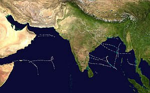
The 1972 North Indian Ocean cyclone season was part of the annual cycle of tropical cyclone formation. The season had no official bounds, but cyclones tend to form between April and December. These dates conventionally delimit the period of each year when most tropical cyclones form in the northern Indian Ocean. There are two main seas in the North Indian Ocean—the Bay of Bengal to the east of the Indian subcontinent and the Arabian Sea to the west of India. The official Regional Specialized Meteorological Centre in this basin is the India Meteorological Department (IMD), while the Joint Typhoon Warning Center (JTWC) releases unofficial advisories. An average of five tropical cyclones form in the North Indian Ocean every season with peaks in May and November.[1] Cyclones occurring between the meridians 45°E and 100°E are included in the season by the IMD.[2]
This section is empty. You can help by . (July 2021)
Tropical Storm Five (05B)[]
Tropical storm (SSHWS)
Duration
July 13 – July 15
Peak intensity
65 km/h (40 mph) (1-min)
This section is empty. You can help by . (July 2021)
Cyclone Nine (09B)[]
Extremely severe cyclonic storm (IMD)
Category 1 tropical cyclone (SSHWS)
Duration
September 7 – September 14
Peak intensity
175 km/h (110 mph) (3-min)
This storm was formed on 7 September, possibly due to a storm's remnant from the West Pacific Ocean. it gradually intensified to a Very Severe Cyclonic Storm by 9 September. The storm made landfall at Ichhapuram in Andhra Pradesh on 10 September. Due to the storm, 100 people and 8000 cattle were perished.Puri in Odisha recorded gust winds up to 185 kmph. Heavy damages to agricultural crops took place at Odisha and Andhra Pradesh. Nearly 2 lakh people were affected by the storm. Ganjam District in Odisha was the worst affected by the storm. It was one of the most intense cyclones to hit India in the month of September.[3]
Cyclone Ten (10B)[]
Very severe cyclonic storm (IMD)
Category 1 tropical cyclone (SSHWS)
Duration
September 20 – September 25
Peak intensity
140 km/h (85 mph) (3-min)
This cyclone was formed on 20 September and intensified to a Very Severe Cyclonic Storm despite being present over the upwelled waters due to Cyclone 09B. It made landfall at Gopalpur in Odisha on 22 September and dissipated by the next day. Wind gusts of up to 140 kmph were recorded at the time of landfall. Despite severe damage to crops and houses, no deaths due to the storm were reported.
Cyclone Twelve (12A)[]
Cyclonic storm (IMD)
Category 1 tropical cyclone (SSHWS)
Duration
October 19 – October 25
Peak intensity
85 km/h (50 mph) (3-min)
This section is empty. You can help by . (July 2021)
This cyclone was formed on 15 November and gradually intensified to a Severe Cyclonic Storm. After making an erratic loop, the storm made landfall at Sriharikota on 22 November. The lowest pressure was 983 hPa and wind gusts of up to 165 kmph were measured by the ship ATAF. 80 people were reportedly killed due to the storm. Several trees were uprooted and thousands of people were rendered homeless.
Cyclone Sixteen (16B)[]
Very severe cyclonic storm (IMD)
Category 1 tropical cyclone (SSHWS)
Duration
December 1 – December 8
Peak intensity
155 km/h (100 mph) (3-min)
This storm has killed 80 people and 150 cattle. 30,000 people were rendered homeless. Cuddalore recorded gust winds up to 150 kmph at the time of landfall. Total damages in Indian Rupees were estimated to be 40 crores.[4] The cyclone is visible on The Blue Marble photo taken by Apollo 17.
^Dipankar C. Patnaik & N. Sivagnanam (November 2007). "DISASTER VULNERABILITY OF COASTAL STATES: A Short Case Study of Orissa, India". Social Science Research Network. p. 4. SSRN1074845. Missing or empty |url= (help)