1979 North Indian Ocean cyclone season

From Wikipedia, the free encyclopedia
1979 North Indian Ocean cyclone season
1979 North Indian Ocean cyclone season summary.jpg
Season summary map
Seasonal boundaries
First system formedMay 6, 1979
Last system dissipatedNovember 25, 1979
Strongest storm
NameOne
 • Maximum winds185 km/h (115 mph)
(3-minute sustained)
 • Lowest pressure936 hPa (mbar)
Seasonal statistics
Depressions11
Cyclonic storms5
Severe cyclonic storms4
Total fatalities≥700
Total damageUnknown
Related articles
North Indian Ocean tropical cyclone seasons
1977, 1978, 1979, 1980, 1981

The 1979 North Indian Ocean cyclone season was part of the annual cycle of tropical cyclone formation. The season has no official bounds but cyclones tend to form between April and December. These dates conventionally delimit the period of each year when most tropical cyclones form in the northern Indian Ocean. There are two main seas in the North Indian Ocean—the Bay of Bengal to the east of the Indian subcontinent and the Arabian Sea to the west of India. The official Regional Specialized Meteorological Centre in this basin is the India Meteorological Department (IMD), while the Joint Typhoon Warning Center (JTWC) releases unofficial advisories. An average of five tropical cyclones form in the North Indian Ocean every season with peaks in May and November.[1] Cyclones occurring between the meridians 45°E and 100°E are included in the season by the IMD.[2]

Systems[]

Cyclone One (1B)[]

Extremely severe cyclonic storm (IMD)
Category 2 tropical cyclone (SSHWS)
01B 1979-05-11 0900Z.png 01B 1979 track.png
DurationMay 6 – May 13
Peak intensity185 km/h (115 mph) (3-min)  936 hPa (mbar)

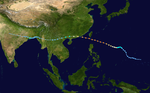
The system formed on 6 May close to the coast of Sri Lanka. It moved towards northwest in its existence after making a small loop. On 13 May, the cyclone made landfall near Ongole in Andhra Pradesh and dissipated rapidly by the same day. The storm killed 700 people and 300,000 cattle over there.[3]Nellore reported gust winds up to 155 kmph. In Peddaganjam and Kovuur, storm surges were up to 12 ft. which led to coastal flooding in those areas. Together 40 lakh people were affected by the storm and nearly 7 lakh houses were damaged.

Tropical Storm Two (2A)[]

Cyclonic storm (IMD)
Tropical storm (SSHWS)
02A Jun 19 1979 1139Z.png 02A 1979 track.png
DurationJune 18 – June 20
Peak intensity75 km/h (45 mph) (3-min) 

Tropical Storm Three (3B) (Hope)[]

Severe cyclonic storm (IMD)
Tropical storm (SSHWS)
03B Aug 7 1979 0943Z.png Hope 1979 track.png
DurationAugust 5 – August 8
Peak intensity100 km/h (65 mph) (3-min) 

Tropical Storm Four (4B/4A)[]

Severe cyclonic storm (IMD)
Tropical storm (SSHWS)
04A Sep 22 1979 1425Z.png 04B 1979 track.png
DurationSeptember 21 – September 23
Peak intensity110 km/h (70 mph) (3-min) 

Tropical Depression Five (5B)[]

Depression (IMD)
Tropical depression (SSHWS)
05B Sep 21 1979 2103Z.png 05B 1979 track.png
DurationSeptember 21 – September 25
Peak intensity45 km/h (30 mph) (3-min) 

Tropical Storm Six (6B)[]

Depression (IMD)
Tropical storm (SSHWS)
06B Oct 31 1979 2218Z.png 06B 1979 track.png
DurationOctober 29 – November 1
Peak intensity45 km/h (30 mph) (3-min) 

Tropical Storm Seven (7A)[]

Cyclonic storm (IMD)
Tropical storm (SSHWS)
07A Nov 15 1979 2257Z.png 07A 1979 track.png
DurationNovember 16 – November 17
Peak intensity65 km/h (40 mph) (3-min) 

Tropical Depression Eight (8B)[]

Deep depression (IMD)
Tropical depression (SSHWS)
08B Nov 24 1979 1022Z.png 08B 1979 track.png
DurationNovember 23 – November 25
Peak intensity55 km/h (35 mph) (3-min) 

See also[]

References[]

  1. ^ "Frequently Asked Questions: What is the annual frequency of Cyclones over the Indian Seas? What is its intra-annual variation?". India Meteorological Department. 2012. Archived from the original on May 21, 2015. Retrieved June 8, 2012.
  2. ^ "Bulletins Issued by Regional Specialized Meteorological Centre (RSMC) – Tropical Cyclones, New Delhi" (PDF). India Meteorological Department. May 25, 2009. Archived from the original (PDF) on 2012-04-12. Retrieved July 16, 2012.
  3. ^ Dipankar C. Patnaik & N. Sivagnanam (November 2007). "DISASTER VULNERABILITY OF COASTAL STATES: A Short Case Study of Orissa, India". Social Science Research Network. p. 4. SSRN 1074845. {{cite web}}: Missing or empty |url= (help)

External links[]

Retrieved from ""