1976 Sabah earthquake
 | |
| UTC time | 1976-07-26 02:56:38 |
|---|---|
| ISC event | 711657 |
| USGS-ANSS | ComCat |
| Local date | 26 July 1976 |
| Local time | 10:56 MST (UTC+08:00)[1] |
| Magnitude | 6.2 (Mw)[1] |
| Depth | 15 km (9.3 mi)[1] |
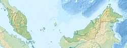
| Epicenter | 4°57′22″N 118°18′29″E / 4.956°N 118.308°ECoordinates: 4°57′22″N 118°18′29″E / 4.956°N 118.308°E[1] |
| Type | Normal |
| Areas affected | Tawau Division & Sandakan Division, Sabah, East Malaysia |
| Max. intensity | VII (Very strong)[2] |

The 1976 Sabah earthquake occurred at 10:56 am on 26 July near Lahad Datu in the eastern portion of Sabah, Malaysia.[1] The moment magnitude was 6.2, making it the largest earthquake in Malaysia recorded by seismic instruments. While slightly larger than the 2015 Sabah earthquake (Mw 6.0), the 1976 event caused less extensive damage.
See also[]
- List of earthquakes in 1976
- List of earthquakes in Malaysia
- Seismic activity of Malaysia
References[]
- ^ a b c d e "USGS Event Summary". United States Geological Survey. Retrieved 2 May 2016.
- ^ National Geophysical Data Center / World Data Service (NGDC/WDS) (1972), Significant Earthquake Database (Data Set), National Geophysical Data Center, NOAA, doi:10.7289/V5TD9V7K
External links[]
- The International Seismological Centre has a bibliography and/or authoritative data for this event.
This article about an earthquake in Asia is a stub. You can help Wikipedia by . |
Categories:
- 1976 earthquakes
- 1976 in Malaysia
- Earthquakes in Malaysia
- History of Sabah
- Malaysia stubs
- Southeast Asian history stubs
- Asian earthquake stubs