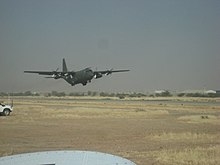
Abéché Airport
Abéché Airport مطار أبشي | |||||||||||
|---|---|---|---|---|---|---|---|---|---|---|---|
 | |||||||||||
| Summary | |||||||||||
| Airport type | Public | ||||||||||
| Operator | Government | ||||||||||
| Serves | Abéché, Chad | ||||||||||
| Elevation AMSL | 1,788 ft / 545 m | ||||||||||
| Coordinates | 13°50′49″N 020°50′39″E / 13.84694°N 20.84417°ECoordinates: 13°50′49″N 020°50′39″E / 13.84694°N 20.84417°E | ||||||||||
| Map | |||||||||||
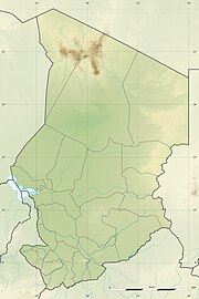 FTTC Location of airport in Chad | |||||||||||
| Runways | |||||||||||
| |||||||||||

Abéché Airport (Arabic: مطار أبشي; French: Aéroport d'Abéché; (IATA: AEH, ICAO: FTTC)) is an airport serving Abéché, the fourth largest city in Chad and the capital city of Chad's Ouaddaï Region.
Facilities[]
The airport resides at an elevation of 1,788 feet (545 m) above mean sea level. It has one runway designated 09/27 with an asphalt surface measuring 2,800 by 30 metres (9,186 ft × 98 ft).[1]
Airline and destinations[]
The following airline offers scheduled passenger service:
| Airlines | Destinations |
|---|---|
| Tchadia Airlines | Faya-Largeau,[3] N'Djamena[3] |
References[]
- ^ a b Airport information for FTTC Archived 2016-03-04 at the Wayback Machine from DAFIF (effective October 2006)
- ^ Airport information for AEH at Great Circle Mapper. Source: DAFIF (effective October 2006).
- ^ a b "Tchadia Airlines outlines planned network from Oct 2018". routesonline.com. Retrieved 26 September 2018.
External links[]
Categories:
- Airports in Chad
- Ouaddaï Region