Abaliget
Abaliget
Abaling (German) | |
|---|---|
Village | |
 Lake Abaliget | |
 Seal | |
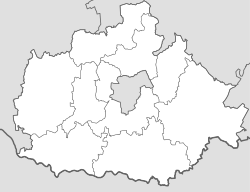 Abaliget Location of Abaliget | |
| Coordinates: 46°08′39″N 18°07′00″E / 46.14419°N 18.11675°ECoordinates: 46°08′39″N 18°07′00″E / 46.14419°N 18.11675°E | |
| Country | |
| County | Baranya |
| District | Pécs |
| Area | |
| • Total | 16.09 km2 (6.21 sq mi) |
| Population (1 Jan 2019)[1] | |
| • Total | 647 |
| • Density | 40/km2 (100/sq mi) |
| Time zone | UTC+1 (CET) |
| • Summer (DST) | UTC+2 (CEST) |
| Postal code | 7678 |
| Area code | 72 |
| NUTS 3 code | HU231 |
| HCSO code | 12548 |
| Website | www |


Abaliget ([ˈɒbɒliɡɛt], German: Abaling) is a village (Hungarian: község) in central Baranya County, Pécs District, in southern Hungary. It is located in the western Mecsek Mountains. The nearby and the area's lakes and hiking trails make it a popular tourist destination. Its population at the was 598.[2]
Geography[]
The village is located at 46° 8′ 39.08″ N, 18° 7′ 0.3″ E. Its area is 16.09 km2 (6.21 sq mi). It is part of the Southern Transdanubia statistical region, and administratively it falls under Baranya County and then Pécs District.
It lies 12 km (7.5 mi) northwest of the city of Pécs[3] and is bordered by the villages of Husztót and Kovácsszénája to the north, Orfű to the east, Kővágószőlős and Kővágótöttös to the south, Hetvehely to the west, and Okorvölgy and Szentkatalin to the northwest.
Abaliget is located in the western Mecsek Mountains, and much of its land lies within the , managed by the Danube-Dráva National Park. The village is located on Middle Triassic limestone karst, which has formed the sinkholes, springs, tufa, and caves that are common features in the surrounding area.[4]
Demographics[]
2011 census[]
As of the , there were 598 residents, 248 households, and 159 families living in the village. The population density was 96 inhabitants per square mile (37/km2). There were 241 dwellings at an average density of 39 per square mile (15/km2).
There were 248 households, of which 64.1% were one-family households, 0.0% were multi-family households, 33.1% were one-person households, and 2.8% were other non-family households. The average household size was 2.41.
There were 159 families, of which 54.7% were couples living with children, 27.0% were couples living without children, 17.0% were single females with children, and 1.3% were single males with children. The average number of children was 1.26. The average family size was 3.08.
The age breakdown of the village was 20.1% under the age of 20, 8.5% between ages 20 and 24, 27.1% aged 25 to 44, 31.6% aged 45 to 64, and 12.7% aged 65 and older. The gender ratio was 1.00 male to every female.
In terms of educational attainment, 93.9% completed at least primary school, 44.1% completed at least secondary school with final examination, and 16.9% had a higher education degree.[2]
Religious affiliation was 55.4% Roman Catholic, 4.0% Calvinist, 1.7% Greek Catholic, 0.3% Lutheran, 1.0% other religion, and 9.5% unaffiliated, with 28.1% declining to answer.
The village had an ethnic minority Roma population of 14.4%. Other minority nationality affiliations of note were German (4.8%) and other, non-native to Hungary (3.8%), with small numbers of Poles, Croats, and Romanians totaling less than 1%. The vast majority declared themselves as Hungarian (83.9%), with 14.9% declining to answer.[note 1][5]
Local government[]
The village is governed by a mayor with a four-person council. The local government of the village operates a with the nearby localities of Husztót, Kovácsszénája, Kővágótöttö, and Orfű. Abaliget maintains a branch office, but the seat of the joint council is in Orfű.[1][6]
As of the election of 2019, the village also has a local for its Roma community, with three elected representatives.[7]
Mayors since 1990[]
| Mayor | Party | Term(s) of Office | |
|---|---|---|---|
| Gábor Ivády | Independent | 2019- | |
| János Kisfali | Independent | 2014-2019 | |
| 2010-2014 | |||
| 2006-2010 | |||
| István Baritz | Independent | 2002-2006 | |
| 1998-2002 | |||
| Lajos Tarai | Independent | 1994-1998 | |
| István Baritz | Independent | 1990-1994 | |
Points of Interest[]

- (also called Paplika), an active karst cave with stalactites formed from Triassic period limestone. It has a total length of 2,000 meters across 3 branches, making it the longest cave in the Mecsek Mountains. It has been under protected status since 1982. The Danube-Dráva National Park Directorate has managed tourist access to the cave and its conservation since 1996. Visitors can go on guided tours of the main branch and the cave is also used for speleotherapy.[9][10][11]
- The Bat Museum (Denevérmúzeum), which opened in 2004 to highlight the research of local bat populations. Bat research has been ongoing in since 1923, and 19 species are known to reside there regularly, the most common being the Geoffroy's bat (M. emarginatus), lesser horseshoe bat (R. hipposideros), and greater horseshoe bat (R. ferrumequinum).[4][12][13]
Transportation[]
Railway[]
- , 3.5 km (2.2 mi) to the northwest of the village off . The station is on the and is operated by MÁV.
Road[]
- connects the village to Pécs.
- connects the village to Orfű.
- , which runs north of the village, connects to Oroszló and Szentlőrinc.
Sister cities[]
 Knonau, Switzerland, since 1993
 Dannenfels, Germany, since 2002
 Sievi, Finland, since 2005
See also[]
- Abaliget Village Website (in Hungarian)
- Abaliget Cave Website (in Hungarian)
- Map of the Western Mecsek Landscape Protection District (in Hungarian)
- Street map (in Hungarian)
- OpenStreetMap
Notes[]
- ^ As a person can affiliate themselves with more than one ethnic group (nationality), the totals may be greater than 100%.
References[]
- ^ Jump up to: a b c d "Gazetteer of Hungary, 1 January 2019" (PDF). Hungarian Central Statistical Office. Retrieved 22 June 2020.
- ^ Jump up to: a b c "Population Census 2011: Regional Data - Baranya County". Hungarian Central Statistical Office. 1 October 2011. Retrieved 22 June 2020.
- ^ "Distance Calculator Find Distance Between Cities". Distance Calculator. Retrieved 2020-06-30.
- ^ Jump up to: a b "Western Mecsek Landscape Protection District". Danube-Dráva National Park Directorate (in Hungarian). Retrieved 2020-06-27.
- ^ "Detailed Gazetteer of Hungary: Abaliget". Hungarian Central Statistics Office. Retrieved 30 June 2020.
- ^ "Local government elections 2019 - Abaliget (Baranya County)". Hungarian National Election Office (in Hungarian). Retrieved 1 July 2020.
- ^ "Nationality local government elections 2019 - Abaliget (Baranya County)". Hungarian National Election Office (in Hungarian). Retrieved 1 July 2020.
- ^ "Download election results, 1990-2019". Hungarian National Election Office (in Hungarian). 29 October 2019. Retrieved 1 July 2020.
- ^ "The History of the Cave". Abaligeti Barlang (in Hungarian). Retrieved 2020-06-26.
- ^ "Caves". Hungarian Nature Conservation Office. Retrieved 26 June 2020.
- ^ "Abaliget Cave". Hungarian Nature Conservation Office (in Hungarian). Retrieved 2020-06-27.
- ^ "Abaliget Bat Museum". Abaligeti Barlang (in Hungarian). Retrieved 2020-06-27.
- ^ Duckeck, Jochen. "Abaligeti-barlang". www.showcaves.com. Retrieved 2020-06-27.

| show Baranya County |
|---|


| Authority control |
|---|
- Populated places in Baranya County
- Hungarian German communities