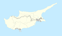
Agios Ilias, Cyprus
Agios Ilias
| |
|---|---|
 Agios Ilias | |
| Coordinates: 35°19′40″N 33°55′40″E / 35.32778°N 33.92778°ECoordinates: 35°19′40″N 33°55′40″E / 35.32778°N 33.92778°E | |
| Country (de jure) | |
| • District | Famagusta District |
| Country (de facto) | |
| • District | İskele District |
| Population (2011)[2] | |
| • Total | 429 |
Agios Ilias (Greek: Άγιος Ηλίας "Saint Elias"; Turkish: Yarköy "village of a cliff", previously Ayiliya) is a village in the Famagusta District of Cyprus, located 6 kilometres (3.7 mi) north-east of Trikomo. It is under the de facto control of Northern Cyprus.
Traditionally, Agios Ilias was primarily inhabited by Greek-speaking Orthodox Christians. In 1973, it had 355 inhabitants, all of whom were Greek Cypriot. In August 1974, they were forced to flee their village by the approaching Turkish army. Today, Agios Ilias is inhabited by settlers from the Denizli Province of Turkey.[3]
The first school was established in the village during the Ottoman period, in 1865. Before then, the village priests (and perhaps monks) provided some teaching from religious books held in the church.
References[]
- ^ In 1983, the Turkish Republic of Northern Cyprus unilaterally declared independence from the Republic of Cyprus. The de facto state is not recognised by any UN state except Turkey.
- ^ "KKTC 2011 Nüfus ve Konut Sayımı" [TRNC 2011 Population and Housing Census] (PDF) (in Turkish). TRNC State Planning Organization. 6 August 2013. Archived from the original (PDF) on 6 November 2013.
- ^ "AGIOS ELIAS". Internal displacement in Cyprus. PRIO Cyprus Centre. Retrieved 19 November 2014.
- Communities in Famagusta District
- Populated places in İskele District
- Cyprus geography stubs


