Agudos
Agudos | |
|---|---|
 Flag | |
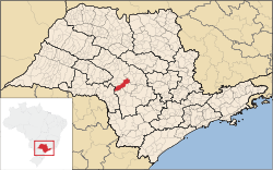 Location in São Paulo state | |
 Agudos Location in Brazil | |
| Coordinates: 22°28′26″S 48°59′1″W / 22.47389°S 48.98361°WCoordinates: 22°28′26″S 48°59′1″W / 22.47389°S 48.98361°W | |
| Country | Brazil |
| Region | Southeast |
| State | São Paulo |
| Area | |
| • Total | 966 km2 (373 sq mi) |
| Elevation | 580 m (1,900 ft) |
| Population (2020 [1]) | |
| • Total | 37,401 |
| • Density | 39/km2 (100/sq mi) |
| Time zone | UTC-03:00 (BRT) |
| • Summer (DST) | UTC-02:00 (BRST) |
| Postal code | 17120-000 |

Agudos is a Brazilian municipality located in the west-central part of the state of São Paulo. The population is 37,401 (2020 est.) in an area of 966 km².[2] Distance from the capital is 330 km and is accessed by the Rodovia Marechal Rondon. The municipality was established in 1898, when it was separated from Lençóis.[3]
Geography[]
Limits[]
Economy[]
Agudos; economy is an agricultural municipality and have some industries of national prominence as Duratex and the Ambev. The municipal agricultural production is made up of:
- Pineapples
- Sugar cane
- Cassava
- Corn
- Orange
- Lemon
- Tangerina
The Duratex industry possesses extensive reserves in the city that are managed by the Duraflora. The cattle of Agudos has about 70,000 cows, 10,000 swines and 300,000 chickens.
References[]
External links[]
- (in Portuguese) Agudos website
| Authority control |
|
|---|
This geographical article relating to the state of São Paulo is a stub. You can help Wikipedia by . |
- Municipalities in São Paulo (state)
- Populated places established in 1898
- 1898 establishments in Brazil
- São Paulo (state) geography stubs