Ain Janna
Ain Janna
عين جنّا | |
|---|---|
 Ajlun mountains | |
 Ain Janna Location in Jordan | |
| Coordinates: 32°20′06″N 35°45′51″E / 32.33500°N 35.76417°E | |
| Grid position | 222/194 |
| Country | |
| Governorate | Ajloun Governorate |
| Time zone | UTC + 2 |

Ain Janna (Arabic: عين جنّا) is a village is located in the Ajloun Governorate in the north-western part of Jordan. The name is Arabic for Spring of Paradise: Ain is a spring (of water), and Janna is Paradise. The name was being his own given to the village due to the abundance of water springs and apparent availability of water in the village and its surroundings. As a matter of fact, Ain Janna still has some springs, causing its landscape to be green and crystal clear. It is about 70 km (43 mi) to the north of Amman, capital of Jordan. It lies on two juxtaposed mountains, and has a view over Ajlun's Castle and three towns. Average altitude of the village is about 1100 meters above sea level, causing most of the houses in the village to have a view reaching far beyond Jordan; one can easily see some mountains of Nablus in the West Bank (about 30 km /22 miles air distance).
History[]
In 1596, during the Ottoman Empire, Ain Janna (under the name of 'Ayn Jannat al-Faqih) was noted in the census as being located in the nahiya of Ajloun in the liwa of Ajloun. It had a population of 43 Muslim households and 3 Muslim bachelors, in addition to 12 Christian households and 3 Christian bachelors. They paid a fixed tax-rate of 25% on various agricultural products, including wheat, barley, summer crops, olive trees, goats and beehives, in addition to occasional revenues and for an olive oil press/press for grape syrup; a total of 10,000 akçe.[3]
In 1838 'Anjara's inhabitants were predominantly Sunni Muslims and Greek Christians.[4]
People[]
Ain Janna is home to about 10,000 people, almost 93% of them belong to a tribe called Al-Qudah[citation needed], the Arabic plural of "Qadi" (Judge). The same tribe stretches over other 5 villages in the near area; with another branch of the tribe living in Mhay, a village in the province of Kerak, about 180 km (110 mi) to the south of Amman. Mainly, profession of grandfathers in the village was farming and cultivation, to which they were fully devoted, and there are many tribes which lives an Ain Janna such as Al-Momani, Al-Jalabneh, and Al-Kharabsheh which is the oldest tribe in the village.[citation needed]
Literacy[]
Almost all the population of the village who were born after 1930 can read and write; while every single person under the age of 50 can be named as literate. Because the meager income overwhelms the villagers, one can easily see that the youth find themselves reluctant to pursue university degrees and higher education so as to follow better jobs. Ain Janna is therefore very well known as a village with a very high percentage of literate people who fill various prestigious jobs in the public sector; especially in academics, judiciary and civil service. On the other hand, about 25% of high school graduates join the Jordanian Armed Forces and departments of the Ministry of Defense; i.e. Public Security, Civil Defense and Department of Intelligence.[citation needed]
Nature & Environment[]
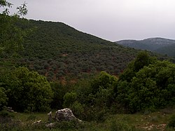
Ain Janna stretches over a green land, and totally surrounded by oak and pine trees. Greenery can be seen wherever one might look, resulting in a sight-seeing view, especially olive trees, grapes, figs and almond. Both mountains of the village, in addition to the mountainous area around, cause the air to be very pure and pollution-free. One can hardly find a house in the village without being surrounded by a number of trees and a small garden. All in all, nature in and around Ain Janna, is very well protected, thanks to the awareness of importance of landscape and environment, and because the whole province lacks factories and pollutant industrial installations that emit poisonous fumes.[citation needed]
References[]
Bibliography[]
- Hütteroth, Wolf-Dieter; Abdulfattah, Kamal (1977). Historical Geography of Palestine, Transjordan and Southern Syria in the Late 16th Century. Erlanger Geographische Arbeiten, Sonderband 5. Erlangen, Germany: Vorstand der Fränkischen Geographischen Gesellschaft. ISBN 3-920405-41-2.
- Robinson, E.; Smith, E. (1841). Biblical Researches in Palestine, Mount Sinai and Arabia Petraea: A Journal of Travels in the year 1838. 3. Boston: Crocker & Brewster.
External links[]
Coordinates: 32°20′06″N 35°45′51″E / 32.335118°N 35.764135°E
- Populated places in Ajloun Governorate
- Tourism in Jordan