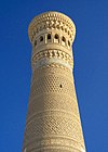
Akhsikath
This article needs additional citations for verification. (June 2020) |
Ahsikent (recorded as Akhsikath in medieval texts; also known as Ahsikath and Axsikat) is a site of ancient settlement and ancient capital of Farghona (Fergana). It is located on the right branch of the Sirdarya River in the Turakurgan district of the Namangan region of Uzbekistan (40°53′12″N 71°27′02″E / 40.886569°N 71.450602°ECoordinates: 40°53′12″N 71°27′02″E / 40.886569°N 71.450602°E). It is currently under consideration for designation as a UNESCO World Heritage Site.
History[]
Aksikent was already well established in the 3rd century BC. There are written records that the Chinese commander Li Guanli besieged the city with 60,000 soldiers for 40 days in 103 BC in an attempt to gain control of the territory and its famous Ferghana horses, and in the following century, Aksikent was conquered firstly by the Kushans and then by the Turks. [1]
In the medieval period, Aksikent was a caravan route stop between Kashgar to Byzantium, and locally made goods were traded as far away as Baghdad and Damascus. The city grew rich on the profits of trade, and by the 10th century it was one of the major cities in the Fergana Valley. Aksikent’s wealth made it a target for Genghis Khan, and it was consequently attacked by the Kara Khitai, and then destroyed during the Mongol invasion in 1219. [2]
There was an attempt to rebuild Aksikent 5 km downriver, and this new city lasted approximately 400 years. It is believed to be the birthplace of Emperor Babur, who came to the throne here in 1494 and described the city in his memoirs, the Baburnama.[3] An earthquake in 1620 demolished the new settlement, and the inhabitants were forced to move to nearby Namangan.[4]
Site description[]
The ruins of Aksikent are located 22km southwest of Namangan, close to the confluence of the Syr Darya and Kasansai rivers in the Namangan Region of Uzbekistan. Aksikent occupied an area of more than 25 hectares, and when the city was at its height, the perimeter wall would have been 18km long and 2m thick.[5]
Aksikent was divided into three parts. In the centre was the citadel, surrounded by the shahristan (the main city), and beyond that were the rabad (suburbs). All the buildings were encircled by fortifications made from mud bricks. The central citadel housed a mosque, a bath house, and the governor’s palace, as well as a zindan (prison). There is also archeological evidence of watch towers, trading domes, hostels, a large market, and a hauz (drinking water reservoir).
The craftsmens’ area of Aksikent was located in the rabad. The metal workshops were particularly important: Aksikent was the largest and, with Merv in Turkmenistan, one of the few places in Central Asia where the very high-quality crucible steel known as Damascus steel is known to have been produced.[6]
World Heritage status[]
This site was added to the UNESCO World Heritage Tentative List on 18 January 2008, in the Cultural category.
References[]
- ^ Ibbotson, Sophie (2020). Uzbekistan. United Kingdom: Bradt Travel Guides Ltd. p. 137. ISBN 9-781784-771089.
- ^ Ibbotson, Sophie (2020). Uzbekistan. United Kingdom: Bradt Guides Ltd. p. 137. ISBN 9-781784-771089.
- ^ "Expression of ancient and modern akhsikent in "Boburnoma"". ACADEMICIA: An International Multidisciplinary Research Journal. 10 (9). 2020. ISSN 2249-7137.
- ^ "Памятники Ахсикент". meros.uz. Retrieved 2020-10-29.
- ^ Ibbotson, Sophie (2020). Uzbekistan. United Kingdom: Bradt Travel Guides Ltd. p. 137. ISBN 9-781784-771089.
- ^ Ibbotson, Sophie (2020). Uzbekistan. United Kingdom: Bradt Travel Guides. p. 137. ISBN 9-781784-771089.
External links[]
- Archaeological sites in Uzbekistan
- Namangan Region
- World Heritage Tentative List
- Sogdian cities
 WikiMiniAtlas