Alamarvdasht
Alamarvdasht
علامرودشت | |
|---|---|
City | |
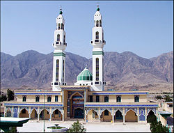 Imam Hasan Religious and Cultural Complex in Alamarvdasht | |
 Alamarvdasht | |
| Coordinates: 27°37′34″N 53°00′00″E / 27.62611°N 53.00000°ECoordinates: 27°37′34″N 53°00′00″E / 27.62611°N 53.00000°E | |
| Country | |
| Province | Fars |
| County | Lamerd |
| Bakhsh | Alamarvdasht |
| Elevation | 470 m (1,540 ft) |
| Population (2016 Census) | |
| • Total | 4,068 [1] |
| Time zone | UTC+3:30 (IRST) |
| • Summer (DST) | UTC+4:30 (IRDT) |
| Area code(s) | 071-5278 |
| Website | www.alamarvdasht.com |

Alamarvdasht (Persian: علامرودشت)[2] is a city and capital of Alamarvdasht District, in Lamerd County, Fars Province, Iran. At the 2006 census, its population was 3,502, in 811 families[3] and at the 2011 census, Alamarvdasht population reached to 4025 (1986 men & 2066 women) in 969 families.[4]
History[]
This section is empty. You can help by . (November 2014) |
Geography[]
Climate[]
Alamarvdasht features a steppe climate, continental climate (Köppen climate classification: BSh) Due to annual precipitation is in the range of 50%–100% of the threshold, the classification is BSh (Hot semi-arid climate).
| showClimate data for Alamarvdasht, Altitude: 457 M |
|---|
References[]
- ^ https://www.amar.org.ir/english
- ^ Alamarvdasht can be found at GEOnet Names Server, at this link, by opening the Advanced Search box, entering "-3052261" in the "Unique Feature Id" form, and clicking on "Search Database".
- ^ "Census of the Islamic Republic of Iran, 1385 (2006)" (Excel). Statistical Center of Iran. Archived from the original on 2011-11-11.
- ^ "Census of the Islamic Republic of Iran, 1390 (2011)". Islamic Republic of Iran. Archived from the original (Excel) on 2016-10-06.
- ^ I.R OF IRAN METEOROLOGICAL ORGANIZATION ( IN PERSIAN ). 1993-2011
| Wikimedia Commons has media related to Alamarvdasht. |
| hide | |||||
|---|---|---|---|---|---|
| District Capital | |||||
| Rural Districts and villages |
| ||||
| show |
|---|

| show |
|---|
| Authority control |
|
|---|
This Lamerd County location article is a stub. You can help Wikipedia by . |
Categories:
- Populated places in Lamerd County
- Cities in Fars Province
- Alamarvdasht District
- Lamerd County geography stubs