Albion, Nebraska
Albion, Nebraska | |
|---|---|
 Downtown Albion: north side of West Church Street, looking eastward | |
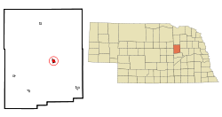 Location of Albion, Nebraska | |
| Coordinates: 41°41′22″N 98°0′11″W / 41.68944°N 98.00306°WCoordinates: 41°41′22″N 98°0′11″W / 41.68944°N 98.00306°W | |
| Country | United States |
| State | Nebraska |
| County | Boone |
| Area | |
| • Total | 1.04 sq mi (2.68 km2) |
| • Land | 1.04 sq mi (2.68 km2) |
| • Water | 0.00 sq mi (0.00 km2) |
| Elevation | 1,772 ft (540 m) |
| Population | |
| • Total | 1,650 |
| • Estimate (2019)[5] | 1,585 |
| • Density | 1,529.92/sq mi (590.49/km2) |
| Time zone | UTC-6 (Central (CST)) |
| • Summer (DST) | UTC-5 (CDT) |
| ZIP code | 68620 |
| Area code(s) | 402 |
| FIPS code | 31-00555[3] |
| GNIS feature ID | 0826929[4] |
| Website | www |

Albion is a city in and the county seat of Boone County, Nebraska, United States.[6] The population was 1,650 at the 2010 census.
Geography[]
Albion is located at 41°41′22″N 98°0′11″W / 41.68944°N 98.00306°W (41.689342, -98.003128).[7]
According to the United States Census Bureau, the city has a total area of 0.99 square miles (2.56 km2), all land.[8]
History[]
After several weeks of discussion, the name "Albion" was chosen in a game of euchre. Two men played for the name "Albion" and two played for the name "Manchester."[9] The town was platted as "Albion" in 1872 by Loran Clark.[10] The name is a transfer from Albion, Michigan.[11] It was designated county seat in 1873.[12]
Climate[]
Albion has a humid continental climate (Köppen Dwa), with cold, dry winters and hot summers. Precipitation is highest in the late spring and summer months, with an annual average of 25.7 in (650 mm).
| hideClimate data for Albion, Nebraska | |||||||||||||
|---|---|---|---|---|---|---|---|---|---|---|---|---|---|
| Month | Jan | Feb | Mar | Apr | May | Jun | Jul | Aug | Sep | Oct | Nov | Dec | Year |
| Average high °F (°C) | 32.8 (0.4) |
36.6 (2.6) |
47.5 (8.6) |
62.0 (16.7) |
72.6 (22.6) |
82.1 (27.8) |
88.5 (31.4) |
86.3 (30.2) |
77.7 (25.4) |
66.3 (19.1) |
49.0 (9.4) |
36.5 (2.5) |
61.5 (16.4) |
| Average low °F (°C) | 9.0 (−12.8) |
13.0 (−10.6) |
23.0 (−5.0) |
35.5 (1.9) |
46.5 (8.1) |
56.9 (13.8) |
61.8 (16.6) |
59.7 (15.4) |
49.8 (9.9) |
37.2 (2.9) |
23.4 (−4.8) |
13.5 (−10.3) |
35.8 (2.1) |
| Average precipitation inches (mm) | 0.4 (10) |
0.7 (18) |
2.0 (52) |
2.8 (70) |
4.2 (106) |
4.5 (115) |
3.4 (87) |
3.7 (93) |
2.8 (70) |
1.7 (42) |
1.1 (29) |
0.6 (16) |
27.9 (708) |
| Source 1: Weatherbase (temperature) [13] | |||||||||||||
| Source 2: Climatemps.com (precipitation)[14] | |||||||||||||
Demographics[]
| Historical population | |||
|---|---|---|---|
| Census | Pop. | %± | |
| 1880 | 330 | — | |
| 1890 | 926 | 180.6% | |
| 1900 | 1,369 | 47.8% | |
| 1910 | 1,584 | 15.7% | |
| 1920 | 1,978 | 24.9% | |
| 1930 | 2,172 | 9.8% | |
| 1940 | 2,268 | 4.4% | |
| 1950 | 2,132 | −6.0% | |
| 1960 | 1,982 | −7.0% | |
| 1970 | 2,074 | 4.6% | |
| 1980 | 1,997 | −3.7% | |
| 1990 | 1,916 | −4.1% | |
| 2000 | 1,797 | −6.2% | |
| 2010 | 1,650 | −8.2% | |
| 2019 (est.) | 1,585 | [5] | −3.9% |
| U.S. Decennial Census[15] | |||
2010 census[]
As of the census[2] of 2010, there were 1,650 people, 747 households, and 443 families living in the city. The population density was 1,666.7 inhabitants per square mile (643.5/km2). There were 822 housing units at an average density of 830.3 per square mile (320.6/km2). The racial makeup of the city was 98.4% White, 0.2% African American, 0.5% Native American, 0.2% Asian, 0.1% Pacific Islander, 0.2% from other races, and 0.4% from two or more races. Hispanic or Latino of any race were 1.8% of the population.
There were 747 households, of which 24.0% had children under the age of 18 living with them, 48.9% were married couples living together, 7.4% had a female householder with no husband present, 3.1% had a male householder with no wife present, and 40.7% were non-families. 37.6% of all households were made up of individuals, and 23.6% had someone living alone who was 65 years of age or older. The average household size was 2.13 and the average family size was 2.80.
The median age in the city was 47.9 years. 21.6% of residents were under the age of 18; 5.9% were between the ages of 18 and 24; 19.5% were from 25 to 44; 25.1% were from 45 to 64; and 28.1% were 65 years of age or older. The gender makeup of the city was 46.2% male and 53.8% female.
2000 census[]
As of the census[3] of 2000, there were 1,797 people, 754 households, and 465 families living in the city. The population density was 2,252.0 people per square mile (867.3/km2). There were 835 housing units at an average density of 1,046.4 per square mile (403.0/km2). The racial makeup of the city was 99.11% White, 0.06% Native American, 0.06% Pacific Islander, 0.33% from other races, and 0.45% from two or more races. Hispanic or Latino of any race were 0.95% of the population.
There were 754 households, out of which 29.3% had children under the age of 18 living with them, 52.8% were married couples living together, 7.3% had a female householder with no husband present, and 38.3% were non-families. 35.8% of all households were made up of individuals, and 21.8% had someone living alone who was 65 years of age or older. The average household size was 2.30 and the average family size was 3.01.
In the city, the population was spread out, with 26.0% under the age of 18, 5.4% from 18 to 24, 21.9% from 25 to 44, 20.7% from 45 to 64, and 26.0% who were 65 years of age or older. The median age was 43 years. For every 100 females, there were 82.8 males. For every 100 females age 18 and over, there were 79.0 males.
As of 2000 the median income for a household in the city was $31,111, and the median income for a family was $42,105. Males had a median income of $27,227 versus $18,750 for females. The per capita income for the city was $17,875. About 5.3% of families and 7.3% of the population were below the poverty line, including 9.0% of those under age 18 and 7.5% of those age 65 or over. The town ranks 117th of 537 Nebraska locations ranked per capita.
Notable people[]
- Historian Viola Florence Barnes
- Major League Baseball pitcher Al Mahon
- Former United States Secretary of the Navy Francis P. Matthews
- Nebraska politician William A. Poynter
References[]
- ^ "2019 U.S. Gazetteer Files". United States Census Bureau. Retrieved July 26, 2020.
- ^ Jump up to: a b "U.S. Census website". United States Census Bureau. Retrieved 2012-06-24.
- ^ Jump up to: a b "U.S. Census website". United States Census Bureau. Retrieved 2008-01-31.
- ^ "US Board on Geographic Names". United States Geological Survey. 2007-10-25. Retrieved 2008-01-31.
- ^ Jump up to: a b "Population and Housing Unit Estimates". United States Census Bureau. May 24, 2020. Retrieved May 27, 2020.
- ^ "Find a County". National Association of Counties. Archived from the original on 2011-05-31. Retrieved 2011-06-07.
- ^ "US Gazetteer files: 2010, 2000, and 1990". United States Census Bureau. 2011-02-12. Retrieved 2011-04-23.
- ^ "US Gazetteer files 2010". United States Census Bureau. Archived from the original on 2012-01-25. Retrieved 2012-06-24.
- ^ "Boone County 2012". nacone.org. Retrieved 2012-04-18.
- ^ Burr, George L. (1921). History of Hamilton and Clay Counties, Nebraska, Volume 1. S.J. Clarke Publishing Company. p. 96.
- ^ "Town and Post Office History" (PDF). Boone County. Archived from the original (PDF) on 4 August 2016. Retrieved 24 March 2018.
- ^ Fitzpatrick, Lillian L. (1960). Nebraska Place-Names. University of Nebraska Press. p. 19. ISBN 0803250606.
- ^ "Weatherbase: Historical Weather for Albion, Nebraska". Weatherbase. 2011. Retrieved on November 24, 2011.
- ^ "ClimaTemps: Albion, Ne Climate Table". ClimaTemps. 2021. Retrieved on February 17, 2021.
- ^ "Census of Population and Housing". Census.gov. Retrieved June 4, 2015.
External links[]
| show Municipalities and communities of Boone County, Nebraska, United States |
|---|
| show Authority control |
|---|
- Cities in Boone County, Nebraska
- Cities in Nebraska
- County seats in Nebraska