Aleosan
This article needs additional citations for verification. (June 2014) |
Aleosan | |
|---|---|
| Municipality of Aleosan | |
 Portion of Barangay Dualing | |
 Seal | |
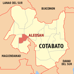 Map of Cotabato with Aleosan highlighted | |
OpenStreetMap  | |
 Aleosan Location within the Philippines | |
| Coordinates: 7°09′31″N 124°34′32″E / 7.15855°N 124.575436°ECoordinates: 7°09′31″N 124°34′32″E / 7.15855°N 124.575436°E | |
| Country | Philippines |
| Region | Soccsksargen |
| Province | Cotabato |
| District | 1st district |
| Founded | April 6, 1982 |
| Barangays | 19 (see Barangays) |
| Government | |
| • Type | Sangguniang Bayan |
| • Mayor | Vicente C. Sorupia Jr. |
| • Vice Mayor | Eduardo C. Cabaya |
| • Representative | Joselito S. Sacdalan |
| • Electorate | 23,325 voters (2019) |
| Area | |
| • Total | 225.44 km2 (87.04 sq mi) |
| Elevation | 47 m (154 ft) |
| Highest elevation | 208 m (682 ft) |
| Lowest elevation | 3 m (10 ft) |
| Population (2020 census) [3] | |
| • Total | 41,944 |
| • Density | 190/km2 (480/sq mi) |
| • Households | 8,803 |
| Economy | |
| • Income class | 3rd municipal income class |
| • Poverty incidence | 50.86% (2015)[4] |
| • Revenue | ₱160,989,241.67 (2020) |
| • Assets | ₱419,526,852.28 (2020) |
| • Expenditure | ₱139,171,738.34 (2020) |
| • Liabilities | ₱211,013,230.24 (2020) |
| Service provider | |
| • Electricity | Cotabato Electric Cooperative (COTELCO) |
| Time zone | UTC+8 (PST) |
| ZIP code | 9415 |
| PSGC | |
| IDD : area code | +63 (0)64 |
| Native languages | Hiligaynon Cebuano Maguindanao Ilianen Tagalog |
| Website | www |

Aleosan, officially the Municipality of Aleosan (Maguindanaon: Ingud nu Aleosan; Iranun: Inged a Aleosan; Hiligaynon: Banwa sang Aleosan; Cebuano: Lungsod sa Aleosan; Tagalog: Bayan ng Aleosan), is a 3rd class municipality in the province of Cotabato, Philippines. According to the 2020 census, it has a population of 41,944 people. [3]
Geography[]
Aleosan is within the political boundary of Cotabato Province. It is approximately 65 kilometres (40 mi) from the capital town of Amas which is barely two (2) hours ride from the seat of its municipal government. It is bounded on the west by Midsayap; on the north by Libungan and on the east and south by Pikit. It is accessible to land transportation from Cotabato City traversing the municipalities of Maguindanao to Kidapawan up to Davao City, as it is located along the major transport route linking the provinces of Maguindanao, Cotabato and Davao del Sur.
Barangays[]
Aleosan is politically subdivided into 19 barangays.124717000 The seat of the municipal government is in barangay San Mateo.
- Note
- ^ a b - 2 barangays in Aleosan forms part of the Special Geographic Area of Bangsamoro region despite Cotabato and Aleosan not being under the administrative jurisdiction of the autonomous region. It was partitioned from Soccsksargen following the two-part plebiscite held in January and February 2019. The Bangsamoro's Development Coordinating Office (DCO) oversees the barangays' affairs.[5]
Climate[]
| Climate data for Aleosan, Cotabato | |||||||||||||
|---|---|---|---|---|---|---|---|---|---|---|---|---|---|
| Month | Jan | Feb | Mar | Apr | May | Jun | Jul | Aug | Sep | Oct | Nov | Dec | Year |
| Average high °C (°F) | 31 (88) |
32 (90) |
33 (91) |
33 (91) |
32 (90) |
31 (88) |
30 (86) |
31 (88) |
31 (88) |
31 (88) |
31 (88) |
31 (88) |
31 (89) |
| Average low °C (°F) | 21 (70) |
21 (70) |
21 (70) |
22 (72) |
23 (73) |
23 (73) |
23 (73) |
23 (73) |
23 (73) |
23 (73) |
22 (72) |
22 (72) |
22 (72) |
| Average precipitation mm (inches) | 19 (0.7) |
14 (0.6) |
15 (0.6) |
18 (0.7) |
33 (1.3) |
42 (1.7) |
44 (1.7) |
42 (1.7) |
30 (1.2) |
31 (1.2) |
28 (1.1) |
17 (0.7) |
333 (13.2) |
| Average rainy days | 6.9 | 5.6 | 6.9 | 8.1 | 15.1 | 17.5 | 17.8 | 18.5 | 14.9 | 14.9 | 12.4 | 8.0 | 146.6 |
| Source: Meteoblue [6] | |||||||||||||
Aleosan area belongs to the fourth type of climate or the intermediate "E" with no distinct dry season. Rainfall is evenly distributed throughout the year with heavier rains from May to September. This type of climate conditions is suitable for the production of crops like rice, corn, mangoes, jackfruit, vegetables and root crops, which are considered seasonal crops and permanent crops like coconut, rubber, coffee, cacao and orchard crops.
History[]
The name Aleosan is an acronym derived from the three (3) towns of Iloilo where majority of the early Christian settlers came from; A is for Alimodian, LEO is for Leon, and SAN for San Miguel.[7]
Parliamentary bill no. 670 authored by Assemblyman Jesus P. Amparo and co-authored by assemblymen Blah T. Sinsuat, Ernesto F. Roldan and Tomas B. Baga Jr. sought to establish and create the Municipality of Aleosan in the Province of Cotabato, which was ultimately approved and signed into law Batas Pambansa bilang 206 on April 6, 1982. For purposes of ratification, Proclamation No. 2188 was signed by President Ferdinand E. Marcos on April 29, 1982. A plebiscite was conducted on May 7, 1982, which was unanimously confirmed the desire and aspiration of the people in the nineteen (19) barangays to become a distinct and regular municipality from Pikit its mother municipality.
Demographics[]
| Year | Pop. | ±% p.a. |
|---|---|---|
| 1990 | 22,574 | — |
| 1995 | 25,408 | +2.24% |
| 2000 | 26,164 | +0.63% |
| 2007 | 32,874 | +3.20% |
| 2010 | 35,746 | +3.09% |
| 2015 | 39,405 | +1.87% |
| 2020 | 41,944 | +1.24% |
| Source: Philippine Statistics Authority [8] [9] [10][11] | ||
In the 2020 census, the population of Aleosan, Cotabato, was 41,944 people, [3] with a density of 190 inhabitants per square kilometre or 490 inhabitants per square mile.
Economy[]
| Poverty Incidence of Aleosan | |
| Source: Philippine Statistics Authority[12][13][14][15][16][17] | |
The municipality is endowed with abundant agricultural raw materials suitable for processing. These include coconut, banana, rubber, mango and coffee. There are small-scale enterprises but these are not sustainable due to inadequate capital. A cassava processing plant was shut down due to insufficient supply of raw materials and low quality of starch produced. The area however, is best suited for mango production and there is a need to develop the industry to cater the growing needs of the locality. The municipality's livestock industry has great potentials being one of the top producers and supplier of livestock in the province.
Tourist attractions[]
- Brgy Malapang – Mountain climbing
- Brgy Pentil – Eco tourism
- Brgy Katalicanan – UK Peak
References[]
- ^ Municipality of Aleosan | (DILG)
- ^ "2015 Census of Population, Report No. 3 – Population, Land Area, and Population Density" (PDF). Philippine Statistics Authority. Quezon City, Philippines. August 2016. ISSN 0117-1453. Archived (PDF) from the original on May 25, 2021. Retrieved July 16, 2021.
- ^ a b c Census of Population (2020). "Region XII (Soccsksargen)". Total Population by Province, City, Municipality and Barangay. PSA. Retrieved 8 July 2021.
- ^ https://psa.gov.ph/sites/default/files/City%20and%20Municipal-level%20Small%20Area%20Poverty%20Estimates_%202009%2C%202012%20and%202015_0.xlsx; publication date: 10 July 2019; publisher: Philippine Statistics Authority.
- ^ "BARMM creates office to administer 63 barangays in North Cotabato". bangsamoro.gov.ph. Retrieved June 30, 2020.
- ^ "Aleosan, Cotabato: Average Temperatures and Rainfall". Meteoblue. Retrieved 16 March 2019.
- ^ http://www.cotabatoprov.gov.ph/lgus/aleosan
- ^ Census of Population (2015). "Region XII (Soccsksargen)". Total Population by Province, City, Municipality and Barangay. PSA. Retrieved 20 June 2016.
- ^ Census of Population and Housing (2010). "Region XII (Soccsksargen)". Total Population by Province, City, Municipality and Barangay. NSO. Retrieved 29 June 2016.
- ^ Censuses of Population (1903–2007). "Region XII (Soccsksargen)". Table 1. Population Enumerated in Various Censuses by Province/Highly Urbanized City: 1903 to 2007. NSO.
- ^ "Province of North Cotabato". Municipality Population Data. Local Water Utilities Administration Research Division. Retrieved 17 December 2016.
- ^ "Poverty incidence (PI):". Philippine Statistics Authority. Retrieved 28 December 2020.
- ^ https://psa.gov.ph/sites/default/files/NSCB_LocalPovertyPhilippines_0.pdf; publication date: 29 November 2005; publisher: Philippine Statistics Authority.
- ^ https://psa.gov.ph/sites/default/files/2003%20SAE%20of%20poverty%20%28Full%20Report%29_1.pdf; publication date: 23 March 2009; publisher: Philippine Statistics Authority.
- ^ https://psa.gov.ph/sites/default/files/2006%20and%202009%20City%20and%20Municipal%20Level%20Poverty%20Estimates_0_1.pdf; publication date: 3 August 2012; publisher: Philippine Statistics Authority.
- ^ https://psa.gov.ph/sites/default/files/2012%20Municipal%20and%20City%20Level%20Poverty%20Estima7tes%20Publication%20%281%29.pdf; publication date: 31 May 2016; publisher: Philippine Statistics Authority.
- ^ https://psa.gov.ph/sites/default/files/City%20and%20Municipal-level%20Small%20Area%20Poverty%20Estimates_%202009%2C%202012%20and%202015_0.xlsx; publication date: 10 July 2019; publisher: Philippine Statistics Authority.
External links[]
Places adjacent to Aleosan | ||||||||||||||||
|---|---|---|---|---|---|---|---|---|---|---|---|---|---|---|---|---|
| ||||||||||||||||
- Municipalities of Cotabato