M'lang
M'lang | |
|---|---|
| Municipality of M'lang | |
 Seal | |
| Etymology: Tamlang (bamboo) | |
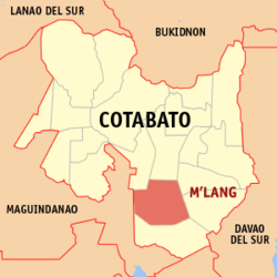 Map of Cotabato with M'lang highlighted | |
OpenStreetMap  | |
 M'lang Location within the Philippines | |
| Coordinates: 6°57′N 124°53′E / 6.95°N 124.88°ECoordinates: 6°57′N 124°53′E / 6.95°N 124.88°E | |
| Country | Philippines |
| Region | Soccsksargen |
| Province | Cotabato |
| District | 3rd district |
| Founded | August 3, 1951 |
| Barangays | 37 (see Barangays) |
| Government | |
| • Type | Sangguniang Bayan |
| • Mayor | Russel M. Abonado |
| • Vice Mayor | Joselito F. Piñol |
| • Representative | Jose I. Tejada |
| • Electorate | 56,532 voters (2019) |
| Area | |
| • Total | 312.13 km2 (120.51 sq mi) |
| Elevation | 26 m (85 ft) |
| Highest elevation | 70 m (230 ft) |
| Lowest elevation | 10 m (30 ft) |
| Population (2020 census) [3] | |
| • Total | 98,195 |
| • Density | 310/km2 (810/sq mi) |
| • Households | 23,008 |
| Economy | |
| • Income class | 1st municipal income class |
| • Poverty incidence | 31.62% (2015)[4] |
| • Revenue | ₱311,331,591.34 (2020) |
| • Assets | ₱655,220,571.62 (2020) |
| • Expenditure | ₱262,441,640.99 (2020) |
| • Liabilities | ₱285,256,186.92 (2020) |
| Service provider | |
| • Electricity | Cotabato Electric Cooperative (COTELCO) |
| Time zone | UTC+8 (PST) |
| ZIP code | 9402 |
| PSGC | |
| IDD : area code | +63 (0)64 |
| Native languages | Maguindanao Hiligaynon Cebuano Ilianen Tagalog |
| Website | www |

M'lang, officially the Municipality of M'lang (Hiligaynon: Banwa sang M'lang; Maguindanao: Ingud nu M'lang), is a 1st class municipality in the province of Cotabato, Philippines. According to the 2020 census, it has a population of 98,195 people. [3]
History[]
The name M'lang was derived from a Maguindanaoan word Tamlang which means "bamboo".
In 1930s, migrants mostly from the islands of Panay and Negros in Western Visayas and some parts of Luzon settled in M'lang. Jacinto Paclibar, who was in search for more fertile lands and vast settlement was the first Christian who settled in M'lang. In the Second World War, he was appointed Chairman of the Civil Emergency Administration under the 118th Infantry Regiment of Wendell Fertig's 10th Military Division, assuming his position in M'lang. After the war ended, he was appointed as Deputy Governor of the undivided Cotabato until 1949. He had in mind a government assisted subdivision project so that landless settlers may have their share to utilize fertile lands for farming and settlement.
M'lang became a regular municipality on August 3, 1951, by virtue of Executive Order No. 462 of the President of the Philippines by the then President Elpidio Quirino, with territories taken from the adjacent towns of Kidapawan (its mother municipality) and Buluan (now part of Maguindanao).[5]
Grography[]
Barangays[]
M'lang is politically subdivided into 37 Barangays. [6]
- Poblacion A
- Poblacion B
- Bagontapay
- Bialong
- Buayan
- Calunasan
- Dalipe
- Dugong
- Dungo-an
- Gaunan
- Inas
- Katipunan
- La Fortuna
- La Suerte
- Langkong
- Lepaga
- Liboo
- Lika
- Luz Village
- Magallon
- Malayan
- New Antique
- New Barbaza
- New Kalibo
- New Consolacion
- New Esperanza
- New Janiuay
- New Lawa-an
- New Rizal
- Nueva Vida
- Pag-asa
- Pulang-lupa
- Sangat
- Tawantawan
- Tibao
- Ugpay
- Palma-Perez
Climate[]
| Climate data for M'lang, Cotabato | |||||||||||||
|---|---|---|---|---|---|---|---|---|---|---|---|---|---|
| Month | Jan | Feb | Mar | Apr | May | Jun | Jul | Aug | Sep | Oct | Nov | Dec | Year |
| Average high °C (°F) | 31 (88) |
32 (90) |
33 (91) |
33 (91) |
32 (90) |
31 (88) |
30 (86) |
31 (88) |
31 (88) |
31 (88) |
31 (88) |
31 (88) |
31 (89) |
| Average low °C (°F) | 21 (70) |
21 (70) |
21 (70) |
22 (72) |
23 (73) |
23 (73) |
23 (73) |
23 (73) |
23 (73) |
23 (73) |
23 (73) |
22 (72) |
22 (72) |
| Average precipitation mm (inches) | 19 (0.7) |
14 (0.6) |
15 (0.6) |
18 (0.7) |
33 (1.3) |
42 (1.7) |
44 (1.7) |
42 (1.7) |
30 (1.2) |
31 (1.2) |
28 (1.1) |
17 (0.7) |
333 (13.2) |
| Average rainy days | 6.9 | 5.6 | 6.9 | 8.1 | 15.1 | 17.5 | 17.8 | 18.5 | 14.9 | 14.9 | 12.4 | 8.0 | 146.6 |
| Source: Meteoblue (modeled/calculated data, not measured locally)[7] | |||||||||||||
Demographics[]
| Year | Pop. | ±% p.a. |
|---|---|---|
| 1960 | 42,085 | — |
| 1970 | 44,844 | +0.64% |
| 1975 | 51,596 | +2.85% |
| 1980 | 57,059 | +2.03% |
| 1990 | 68,971 | +1.91% |
| 1995 | 71,846 | +0.77% |
| 2000 | 78,170 | +1.82% |
| 2007 | 86,321 | +1.38% |
| 2010 | 87,749 | +0.60% |
| 2015 | 95,070 | +1.54% |
| 2020 | 98,195 | +0.64% |
| Source: Philippine Statistics Authority [8] [9] [10][11] | ||
In the 2020 census, the population of M'lang was 98,195 people, [3] with a density of 310 inhabitants per square kilometre or 800 inhabitants per square mile.
Transportation[]
The Central Mindanao Airport, in Barangay Tawan-tawan, is intended to serve as the primary air transport hub for agricultural produce of Cotabato and those coming from central Mindanao. It has a 1.2 kilometer runway with a capability for commercial flights, but there are no scheduled flights. Central Mindanao project is designed to provide capacity of 3.5 million passengers p/a.[12]
Education[]
- Notre Dame of M'lang
- Bialong Elementary School
- Mlang Pilot Elementary School
- Mlang National High School
- Southern Baptist College
- Mariano Untal Memorial High School (Bagontapay National High School)
- Bagontapay Central Elementary School
- Buayan Elementary School
- New Barbaza Elementary School
- Magallon Elementary School
- Lepaga Elementary School
- Lika National High School
- La Fortuna Elementary School
- Dugong Elementary School
- Sangat Elementary School
- Dalipe Elementary School
- New Rizal National High School
- Nueva Vida National High School
- Katipunan Elementary High School
- Katipunan National High School
- Don Tomas Buenaflor Elementary School
References[]
- ^ Municipality of M'lang | (DILG)
- ^ "2015 Census of Population, Report No. 3 – Population, Land Area, and Population Density" (PDF). Philippine Statistics Authority. Quezon City, Philippines. August 2016. ISSN 0117-1453. Archived (PDF) from the original on May 25, 2021. Retrieved July 16, 2021.
- ^ a b c Census of Population (2020). "Region XII (Soccsksargen)". Total Population by Province, City, Municipality and Barangay. PSA. Retrieved 8 July 2021.
- ^ https://psa.gov.ph/sites/default/files/City%20and%20Municipal-level%20Small%20Area%20Poverty%20Estimates_%202009%2C%202012%20and%202015_0.xlsx; publication date: 10 July 2019; publisher: Philippine Statistics Authority.
- ^ http://www.facebook.com/kidapawanofthepast
- ^ "Province: North Cotabato". PSGC Interactive. Quezon City, Philippines: Philippine Statistics Authority. Retrieved 12 November 2016.
- ^ "M'lang: Average Temperatures and Rainfall". Meteoblue. Retrieved 30 January 2020.
- ^ Census of Population (2015). "Region XII (Soccsksargen)". Total Population by Province, City, Municipality and Barangay. PSA. Retrieved 20 June 2016.
- ^ Census of Population and Housing (2010). "Region XII (Soccsksargen)". Total Population by Province, City, Municipality and Barangay. NSO. Retrieved 29 June 2016.
- ^
Censuses of Population (1903–2007). "Region XII (Soccsksargen)". Table 1. Population Enumerated in Various Censuses by Province/Highly Urbanized City: 1903 to 2007. NSO.
{{cite encyclopedia}}: CS1 maint: url-status (link) - ^ "Province of North Cotabato". Municipality Population Data. Local Water Utilities Administration Research Division. Retrieved 17 December 2016.
- ^ Arguillas, Carolyn O. (February 20, 2016). "M'lang airport's first use: to fly a plane seeding clouds". MindaNews. Retrieved 9 January 2017.
External links[]
- M'lang Profile at PhilAtlas.com
- Philippine Standard Geographic Code
- Official Website of the Municipality of M'lang
- Kidapawan of the past
- [1]
- [2]
- [3]
Places adjacent to M'lang | ||||||||||||||||
|---|---|---|---|---|---|---|---|---|---|---|---|---|---|---|---|---|
| ||||||||||||||||
- Municipalities of Cotabato