Allora, Queensland
| Allora Queensland | |||||||||||||||
|---|---|---|---|---|---|---|---|---|---|---|---|---|---|---|---|
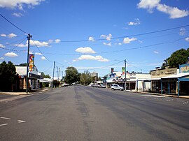 Main street | |||||||||||||||
 Allora | |||||||||||||||
| Coordinates | 28°02′08″S 151°58′49″E / 28.0355°S 151.9802°ECoordinates: 28°02′08″S 151°58′49″E / 28.0355°S 151.9802°E | ||||||||||||||
| Population | 1,223 (2016 census)[1] | ||||||||||||||
| • Density | 12.740/km2 (32.995/sq mi) | ||||||||||||||
| Postcode(s) | 4362 | ||||||||||||||
| Area | 96.0 km2 (37.1 sq mi) | ||||||||||||||
| Time zone | AEST (UTC+10:00) | ||||||||||||||
| Location |
| ||||||||||||||
| LGA(s) | Southern Downs Region | ||||||||||||||
| State electorate(s) | Southern Downs | ||||||||||||||
| Federal division(s) | Maranoa | ||||||||||||||
| |||||||||||||||

Allora is a rural town and locality in the Southern Downs Region, Queensland, Australia.[2][3] In the 2016 census, Allora had a population of 1,223 people.[1]
Geography[]
Allora is on the Darling Downs in south-eastern Queensland, Australia, 158 kilometres (98 mi) south-west of the state capital, Brisbane. The town is located on the New England Highway between Warwick and Toowoomba.
History[]

Giabal (also known as Paiamba, Gomaingguru) is an Australian Aboriginal language. The Giabal language region includes the landscape within the local government boundaries of the Toowoomba Regional Council, particularly Toowoomba south to Allora and west to Millmerran.[4]
The region surrounding this small farming community was first explored by Europeans in the 1840s.
In 1854 the first Presbyterian services were held in Allora.[5]
The town was surveyed in 1859. Its name is believed to derive from an Aboriginal word "gnarrallah", meaning waterhole or swampy place.[2]
Following European settlement, the history of the area is entwined with two famous pastoral homesteads in the vicinity of Allora: Glengallan and Talgai . Both properties ran sheep.
The original "Talgai" run was taken up by E. E. Dalrymple in 1840. The creek that runs through Allora is named in his honour. Built in 1868 for the Clark family, Talgai Homestead stood on 300,000 acres (1,200 km2). The homestead is built of sandstone and covers sixty squares. It is now a bed and breakfast.
Allora Post Office opened on 31 March 1863.[6]

In 1866 a Wesleyan Methodist church was established in Allora.[7][8] Improvements were made in 1875.[9] A new church was built in 1896.[7]
The Allora State School opened on 1 May 1867.[10][11] On 31 December 2008, it was renamed Allora P-10 State School.[10]
From 1869, Allora had its own local government (initially Borough of Allora, from 1903 Town of Allora) then was combined with the Clifton Shire. In 1914 it separated from the Clifton Shire to become a shire in its own right as the Shire of Allora, which was administered from the Shire's offices initially on the corner of Warwick and Forde Streets Allora, and then at 78 Herbert Street in Allora. In 1994, the Shire of Allora was amalgamated into the Shire of Warwick.
In 1873 a permanent Presbyterian congregation was established with the arrival of Reverend Thomas Kingsford as a permanent minister. Construction on a church building began in 1880 and was officially opened on 29 May 1881 by the Moderator, Right Reverend John Fleming McSwaine.[5][12]
In 1886 the first fossil evidence of early human occupation in the area, the Talgai Skull, was found on Talgai Homestead, embedded in the wall of Dalrymple Creek. Radiocarbon dating suggests the Talgai skull is between 9,000 and 11,000 years old.[13] It is believed to be the skull of a boy of approximately 15 years of age who had been killed by a massive blow to the side of the head.[14]
From the 1870s, red cedar, pine and beech logged from the Goomburra valley were milled at Allora.
St Patick's Catholic Church was opened on Whit-Sunday in June 1871.[15]
St David's Anglican Church opened in late 1888 without any ceremony.[16] It was consecrated in 1890.[17][18]
By 1894 a Presbyterian church had opened in Allora.[19]
The Allora Boer War Memorial was unveiled on 19 October 1904 by Colonel Henry Chauvel.[20]
Wilsonville Provisional School opened in 1906. On 1 January 1909 it became Wilsonville State School. It was amalgamated with Glengallan State School in late 1922 or early 1923 to create Mount Marshall State School.[21]
St Patrick's Catholic School was established on 24 January 1916 by the Sisters of St Joseph of the Sacred Heart. The official opening ceremony was conducted by Roman Catholic Archbishop of Brisbane, James Duhig.[21][22][23][24]

The Allora Shire Soldiers Memorial was unveiled on 11 November 1921 by General J.C. Robertson and the mothers of those who died.[25]
St Paul's Church of England in Back Plains was dedicated on 12 February 1892 by Archbishop of Brisbane William Webber. The last service was conducted in Back Plains on 8 August 1943. In 1953 the church building was relocated to Nobby where it was re-established as St Paul's Church of England.[26] The last service at Nobby was conducted circa 11 May 1975. In 1979 the building was relocated to 12 Jubb Street, Allora (28°01′51″S 151°58′54″E / 28.0309°S 151.9818°E) to become the Scots Presbyterian Church for those Presbyterians in the district who did not wish to become part of the Uniting Church of Australia. The church in Allora was dedicated on 26 July 1980 by Presbyterian Moderator Rt Rev F. White.[27][28]
The current Allora Public Library opened in 1966 and had a minor refurbishment in 2010.[29]
At the 2011 census, Allora had a population of 889.[30]
In the 2016 census, Allora had a population of 1,223 people.[1]
Education[]
Allora P-10 State School is a government primary and secondary (Prep-10) school for boys and girls at 21 Warwick Street (28°02′10″S 151°59′10″E / 28.0361°S 151.9861°E).[31][32] In 2017, the school had an enrolment of 250 students with 23 teachers (19 full-time equivalent) and 18 non-teaching staff (12 full-time equivalent).[33] It includes a special education program.[31]
St Patrick's School is a Catholic primary (Prep-6) school for boys and girls at 35 Arnold Street (28°02′09″S 151°58′41″E / 28.0357°S 151.9780°E).[31][34] In 2017, the school had an enrolment of 79 students with 8 teachers (6 full-time equivalent) and 5 non-teaching staff (2 full-time equivalent).[33]
Amenities[]
The Southern Downs Regional Council operates a public library in Allora at 78 Herbert Street.[35]
The Allora branch of the Queensland Country Women's Association meets at 51 Warwick Street.[36]
St David's Anglican Church is at 1 Church Street (28°02′10″S 151°59′21″E / 28.0362°S 151.9892°E).[17]
Allora Uniting Church is at 44 Warwick Street (28°02′06″S 151°58′52″E / 28.0351°S 151.9812°E).[37]
Heritage listings and local attractions[]


Local attractions include the Goomburra Forest Reserve, part of which was World Heritage listed in 1994 by UNESCO.
The Talgai skull is located in the Shellshear Museum, Department of Anatomy, Sydney University. A replica is found in the Allora Museum.
The old bank building in Herbert Street building is known locally as the "Mary Poppins house", after resident P. L. Travers' most famous work.[39]
Allora has a number of heritage-listed sites, including:
- Allora-Clifton Road: Allora Cemetery[40]
- 1 Church Street: St David's Anglican Church[41]
- Dalrymple Creek Road: Talgai Homestead[42]
- Warwick Street: Boer War Memorial[43]
Notable residents[]
- Wayne Bennett, Premiership winning rugby league coach in the NRL
- Sir James Connolly, politician in Western Australia
- Matthew Denny, IAAF Athletics 2013 World Youth Championships gold medallist discus throw
- Laura Geitz, Australia National Netball Team Captain, Commonwealth Games Gold Medallist and ANZ Championships Premiership Captain
- Greg Holmes, Rugby Union tighthead prop. Queensland 'Reds' 144 games; Australia 27 Tests. Currently plays for the Exeter Chiefs in England in the Aviva Premiership.
- Private John Leak, Victoria Cross recipient at Pozières, France, on 23 July 1916. Farmed and worked in the Allora district, "The Commonage" Berat, from 1919 to 1920.
- Tom McVeigh, Federal Member for Darling Downs for the National Country Party (1972 - 1984 when seat abolished). Member for Groom (1984 - 1988). Minister for Housing and Construction and Minister for Home Affairs and the Environment.
- P. L. Travers, author of Mary Poppins
References[]
- ^ a b c Australian Bureau of Statistics (27 June 2017). "Allora (SSC)". 2016 Census QuickStats. Retrieved 20 October 2018.

- ^ a b "Allora – town in Southern Downs Region (entry 416)". Queensland Place Names. Queensland Government. Retrieved 1 December 2019.
- ^ "Allora – locality in Southern Downs Region (entry 47644)". Queensland Place Names. Queensland Government. Retrieved 1 December 2019.
- ^
 This Wikipedia article incorporates CC-BY-4.0 licensed text from: "Giabal". Queensland Aboriginal and Torres Strait Islander languages map. State Library of Queensland. Retrieved 23 January 2020.
- ^ a b "Presbyterian Churches on the Downs - Downs Folk". Downs Folk. Archived from the original on 24 May 2020. Retrieved 24 May 2020.
- ^ Phoenix Auctions History. "Post Office List". Phoenix Auctions. Retrieved 20 March 2021.
- ^ a b "METHODISM". Warwick Daily News (5109). Queensland, Australia. 30 November 1935. p. 8. Retrieved 10 September 2021 – via National Library of Australia.
- ^ "Local and General News". Warwick Examiner And Times. VII (349). Queensland, Australia. 8 November 1873. p. 2. Retrieved 10 September 2021 – via National Library of Australia.
- ^ "METHODISM". Warwick Daily News (5109). Queensland, Australia. 30 November 1935. p. 8. Retrieved 10 September 2021 – via National Library of Australia.
- ^ a b "Opening and closing dates of Queensland Schools". Queensland Government. Retrieved 18 April 2019.
- ^ "Queensland primary schools". Queensland Times, Ipswich Herald and General Advertiser. VI (812). 15 August 1867. p. 3. Retrieved 3 February 2017 – via Trove.
- ^ "Fifty years of progress". Warwick Daily News. Queensland, Australia. 27 March 1923. p. 6. Archived from the original on 15 September 2020. Retrieved 24 May 2020 – via Trove.
- ^ Allen, Jim (2010). "The Curious History of the Talgai Skull". Bulletin of the History of Archaeology. Ubiquity Press. 20 (2): 4. doi:10.5334/bha.20202. ISSN 2047-6930.
- ^ "Talgai Skull". austhrutime.com. Archived from the original on 30 March 2016. Retrieved 11 September 2015.
- ^ "RELIGIOUS". Queensland Times, Ipswich Herald And General Advertiser. X (1409). Queensland, Australia. 10 June 1871. p. 3. Retrieved 4 December 2021 – via National Library of Australia.
- ^ "Religious Items". The Week. XXVII (683). Queensland, Australia. 19 January 1889. p. 6. Retrieved 22 May 2021 – via Trove.
- ^ a b "Year Book" (PDF). Anglican Archdiocese of Brisbane. 2019. p. 130. Archived (PDF) from the original on 15 September 2020. Retrieved 15 September 2020.
- ^ "General News". The Queenslander. XXXVI (721). Queensland, Australia. 27 July 1889. p. 170. Retrieved 22 May 2021 – via Trove.
- ^ "Allora—a flourishing township of the Darling Downs, Queensland". Australian Town and Country Journal. XLIX (1275). New South Wales, Australia. 7 July 1894. p. 27. Retrieved 22 May 2021 – via Trove.
- ^ "Boer War Memorial". Monument Australia. Archived from the original on 7 April 2014. Retrieved 5 April 2014.
- ^ a b Queensland Family History Society (2010), Queensland schools past and present (Version 1.01 ed.), Queensland Family History Society, ISBN 978-1-921171-26-0
- ^ "Our history". St Patrick's School Allora. Archived from the original on 23 January 2020. Retrieved 23 January 2020.
- ^ "THE CHURCHES". Daily Standard. Queensland, Australia. 8 January 1916. p. 3 (SECOND EDITION). Archived from the original on 15 September 2020. Retrieved 23 January 2020 – via Trove.
- ^ "Queensland". Sisters of Saint Joseph of the Sacred Heart. Archived from the original on 9 November 2019. Retrieved 8 March 2021.
- ^ "Allora Shire Soldiers Memorial". Monument Australia. Archived from the original on 7 April 2014. Retrieved 5 April 2014.
- ^ Rees, Glyn (27 August 2016). "Back Plains set to celebrate". Warwick Daily News. Archived from the original on 28 August 2016. Retrieved 1 January 2020.
- ^ "Closed Churches". Anglican Church of Southern Queensland. Archived from the original on 3 April 2019. Retrieved 24 February 2019.
- ^ "Scots' Presbyterian Church". Churches Australia. Archived from the original on 15 September 2020. Retrieved 2 January 2020.
- ^ "Allora Public Library" (PDF). Queensland Public Libraries Statistical Bulletin 2016-2017" (PDF). Public Libraries Connect. November 2017. November 2017. Archived (PDF) from the original on 30 January 2018. Retrieved 22 January 2018.
- ^ Australian Bureau of Statistics (31 October 2012). "Allora (L) (Urban Centre/Locality)". 2011 Census QuickStats. Retrieved 12 May 2014.
- ^ a b c "State and non-state school details". Queensland Government. 9 July 2018. Archived from the original on 21 November 2018. Retrieved 21 November 2018.
- ^ "Allora P-10 State School". Archived from the original on 3 April 2021. Retrieved 20 March 2021.
- ^ a b "ACARA School Profile 2017". Archived from the original on 22 November 2018. Retrieved 22 November 2018.
- ^ "St Patrick's School". Archived from the original on 5 October 2018. Retrieved 21 November 2018.
- ^ "Allora Library". Public Libraries Connect. 26 April 2014. Archived from the original on 22 January 2018. Retrieved 22 January 2018.
- ^ "Branch Locations". Queensland Country Women's Association. Archived from the original on 26 December 2018. Retrieved 26 December 2018.
- ^ "UCA - UCA Allora Congregation". UCA Eastern Downs Parish. Retrieved 6 May 2021.
- ^ "John McDowell – Discovering Anzacs". National Archives of Australia. 23 October 2013. Archived from the original on 18 October 2014. Retrieved 10 October 2014.
- ^ "University of Queensland: Queensland Places: Allora". Queensland Places. Archived from the original on 28 December 2013. Retrieved 4 March 2014.
- ^ "Allora Cemetery (entry 602153)". Queensland Heritage Register. Queensland Heritage Council. Retrieved 13 July 2013.
- ^ "St Davids Anglican Church (entry 602061)". Queensland Heritage Register. Queensland Heritage Council. Retrieved 13 July 2013.
- ^ "Talgai Homestead (entry 600006)". Queensland Heritage Register. Queensland Heritage Council. Retrieved 13 July 2013.
- ^ "Boer War Memorial and Park (entry 600005)". Queensland Heritage Register. Queensland Heritage Council. Retrieved 13 July 2013.
External links[]
| Wikimedia Commons has media related to Allora, Queensland. |
- Town & travel information Sydney Morning Herald
- "Allora". Queensland Places. Centre for the Government of Queensland, University of Queensland.
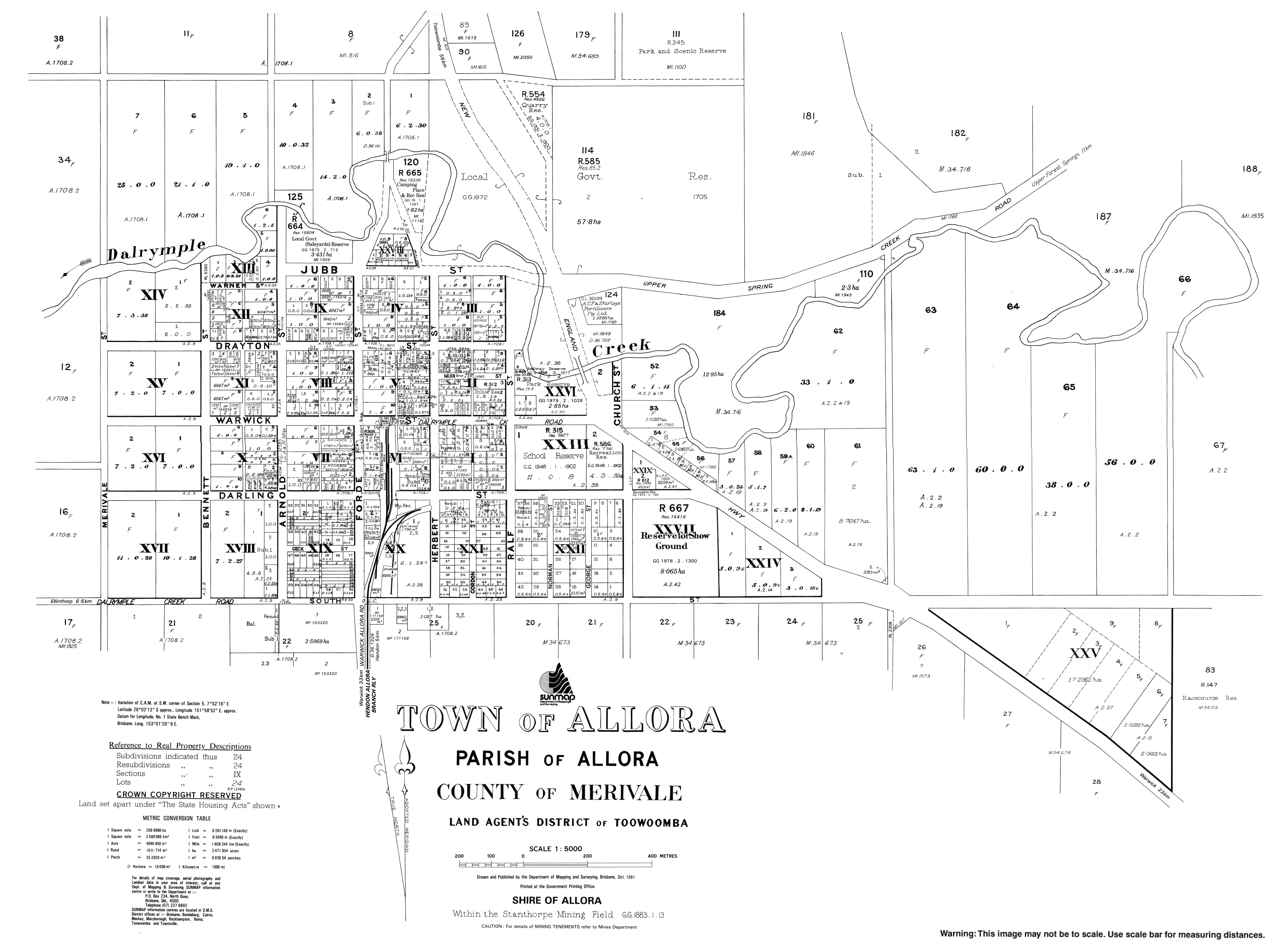
- "Town map of Allora". Queensland Government. 1981.
- Towns in Queensland
- Allora, Queensland
- Southern Downs Region
- Towns in the Darling Downs
- 1859 establishments in Australia
- Localities in Queensland