Alluvial City, Louisiana
Alluvial City | |
|---|---|
 Alluvial City | |
| Coordinates: 29°50′29″N 89°41′29″W / 29.84139°N 89.69139°WCoordinates: 29°50′29″N 89°41′29″W / 29.84139°N 89.69139°W | |
| Country | |
| State | |
| Parish | |
| MCD | District E |
| Established | 19th century |
| Elevation | 0.9 m (3 ft) |
| Time zone | UTC−6 (Central) |
| • Summer (DST) | UTC−5 (Central) |
| ZIP code | 70085 |
| Area code(s) | 504 |
| GNIS feature ID | 559767 |


Alluvial City is an Isleño fishing community in St. Bernard Parish, Louisiana, United States.[1] The community is located on the western bank of Bayou la Loutre. Alluvial City is connected to the neighboring community of Yscloskey by the Bayou la Loutre lift bridge, also known as the Yscloskey bridge.[2][3]
In popular culture[]
The community served as inspiration for the literary work Alluvial Cities: Poems.[4]
References[]
- ^ "Alluvial City". Geographic Names Information System. United States Geological Survey. Retrieved August 29, 2021.
- ^ Broach, Drew (2015-08-07). "29 historic bridges of southeast Louisiana". NOLA.com. The Times-Picayune. Archived from the original on 2021-09-15. Retrieved 2021-09-15.
- ^ Parker, Halle (2021-08-31). "Destroyed by Hurricane Katrina, St. Bernard Parish fares much better than others in Ida". NOLA.com. Archived from the original on 2021-08-31. Retrieved 2021-09-15.
- ^ Hannan, Christopher M. "Alluvial Cities: Poems". Texas A&M University Press. Retrieved 2021-10-04.
{{cite web}}: CS1 maint: url-status (link)
Municipalities and communities of St. Bernard Parish, Louisiana, United States | ||
|---|---|---|
Parish seat: Chalmette | ||
| CDPs | 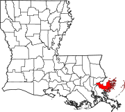 | |
| Other communities | ||
| Ghost towns | ||
| ||
This Louisiana state location article is a stub. You can help Wikipedia by . |
Categories:
- Populated places in St. Bernard Parish, Louisiana
- Louisiana geography stubs