Alma, Michigan
Alma, Michigan | |
|---|---|
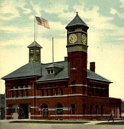 Alma City Hall | |
 Location of Alma, Michigan | |
| Coordinates: 43°22′42″N 84°39′34″W / 43.37833°N 84.65944°WCoordinates: 43°22′42″N 84°39′34″W / 43.37833°N 84.65944°W | |
| Country | United States |
| State | Michigan |
| County | Gratiot |
| Area | |
| • Total | 6.05 sq mi (15.67 km2) |
| • Land | 5.89 sq mi (15.26 km2) |
| • Water | 0.16 sq mi (0.41 km2) |
| Elevation | 735 ft (224 m) |
| Population | |
| • Total | 9,383 |
| • Estimate (2019)[5] | 8,890 |
| • Density | 1,508.83/sq mi (582.56/km2) |
| Time zone | UTC-5 (Eastern (EST)) |
| • Summer (DST) | UTC-4 (EDT) |
| ZIP codes | 48801-48802 |
| Area code(s) | 989 |
| FIPS code | 26-01540[3] |
| GNIS feature ID | 0620002[4] |
| Website | www |

Alma is the largest city in Gratiot County in the U.S. state of Michigan. The population was 9,383 at the 2010 census. It was incorporated as the Village of Alma in 1872 and became a city in 1905.
Alma hosts the annual Highland Festival on Memorial Day weekend. It brings members of Scottish clans and interested onlookers together for a weekend of Highland dancing, bagpipes, kilts, and camaraderie.
Alma College, a small liberal-arts institution of approximately 1,300 students, is located in town and focuses on multidisciplinary learning in a residential setting.
Alma is the birthplace of both the modernist architect Ralph Rapson and writer/composer/lyricist Dan Goggin (Nunsense).
Alma was the home of Leonard Refineries which sold gasoline and other petroleum products throughout the lower peninsula of Michigan from its founding in 1936 until about 1966.[citation needed]
Geography[]
According to the United States Census Bureau, the city has a total area of 6.09 square miles (15.77 km2), of which 5.93 square miles (15.36 km2) is land and 0.16 square miles (0.41 km2) is water.[6]
History[]
Alma was founded in 1853 by Ralph Ely. Perhaps first known for the Alma Springs Sanitarium, built and promoted in the 1880s by millionaire lumberman and capitalist Ammi W. Wright, it achieved its greatest prominence nationally in the 1910s and 1920s as home of the Republic Motor Truck Company, briefly the largest exclusive truck manufacturer in the world.[7] In 1953 Alma became the first place that high-octane gas, 96 octane, was produced.[8]
Demographics[]
| Historical population | |||
|---|---|---|---|
| Census | Pop. | %± | |
| 1870 | 402 | — | |
| 1880 | 437 | 8.7% | |
| 1890 | 1,655 | 278.7% | |
| 1900 | 2,047 | 23.7% | |
| 1910 | 2,757 | 34.7% | |
| 1920 | 7,542 | 173.6% | |
| 1930 | 6,734 | −10.7% | |
| 1940 | 7,202 | 6.9% | |
| 1950 | 8,341 | 15.8% | |
| 1960 | 8,978 | 7.6% | |
| 1970 | 9,611 | 7.1% | |
| 1980 | 9,652 | 0.4% | |
| 1990 | 9,034 | −6.4% | |
| 2000 | 9,275 | 2.7% | |
| 2010 | 9,383 | 1.2% | |
| 2019 (est.) | 8,890 | [5] | −5.3% |
| U.S. Decennial Census[9] | |||
2010 census[]
As of the census[2] of 2010, there were 9,383 people, 3,468 households, and 2,033 families living in the city. The population density was 1,582.3 inhabitants per square mile (610.9/km2). There were 3,784 housing units at an average density of 638.1 per square mile (246.4/km2). The racial makeup of the city was 92.8% White, 0.9% African American, 0.6% Native American, 0.8% Asian, 2.8% from other races, and 2.2% from two or more races. Hispanic or Latino of any race were 8.1% of the population.
There were 3,468 households, of which 30.8% had children under the age of 18 living with them, 38.4% were married couples living together, 15.2% had a female householder with no husband present, 5.0% had a male householder with no wife present, and 41.4% were non-families. 34.7% of all households were made up of individuals, and 14.8% had someone living alone who was 65 years of age or older. The average household size was 2.30 and the average family size was 2.92.
The median age in the city was 30.8 years. 21.4% of residents were under the age of 18; 21.3% were between the ages of 18 and 24; 21.1% were from 25 to 44; 20.7% were from 45 to 64; and 15.6% were 65 years of age or older. The gender makeup of the city was 46.9% male and 53.1% female.
2000 census[]
As of the census[3] of 2000, there were 9,275 people, 3,220 households, and 2,022 families living in the city. The population density was 1,729.7 per square mile (668.1/km2). There were 3,476 housing units at an average density of 648.2 per square mile (250.4/km2). The racial makeup of the city was 93.75% White, 0.53% African American, 0.52% Native American, 0.75% Asian, 0.01% Pacific Islander, 2.57% from other races, and 1.88% from two or more races. Hispanic or Latino of any race were 6.21% of the population.
There were 3,220 households, out of which 32.4% had children under the age of 18 living with them, 45.6% were married couples living together, 13.8% had a female householder with no husband present, and 37.2% were non-families. 30.5% of all households were made up of individuals, and 12.9% had someone living alone who was 65 years of age or older. The average household size was 2.39 and the average family size was 2.98.

In the city, the population was spread out, with 21.9% under the age of 18, 20.4% from 18 to 24, 23.0% from 25 to 44, 17.8% from 45 to 64, and 16.9% who were 65 years of age or older. The median age was 32 years. For every 100 females, there were 81.8 males. For every 100 females age 18 and over, there were 77.3 males.
The median income for a household in the city was $33,536, and the median income for a family was $44,229. Males had a median income of $35,013 versus $20,655 for females. The per capita income for the city was $18,218. About 8.5% of families and 11.6% of the population were below the poverty line, including 12.1% of those under age 18 and 7.6% of those age 65 or over.
Transportation[]
 US 127
 Bus. US 127
 M-46
M-46- Public bus transportation is provided on a dial-a-ride service basis by DART Transportation from 7:30 a.m.-8:00 p.m. during weekdays within the city limits and to surrounding areas.
- Indian Trails provides daily intercity bus service to Alma between St. Ignace and East Lansing, Michigan.[10]
Local media[]
The Morning Sun newspaper, based in Mt. Pleasant, serves the Alma area as its daily newspaper. The Gratiot County Herald, based in Ithaca, serves the Alma area as its weekly newspaper. Alma is home to three commercial radio stations. WQBX (104.9 FM) plays satellite-fed hot adult contemporary music, and sister station WFYC (1280 AM) is an ESPN Radio affiliate.
Standalone AM WMLM (1520 AM), licensed to nearby St. Louis, plays classic country music, also satellite-fed.
The Alma area is located about midway between Saginaw and Grand Rapids, and thus also receives TV and radio signals from both cities, as well as Mt. Pleasant and Lansing.
Notable people[]
- Keegan Akin, professional baseball player, born in Alma
- Dan Goggin, actor and writer (Nunsense)
- Louisa Boyd Yeomans King, gardener and author; lived c. 1902–1927[11]
- Betty Mahmoody, author of Not Without My Daughter; born in Alma
- Kevin Puts, 2012 Pulitzer Prize winner for music; grew up in Alma[12]
- Ralph Rapson, modernist architect; born in Alma
Climate[]
This climatic region is typified by large seasonal temperature differences, with warm to hot (and often humid) summers and cold (sometimes severely cold) winters. According to the Köppen Climate Classification system, Alma has a humid continental climate, abbreviated "Dfa" on climate maps.[13]
| hideClimate data for Alma, Michigan (1991–2020 normals, extremes 1887–present) | |||||||||||||
|---|---|---|---|---|---|---|---|---|---|---|---|---|---|
| Month | Jan | Feb | Mar | Apr | May | Jun | Jul | Aug | Sep | Oct | Nov | Dec | Year |
| Record high °F (°C) | 64 (18) |
67 (19) |
86 (30) |
89 (32) |
94 (34) |
100 (38) |
108 (42) |
102 (39) |
98 (37) |
90 (32) |
82 (28) |
68 (20) |
108 (42) |
| Average high °F (°C) | 29.1 (−1.6) |
32.0 (0.0) |
42.6 (5.9) |
55.9 (13.3) |
68.5 (20.3) |
78.1 (25.6) |
82.2 (27.9) |
80.1 (26.7) |
72.9 (22.7) |
60.0 (15.6) |
45.8 (7.7) |
34.5 (1.4) |
56.8 (13.8) |
| Daily mean °F (°C) | 22.0 (−5.6) |
23.7 (−4.6) |
33.0 (0.6) |
45.2 (7.3) |
57.0 (13.9) |
66.9 (19.4) |
70.8 (21.6) |
69.0 (20.6) |
61.3 (16.3) |
49.7 (9.8) |
37.7 (3.2) |
28.2 (−2.1) |
47.0 (8.3) |
| Average low °F (°C) | 15.0 (−9.4) |
15.4 (−9.2) |
23.4 (−4.8) |
34.5 (1.4) |
45.6 (7.6) |
55.6 (13.1) |
59.3 (15.2) |
57.8 (14.3) |
49.7 (9.8) |
39.4 (4.1) |
29.7 (−1.3) |
21.9 (−5.6) |
37.3 (2.9) |
| Record low °F (°C) | −24 (−31) |
−29 (−34) |
−18 (−28) |
5 (−15) |
20 (−7) |
33 (1) |
37 (3) |
30 (−1) |
24 (−4) |
12 (−11) |
−6 (−21) |
−14 (−26) |
−29 (−34) |
| Average precipitation inches (mm) | 2.17 (55) |
1.76 (45) |
2.10 (53) |
3.46 (88) |
3.73 (95) |
3.64 (92) |
3.26 (83) |
3.71 (94) |
2.73 (69) |
3.24 (82) |
2.66 (68) |
2.04 (52) |
34.50 (876) |
| Average snowfall inches (cm) | 10.7 (27) |
9.9 (25) |
5.4 (14) |
2.1 (5.3) |
0.0 (0.0) |
0.0 (0.0) |
0.0 (0.0) |
0.0 (0.0) |
0.0 (0.0) |
0.3 (0.76) |
2.7 (6.9) |
8.2 (21) |
39.3 (100) |
| Average precipitation days (≥ 0.01 in) | 12.5 | 9.9 | 9.3 | 11.9 | 12.0 | 10.5 | 10.1 | 10.1 | 9.7 | 12.0 | 11.3 | 11.9 | 131.2 |
| Average snowy days (≥ 0.1 in) | 8.1 | 6.5 | 3.4 | 1.4 | 0.0 | 0.0 | 0.0 | 0.0 | 0.0 | 0.1 | 1.7 | 6.0 | 27.2 |
| Source: NOAA[14][15] | |||||||||||||
See also[]
- Alma College
- Alma High School
References[]
- ^ "2019 U.S. Gazetteer Files". United States Census Bureau. Retrieved July 25, 2020.
- ^ Jump up to: a b "U.S. Census website". United States Census Bureau. Retrieved 2012-11-25.
- ^ Jump up to: a b "U.S. Census website". United States Census Bureau. Retrieved 2008-01-31.
- ^ "US Board on Geographic Names". United States Geological Survey. 2007-10-25. Retrieved 2008-01-31.
- ^ Jump up to: a b "Population and Housing Unit Estimates". United States Census Bureau. May 24, 2020. Retrieved May 27, 2020.
- ^ "US Gazetteer files 2010". United States Census Bureau. Archived from the original on 2012-01-25. Retrieved 2012-11-25.
- ^ McMacken, David; Louise Davenport (1976). Down Twelve Decades: A Pictorial History of Alma, Michigan. Alma, Michigan: Alma Bicentennial Committee.
- ^ "Finding Aid for Leonard Refineries Inc". Clarke Historical Library. Retrieved 30 September 2012.
- ^ "Census of Population and Housing". Census.gov. Retrieved June 4, 2015.
- ^ "EAST LANSING-PETOSKEY-ST. IGNACE" (PDF). Indian Trails. January 15, 2013. Archived from the original (PDF) on June 29, 2014. Retrieved 2013-02-27.
- ^ Matyn, M. "Finding aid for Mrs. Francis King Collection". Clarke Historical Library, Central Michigan University. Retrieved 9 November 2015.
- ^ "Symphony Magazine, 'In the Moment'" (PDF). Retrieved 2015-01-30.
- ^ Climate Summary for Alma, Michigan
- ^ "NowData - NOAA Online Weather Data". National Oceanic and Atmospheric Administration. Retrieved September 4, 2021.
- ^ "Station: Alma, MI". U.S. Climate Normals 2020: U.S. Monthly Climate Normals (1991-2020). National Oceanic and Atmospheric Administration. Retrieved September 4, 2021.
External links[]
| Wikimedia Commons has media related to Alma, Michigan. |
- City of Alma
 Alma travel guide from Wikivoyage
| show Municipalities and communities of Gratiot County, Michigan, United States |
|---|

| show Authority control |
|---|
- Cities in Gratiot County, Michigan
- Micropolitan areas of Michigan
- Populated places established in 1853