Altmarkkreis Salzwedel
Altmarkkreis Salzwedel | |
|---|---|
 Flag  Coat of arms | |
 | |
| Country | Germany |
| State | Saxony-Anhalt |
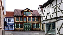
| Capital | Salzwedel |
| Area | |
| • Total | 2,293.05 km2 (885.35 sq mi) |
| Population (31 December 2020)[1] | |
| • Total | 82,687 |
| • Density | 36/km2 (93/sq mi) |
| Time zone | UTC+01:00 (CET) |
| • Summer (DST) | UTC+02:00 (CEST) |
| Vehicle registration | SAW, GA, KLZ |
| Website | altmarkkreis-salzwedel.de |
Altmarkkreis Salzwedel is a district in Saxony-Anhalt, Germany. It is bounded by (from the west and clockwise) the districts Gifhorn, Uelzen, Lüchow-Dannenberg in Lower Saxony, and the districts of Stendal and Börde (district).
History[]
The Altmark is a historical region that covers the territory of this district as well as parts of the neighbouring district of Stendal. In the 10th century AD, it was the eastern border province of the Holy Roman Empire; castles were built here in order to move the borders eastwards. The Altmark was a swampy and heavily contested region for centuries. In the 12th century, many swamps were drained, and the strongholds became small towns. In the Late Middle Ages, many towns were members of the Hanseatic League. Due to the Thirty Years' War the Altmark was completely devastated in the 17th century. It never regained its importance and remains sparsely populated to date.
The district was established in 1994 by merging the former districts of Gardelegen, Klötze, Salzwedel and (partially) Osterburg.
Geography[]
The Altmark is a plain countryside, which once was full of fens and ponds. Today it is mainly covered with forests and heaths. It is generally dry, although some swampy regions survived. The largest of those is the Drömling, a large wetland in the southwest, which is a nature park shared with the neighbouring Börde (district).
The largest lake of the district is the Arendsee (5.54 km2); the town of Arendsee is named after this lake.
Coat of arms[]
The coat of arms displays:
- The heraldic eagle of Brandenburg, which was also part of the arms of Salzwedel
- The lion of Lüneburg, since the town of Klötze belonged to the duchy of Brunswick-Lüneburg in medieval times
- The symbol of the Altmark, that was used during the 11th and 12th centuries
Towns and municipalities[]
The district Altmarkkreis Salzwedel consists of the following subdivisions:[2]
| Free towns | Verbandsgemeinde |
|---|---|
See also[]
References[]
- ^ "Bevölkerung der Gemeinden – Stand: 31. Dezember 2020" (PDF). Statistisches Landesamt Sachsen-Anhalt (in German). June 2021.
- ^ "Statistisches Landesamt Sachsen-Anhalt". Archived from the original on 2017-05-15. Retrieved 2009-08-06.
External links[]
| Wikimedia Commons has media related to Altmarkkreis Salzwedel. |
- Official Website (German)
- Tourism website for the Altmark region (German)
- Drömling Nature Park (German, English)
Coordinates: 52°41′N 11°13′E / 52.683°N 11.217°E

| show Authority control |
|---|
- Districts of Saxony-Anhalt
- Altmarkkreis Salzwedel