Amber Mountain (Alberta)
| Amber Mountain | |
|---|---|
 Amber Mountain Location of Amber Mountain in Alberta | |
| Highest point | |
| Elevation | 2,565 m (8,415 ft)[1] |
| Prominence | 145 m (476 ft)[1] |
| Parent peak | The Watchtower (2971 m)[1] |
| Listing | Mountains of Alberta |
| Coordinates | 52°48′42″N 117°54′19″W / 52.81167°N 117.90528°WCoordinates: 52°48′42″N 117°54′19″W / 52.81167°N 117.90528°W[2] |
| Geography | |
| Location | Jasper National Park Alberta |
| Parent range | Maligne Range Canadian Rockies |
| Topo map | NTS 83C13 Medicine Lake[2] |
| Geology | |
| Age of rock | Cambrian |
| Type of rock | Shale |
| Climbing | |
| Easiest route | Hiking |


Amber Mountain is a 2,565-metre (8,415-foot) mountain summit located in the Maligne Range of Jasper National Park, in the Canadian Rockies of Alberta, Canada. Amber Mountain was so named on account of amber-hued shale outcroppings.[3] The mountain was named in 1916 by Morrison P. Bridgland (1878-1948), a Dominion Land Surveyor who named many peaks in Jasper Park and the Canadian Rockies.[1] [4] The mountain's name was officially adopted in 1947 when approved by the Geographical Names Board of Canada.[2] Its nearest higher peak is The Watchtower, 5.0 km (3.1 mi) to the east.[1] Amber Mountain is composed of sedimentary rock laid down during the Cambrian period and pushed east and over the top of younger rock during the Laramide orogeny.[5]
Climate[]
Based on the Köppen climate classification, Amber Mountain is located in a subarctic climate with long, cold, snowy winters, and mild summers.[6] Temperatures can drop below -20 °C with wind chill factors below -30 °C. Precipitation runoff from Amber Mountain drains into tributaries of the Athabasca River.
See also[]
References[]
- ^ a b c d e "Amber Mountain". Bivouac.com. Retrieved 2019-04-03.
- ^ a b c "Amber Mountain". Geographical Names Data Base. Natural Resources Canada. Retrieved 2019-04-03.
- ^ Place-names of Alberta. Ottawa: Geographic Board of Canada. 1928. p. 11.
- ^ MacLaren, I.S. (2005). Mapper of Mountains M.P. Bridgland in the Canadian Rockies 1902-1930. With Eric Higgs, Gabrielle Zezulka-Mailloux. Edmonton, AB: The University of Alberta Press. ISBN 0-88864-456-6.
- ^ Gadd, Ben (2008), Geology of the Rocky Mountains and Columbias
- ^ Peel, M. C.; Finlayson, B. L. & McMahon, T. A. (2007). "Updated world map of the Köppen−Geiger climate classification". Hydrol. Earth Syst. Sci. 11: 1633–1644. ISSN 1027-5606.
External links[]
- Parks Canada web site: Jasper National Park
Gallery[]
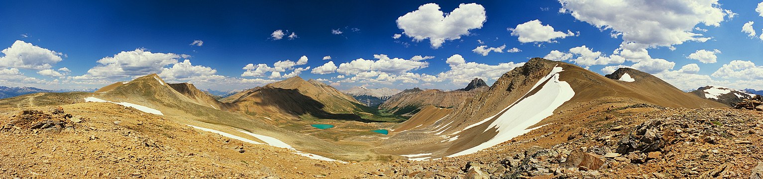
View from Amber Mountain looking northeast toward Centre Mountain, The Watchtower, and South Amber Mountain

This Alberta's Rockies location article is a stub. You can help Wikipedia by . |
- Two-thousanders of Alberta
- Alberta's Rockies
- Alberta's Rockies geography stubs