Angola, Kansas
Angola, Kansas | |
|---|---|
 | |
 Angola | |
| Coordinates: 37°6′20″N 95°26′58″W / 37.10556°N 95.44944°WCoordinates: 37°6′20″N 95°26′58″W / 37.10556°N 95.44944°W | |
| Country | United States |
| State | Kansas |
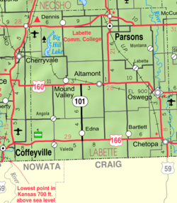
| County | Labette |
| Founded | 1886 |
| Platted | 1886 |
| Time zone | UTC-6 (CST) |
| • Summer (DST) | UTC-5 (CDT) |
| Area code | 620 |


Angola is an unincorporated community in Labette County, Kansas, United States.
History[]
Angola was laid out in 1886.[1] The post office was established January 31, 1887, and discontinued September 16, 1971. The community was served by the Missouri-Kansas-Texas Railroad for many years, however flooding on the Verdigris River washed out the railroad bridge in the 1970s and rail traffic was thereafter re-routed, no longer passing through Angola.
Education[]
The community is served by Labette County USD 506 public school district.
References[]
- ^ Blackmar, Frank Wilson (1912). Kansas: A Cyclopedia of State History, Embracing Events, Institutions, Industries, Counties, Cities, Towns, Prominent Persons, Etc. Standard Publishing Company. pp. 77.
Further reading[]
External links[]
Municipalities and communities of Labette County, Kansas, United States | ||
|---|---|---|
| Cities |  | |
| Unincorporated communities | ||
| Townships | ||
| Footnotes | †This populated place is designated a Census-Designated Place (CDP) by the United States Census Bureau. | |
| ||
Categories:
- Unincorporated communities in Labette County, Kansas
- Unincorporated communities in Kansas
- Populated places established in 1887
- Southeast Kansas geography stubs