Annapurna Rural Municipality, Kaski
This article needs additional citations for verification. (December 2021) |
Annapurna Rural Municipality
अन्नपूर्ण गाउँपालिका | |
|---|---|
 Annapurna Rural Municipality Location in Nepal | |
| Coordinates: 28°16′59″N 83°51′21″E / 28.283118°N 83.855864°E | |
| Country | |
| Province | Gandaki |
| District | Kaski District |
| Area | |
| • Total | 417.74 km2 (161.29 sq mi) |
| Population | |
| • Total | 23,417 |
| • Density | 56/km2 (150/sq mi) |
| Time zone | UTC+5:45 (Nepal Time) |
| Website | annapurnamunkaski.gov.np |

Annapurna Rural Municipality, Kaski (Nepali : अन्नपूर्ण गाउँपालिका) is a Gaunpalika in Kaski District in Gandaki Province of Nepal named after the Annapurna Mountain. On 12 March 2017, the Government of Nepal implemented a new local administrative structure. With the implementation of the new local administrative structure, VDSs have been replaced with Municipal and Village Councils. Annapurna Gaupalika is one of these 753 local units.[1]
History[]
Annapurna Rural Municipality was incorporated by merging Dhikurpokhari, Lumle, Salyan, Bhadaure Tamagi, Dangsing and Ghandruk Village Development Committees (VDCs). This rural Municipality came into existence on 10 March 2017.[2][3][4][5]
Location[]
Annapurna Rural Municipality is surrounded by Machhapuchchhre Rural Municipality on the East, Myagdi district on the West, Manang District on the North and Parbat district and Pokhara Metropolitan City on the South with a total area of 417.74 km2 (161.29 sq mi) and the total population of 23,565 individuals according to Nepal census 2011 (2068 BS). The population density of this Rural Municipality is 56.411/km2 (146.103/sq mi). This Rural Municipality is divided into 11 wards. This rural municipality lies 4528 feet above from the sea level. The Mid-Hill Highway(Pokhara-Baglung Segment) goes through the center of this Gaupalika.
Economic Activities[]
The major economic sources of this Gaupalika are:
- Tourism
The major places for tourist attraction of this Gaupalika are Lumle, Machhapuchhre & Annapurna Base Camp, Ghodepani, Ghandruk, Panchase, Isaru, Hidden Lake, Nasikhark etc.
- Agriculture
People are doing their agriculture as their prime source of income. Nowadays People are using modern technology for doing agriculture.
- Animal Husbandry
Rearing of animals for animal related products is Animal Husbandry. People in this Gaupalika rear animals like Cows, Buffalo, Yaks and Goat for Milk and Buffalo, Sheep, Goat and Pig for meat.
- Poultry Farming
We can see many Poultry Firm in the southern part of this Gaupalika where different types are poultry are rearing like Broiler, Lear's and Local Fowl.
- Horticulture
Agriculture of fruits for living is Horticulture. People in this Gaupalika are planting Orange, Pears, Apple etc for their Cash Crops.
Major Markets[]
The main market area of this Gaupalika are:
- Naudanda
- Kande
- Nayapul
- Birethanti
- Syauli Bazar
References[]
- ^ "अन्नपूर्ण गाउँपालिका ,गाँउ कार्यपालिकाको कार्यालय | गण्डकी प्रदेश, कास्की, नेपाल". annapurnamunkaski.gov.np. Retrieved 2020-07-05.
- ^ Collegenp. "Annapurna Rural Municipality, Kaski | Collegenp". www.collegenp.com. Retrieved 2020-07-09.
- ^ "कास्की जि.स.स". ddckaski.gov.np. Retrieved 2020-07-09.
- ^ "Annapurna Municipality, Kaski District, Gandaki Pradesh, Nepal". www.mindat.org. Retrieved 2020-07-09.
- ^ "Map" (PDF).
Headquarters: Pokhara | ||
| Metropolitan cities | 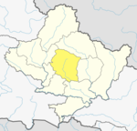 | |
| Rural municipalities | ||
| Former VDCs |
| |
| Villages | ||
This article about a location in the Kaski District of Nepal is a stub. You can help Wikipedia by . |
- Gandaki Province
- Kaski District
- Rural municipalities of Nepal established in 2017
- Rural municipalities in Kaski District
- Kaski District geography stubs