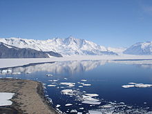
Antarctic
Coordinates: 90°00′S 00°00′W / 90.000°S -0.000°E


The Antarctic (/ænˈtɑːrtɪk/ or /ænˈtɑːrktɪk/, US English also /æntˈɑːrtɪk/ or /æntˈɑːrktɪk/; commonly /æˈnɑːrtɪk/)[Note 1] is a polar region around Earth's South Pole, opposite the Arctic region around the North Pole. The Antarctic comprises the continent of Antarctica, the Kerguelen Plateau and other island territories located on the Antarctic Plate or south of the Antarctic Convergence. The Antarctic region includes the ice shelves, waters, and all the island territories in the Southern Ocean situated south of the Antarctic Convergence, a zone approximately 32 to 48 km (20 to 30 mi) wide varying in latitude seasonally.[4] The region covers some 20 percent of the Southern Hemisphere, of which 5.5 percent (14 million km2) is the surface area of the Antarctica continent itself. All of the land and ice shelves south of 60°S latitude are administered under the Antarctic Treaty System. Biogeographically, the Antarctic realm is one of eight biogeographic realms of Earth's land surface.
Geography[]


As defined by the Antarctic Treaty System, the Antarctic region is everything south of the 60°S latitude. The Treaty area covers Antarctica and the archipelagos of the Balleny Islands, Peter I Island, Scott Island, the South Orkney Islands, and the South Shetland Islands.[5] However, this area does not include the Antarctic Convergence, a transition zone where the cold waters of the Southern Ocean collide with the warmer waters of the north, forming a natural border to the region.[6] Because the Convergence changes seasonally, the Convention for the Conservation of Antarctic Marine Living Resources (CCAMLR) approximates the Convergence line by joining specified points along parallels of latitude and meridians of longitude.[7] The implementation of the convention is managed through an international Commission headquartered in Hobart, Australia, by an efficient system of annual fishing quotas, licenses and international inspectors on the fishing vessels, as well as satellite surveillance[citation needed]
The islands situated between 60°S latitude parallel to the south and the Antarctic Convergence to the north, and their respective 200-nautical-mile (370 km) exclusive economic zones fall under the national jurisdiction of the countries that possess them: South Georgia and the South Sandwich Islands (United Kingdom), Bouvet Island (Norway), and Heard and McDonald Islands (Australia).
Kerguelen Islands (France; also an EU Overseas territory) are situated in the Antarctic Convergence area, while the Isla Grande de Tierra del Fuego, Falkland Islands, Isla de los Estados, Hornos Island with Cape Horn, Diego Ramírez Islands, Campbell Island, Macquarie Island, Amsterdam and Saint Paul Islands, Crozet Islands, Prince Edward Islands, and Gough Island and Tristan da Cunha group remain north of the Convergence and thus outside the Antarctic region.
Ecology[]
Antarctica[]
A variety of animals live in Antarctica for at least some of the year, including:[8][9]
- Seals
- Penguins
- South Georgia pipits
- Albatrosses
- Antarctic petrels
- Whales
- Fish, such as Antarctic icefish, Antarctic toothfish
- Squid, including the colossal squid
- Antarctic krill
Most of the Antarctica continent is permanently covered by ice and snow, leaving less than 1 percent of the land exposed. There are only two species of flowering plant, Antarctic hair grass and Antarctic pearlwort, but a range of mosses, liverworts, lichens and macrofungi.[10]
Sub-Antarctic Islands[]
Biodiversity among terrestrial flora and fauna is low on the islands: studies have theorized that the harsh climate was a major contributor towards species richness, but multiple correlations have been found with area, temperature, remoteness of islands, and food chain stability. For example, herbivorous insects are poor in number due to low plant richness, and likewise, indigenous bird numbers are related to insects, which are a major food source.[11]
 Isla de los Estados (Argentina)
 Isla Grande de Tierra del Fuego (Chile)

Conservation[]
The Antarctic hosts the world's largest protected area comprising 1.07 million km2, the South Georgia and the South Sandwich Islands Marine Protection Area created in 2012.[12] The latter exceeds the surface area of another vast protected territory, the Greenland National Park’s 972,000 km2.[13] (While the Ross Sea Marine Protection Area established in 2016 is still larger at 1.55 million km2, its protection is set to expire in 35 years.[14][15]) To protect the area, all Antarctic ships over 500 tonnes are subject to mandatory regulations under the Polar Code, adopted by the International Maritime Organization (in force since 1 January 2017).[16][17]
Society[]

People[]
The first recorded sighting of Antarctica is credited to the Spaniard Gabriel de Castilla, who reported seeing distant southern snow-capped mountains in 1603. The first Antarctic land discovered was the island of South Georgia, visited by the English merchant Anthony de la Roché in 1675. Although myths and speculation about a Terra Australis ("Southern Land") date back to antiquity, the first confirmed sighting of the continent of Antarctica is commonly accepted to have occurred in 1820 by the Russian expedition of Fabian Gottlieb von Bellingshausen and Mikhail Lazarev on Vostok and Mirny.
The Australian James Kerguelen Robinson (1859–1914) was the first human born in the Antarctic, on board the sealing ship Offley in Gulf of Morbihan (Royal Sound then), Kerguelen Island on 11 March 1859.[18][19] The first human born on an Antarctic island was Solveig Gunbjørg Jacobsen born on 8 October 1913 in Grytviken, South Georgia.[20]

Emilio Marcos Palma (born 7 January 1978) is an Argentine man who was the first documented person born on the continent of Antarctica at the Esperanza Base.[21] His father, Captain Jorge Palma, was head of the Argentine Army detachment at the base. While ten people have been born in Antarctica since, Palma's birthplace remains the southernmost. In late 1977, Silvia Morella de Palma, who was then seven months pregnant, was airlifted to Esperanza Base, in order to complete her pregnancy in the base. The airlift was a part of the Argentine solutions to the sovereignty dispute over territory in Antarctica. Emilio was automatically granted Argentine citizenship by the government since his parents were both Argentine citizens, and he was born in the claimed Argentine Antarctica. Palma can be considered to be the first native Antarctican.
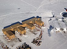
The Antarctic region had no indigenous population when first discovered, and its present inhabitants comprise a few thousand transient scientific and other personnel working on tours of duty at the several dozen research stations maintained by various countries. However, the region is visited by more than 40,000[22] tourists annually, the most popular destinations being the Antarctic Peninsula area (especially the South Shetland Islands) and South Georgia Island.
In December 2009, the growth of tourism, with consequences for both the ecology and the safety of the travellers in its great and remote wilderness, was noted at a conference in New Zealand by experts from signatories to the Antarctic Treaty. The definitive results of the conference was presented at the Antarctic Treaty states' meeting in Uruguay in May 2010.[23]
Time zones[]
Because Antarctica surrounds the South Pole, it is theoretically located in all time zones. For practical purposes, time zones are usually based on territorial claims or the time zone of a station's owner country or supply base.[24]
List of offshore islands[]

North of 60°S latitude[]
 Bouvet Island (Norway)
 Heard Island and McDonald Islands (Australia)
- Heard Island
- McDonald Islands
 Kerguelen Islands (France)
 South Georgia and the South Sandwich Islands (United Kingdom)
- South Georgia Islands
- Shag Rocks
- South Georgia
- South Sandwich Islands
- South Georgia Islands
South of 60°S latitude[]
 Balleny Islands (Antarctic Treaty System)
- Peter I Island (Antarctic Treaty System)
- Scott Island (Antarctic Treaty System)
- South Orkney Islands (Antarctic Treaty System)
- South Shetland Islands (Antarctic Treaty System)
See also[]
Notes[]
- ^ The word was originally pronounced without the first /k/, but the spelling pronunciation has become common and is often considered more correct. The pronunciation without the first k sound and the first t sound is however widespread and a typical phenomenon of English in many other similar words too.[1] The "c" was added to the spelling for etymological reasons and then began to be pronounced, but (as with other spelling pronunciations) at first only by less educated people.[2][3]
References[]
- ^ American Heritage Dictionary Archived 2015-12-08 at the Wayback Machine
- ^ Crystal, David (2006). The Fight for English. Oxford University Press. p. 172. ISBN 978-0-19-920764-0.
- ^ Harper, Douglas. "Antarctic". Online Etymology Dictionary. Archived from the original on 11 January 2012. Retrieved 16 November 2011.
- ^ "Scientific Committee on Antarctic Research website". SCAR. Archived from the original on 14 December 2013. Retrieved 15 March 2015.
- ^ "The Antarctic Treaty | NSF - National Science Foundation". www.nsf.gov. Retrieved 7 October 2020.
- ^ "Commission for the Conservation of Antarctic Marine Living Resources - Department of Agriculture". www.agriculture.gov.au. Retrieved 7 October 2020.
- ^ Convention for the Conservation of Antarctic Marine Living Resources Archived 2010-05-05 at the Wayback Machine
- ^ "Antarctic Wildlife". Natural Environment Research Council - British Antarctic Survey. Archived from the original on 5 October 2012. Retrieved 20 November 2012.
- ^ Vanessa Woods (14 October 2011). "Antarctic wildlife". Commonwealth Scientific and Industrial Research Organisation. Archived from the original on 14 December 2013. Retrieved 20 November 2012.
- ^ "Plants of Antarctica". Natural Environment Research Council - British Antarctic Survey. Archived from the original on 7 June 2011. Retrieved 20 November 2012.
- ^ Chown; Gremmen; Gaston (1998). "Ecological Biogeography of Southern Ocean Islands: Species-Area Relationships, Human Impacts, and Conservation". The American Naturalist. 152 (4): 562–75. doi:10.2307/2463357. ISSN 0003-0147. JSTOR 2463357. PMID 18811364.
- ^ SGSSI Marine Protection Area (Management Plan).
- ^ Greenland in figures 2009. Statistics Greenland, 2009.
- ^ CCAMLR to create world's largest Marine Protected Area. CCAMLR Website
- ^ Slezak, Michael (26 October 2016). "World's largest marine park created in Ross Sea in Antarctica in landmark deal". The Guardian. Archived from the original on 28 October 2016. Retrieved 28 October 2016.
- ^ "Shipping in polar waters". IMO. Retrieved 2 August 2021.
- ^ "The Polar Code, One Year On". The Maritime Executive. Retrieved 2 August 2021.
- ^ Robinson, James (1906). "Appendix B: Log of the Offley". In Cerchi, D. (ed.). Reminiscences (Report). Hobart, Tasmania, AU: Archives Office of Tasmania. pp. 98–99. Archived from the original on 6 February 2012.
- ^ Ivanov, Lyubomir; Ivanova, Nusha (2014). Антарктика: Природа, История, Усвояване, Географски Имена, Българско Участие [Antarctic: Nature, History, Utilization, Geographic Names, and Bulgarian Participation] (in Bulgarian) (first ed.). Sofia, Bulgaria: Manfred Wörner Foundation. ISBN 978-619-90008-1-6 – via ResearchGate.net. —— see also:. biblio.bg (in Bulgarian) (Second revised and updated ed.). 2014. ISBN 978-619-90008-2-3. Archived from the original on 10 February 2016.
- ^ Headland, Robert (1984). The Island of South Georgia. Cambridge: Cambridge University Press. ISBN 9780521424745.
- ^ "Emilio Palma, argentino y "Adán" de la Antártida | Información General".
- ^ IAATO tourist statistics 2007/08
- ^ Antarctic Nations Considering New Controls On Ships Amid Tourism Explosion. Archived 2012-01-18 at the Wayback Machine Ray Lilley, The Associated Press, 8 December 2009.
- ^ National Geographic Society. (2012, October 09). South Pole. Retrieved October 20, 2020, from https://www.nationalgeographic.org/encyclopedia/south-pole/
Further reading[]
- Krupnik, Igor, Michael A. Lang, and Scott E. Miller, eds. Smithsonian at the Poles: Contributions to International Polar Year Science. Washington, D.C.: Smithsonian Institution Scholarly Press, 2009.
External links[]
- British Services Antarctic Expedition 2012
- Committee for Environmental Protection of Antarctica
- Secretariat of the Antarctic Treaty
- CCAMLR Commission
- Antarctic Heritage Trusts
- International Association of Antarctica Tour Operators
- Map of the Antarctic Convergence
- The South Atlantic and Subantarctic Islands
- Ushuaia is the most popular gateway to Antarctica
| show Antarctica |
|---|


| show Authority control |
|---|
- Antarctic region
- Geography of Antarctica