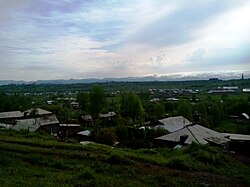
Arapi, Armenia
Arapi
Առափի | |
|---|---|
community | |
 | |
 Arapi | |
| Coordinates: 40°46′47″N 43°48′02″E / 40.77972°N 43.80056°ECoordinates: 40°46′47″N 43°48′02″E / 40.77972°N 43.80056°E | |
| Country | |
| Marz (Province) | Shirak |
| Elevation | 1,500 m (4,900 ft) |
| Population (2010) | |
| • Total | 2,053 |
| Time zone | UTC+4 ( ) |
| • Summer (DST) | UTC+5 ( ) |
| Arapi, Armenia at GEOnet Names Server | |

Arapi (Armenian: Առափի, also Romanized as Arrap’i and Arrapi) is a village and rural community (municipality) in the Shirak Province of Armenia. Statistical Committee of Armenia reported its population was 2,053 in 2010,[1] up from 1,980 at the 2001 census.[2]
Population[]
Population per years is the following.[3]
| Year | 1886 | 1914 | 1931 | 1959 | 1970 | 1979 | 1989 | 2001 | 2004 |
|---|---|---|---|---|---|---|---|---|---|
| Pop. | 577 | 989 | 1087 | 1359 | 1511 | 1589 | 2075 | 1980 | 2035 |
References[]
- ^ "Marzes of Armenia and Yerevan City in Figures, 2010" (PDF). Statistical Committee of Armenia.
- ^ Report of the results of the 2001 Armenian Census, Statistical Committee of Armenia
- ^ "Dictionary of Armenian residences (Հայաստանի հանրապետության բնակավայրերի բառարան), page 24" (PDF). Retrieved April 18, 2014.

This article about a location in Shirak Province, Armenia is a stub. You can help Wikipedia by . |
Categories:
- Communities in Shirak Province
- Populated places in Shirak Province
- Shirak geography stubs