Arapiraca
This article needs additional citations for verification. (May 2012) |
Arapiraca | |
|---|---|
Municipality | |
 | |
 Flag  Seal | |
 Location of Arapiraca in the State of Alagoas | |
 Arapiraca Location in Brazil | |
| Coordinates: 9°45′07″S 36°39′39″W / 9.75194°S 36.66083°WCoordinates: 9°45′07″S 36°39′39″W / 9.75194°S 36.66083°W | |
| Country | |
| State | Alagoas |
| Mesoregion | |
| Microregion | |
| Founded | 30 October 1924 |
| Government | |
| • Mayor | Luciano Barbosa(MDB) |
| Area | |
| • Total | 351.475 km2 (135.705 sq mi) |
| Elevation | 264 m (866 ft) |
| Population (2020 est [1]) | |
| • Total | 233,047 |
| • Density | 600.83/km2 (1,556.1/sq mi) |
| Demonym(s) | Arapiraquense |
| Time zone | UTC−3 (BRT) |
| Postal code | 57300 |
| Area code(s) | (+55) 82 |
| Website | Official website (in Portuguese) |

Arapiraca is a municipality located in the center of the Brazilian state of Alagoas, some 135 km (84 mi) from the state capital, Maceió. It was founded in 1924. As of 2010, it has a population of 214.006,[2] but IBGE estimated 233,047 inhabitants for 2020.
Arapiraca is the second largest city in Alagoas, and is known mostly for its production of tobacco, hence its nickname of "The Brazilian Tobacco Capital".
Neighboring municipalities[]
Clockwise from the north:
- north: Igaci
- north-north-east: Craíbas
- north-east: Coité do Nóia
- east: Limoeiro de Anadia
- south-east: Junqueiro
- south-south-east: São Sebastião
- south: Feira Grande
- south-west: Lagoa da Canoa
Sports[]
Agremiação Sportiva Arapiraquense, better known as ASA, is the city's football club. The club plays its home matches at the Estádio Municipal Coaracy da Mata Fonseca.
References[]
- ^ IBGE 2020
- ^ IBGE – "Archived copy". Archived from the original on 2008-06-11. Retrieved 2008-06-11.CS1 maint: archived copy as title (link)
| hide | ||
|---|---|---|
Capital: Maceió | ||
| Arapiraca | 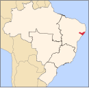 | |
| Palmeira dos Índios | ||
| Traipu | ||
| Litoral Norte Alagoano | ||
| Maceió | ||
| Mata Alagoana | ||
| Penedo | ||
| São Miguel dos Campos | ||
| Serrana dos Quilombos | ||
| Alagoana do Sertão do São Francisco | ||
| Batalha | ||
| Santana do Ipanema | ||
| Serrana do Sertão Alagoano | ||
| Authority control |
|
|---|
This Alagoas, Brazil location article is a stub. You can help Wikipedia by . |
Categories:
- Municipalities in Alagoas
- Populated places established in 1924
- Alagoas geography stubs