Ardena, New Jersey
Ardena, New Jersey | |
|---|---|
Unincorporated community | |
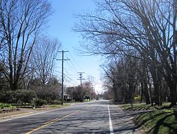 The intersection of CR 524 and Vanderveer Road in Ardena | |
 Ardena, New Jersey Location of Ardena in Monmouth County Inset: Location of county within the state of New Jersey  Ardena, New Jersey Ardena, New Jersey (New Jersey)  Ardena, New Jersey Ardena, New Jersey (the United States) | |
| Coordinates: 40°12′41″N 74°13′58″W / 40.21139°N 74.23278°WCoordinates: 40°12′41″N 74°13′58″W / 40.21139°N 74.23278°W | |
| Country | |
| State | |
| County | Monmouth |
| Township | Howell |
| Elevation | 98 ft (30 m) |
| GNIS feature ID | 874371[1] |
Ardena is an unincorporated community located within Howell Township in Monmouth County, New Jersey, United States.[2][3][4][5] The community is located along County Route 524 near Vanderveer Road in the western part of the township. The area consists of about half farmland and half residential developments.[6]
References[]
- ^ a b "Ardena". Geographic Names Information System. United States Geological Survey.
- ^ "Parcel and Subdisvision Map". Howell Township. October 2016. Retrieved March 31, 2020.
- ^ "NJDOT Graphic Information System Maps Middlesex" (PDF). New Jersey Department of Transportation. Retrieved March 29, 2020.
- ^ Locality Search Archived 2016-07-09 at the Wayback Machine, State of New Jersey. Accessed February 17, 2015.
- ^ Tova Navarra, Tova Navarra (1996), Howell and Farmingdale: A Social and Cultural History, Arcadia Publishing, ISBN 9780738563763
- ^ Google (March 31, 2016). "Aerial view of Ardena" (Map). Google Maps. Google. Retrieved March 31, 2016.

This Monmouth County, New Jersey state location article is a stub. You can help Wikipedia by . |
Categories:
- Neighborhoods in Howell Township, New Jersey
- Unincorporated communities in Monmouth County, New Jersey
- Unincorporated communities in New Jersey
- Monmouth County, New Jersey geography stubs