Sea Bright, New Jersey
Sea Bright, New Jersey | |
|---|---|
| Borough of Sea Bright | |
 Downtown Sea Bright | |
 Map of Sea Bright in Monmouth County. Inset: Location of Monmouth County highlighted in the State of New Jersey. | |
 Census Bureau map of Sea Bright, New Jersey | |
| Coordinates: 40°21′34″N 73°58′30″W / 40.359432°N 73.974892°WCoordinates: 40°21′34″N 73°58′30″W / 40.359432°N 73.974892°W[1][2] | |
| Country | |
| State | |
| County | Monmouth |
| Incorporated | March 21, 1889 |
| Government | |
| • Type | Borough |
| • Body | Borough Council |
| • Mayor | Brian P. Kelly (R, term ends December 31, 2023)[3] |
| • Administrator | Joseph Verruni[4] |
| • Municipal clerk | Christine Pfeiffer[4] |
| Area | |
| • Total | 1.29 sq mi (3.33 km2) |
| • Land | 0.72 sq mi (1.86 km2) |
| • Water | 0.57 sq mi (1.47 km2) 43.88% |
| Area rank | 472nd of 565 in state 42nd of 53 in county[1] |
| Elevation | 0 ft (0 m) |
| Population | |
| • Total | 1,412 |
| • Estimate (2019)[10] | 1,338 |
| • Rank | 517th of 566 in state 46th of 53 in county[11] |
| • Density | 1,935.5/sq mi (747.3/km2) |
| • Density rank | 296th of 566 in state 34th of 53 in county[11] |
| Time zone | UTC−05:00 (Eastern (EST)) |
| • Summer (DST) | UTC−04:00 (Eastern (EDT)) |
| ZIP Code | |
| Area code(s) | 732[14] |
| FIPS code | 3402566240[1][15][16] |
| GNIS feature ID | 0885387[1][17] |
| Website | www |

Sea Bright is a borough in Monmouth County, New Jersey, United States. As of the 2010 United States Census, the borough's population was 1,412,[7][8][9] reflecting a decline of 406 (-22.3%) from the 1,818 counted in the 2000 Census, which had in turn increased by 125 (+7.4%) from the 1,693 counted in the 1990 Census.[18]
Sea Bright was formed as a borough by an act of the New Jersey Legislature on March 21, 1889, from portions of Ocean Township, based on the results of a referendum held the previous day. The borough was reincorporated on March 10, 1897.[19] Additional portions of Ocean Township were annexed by the borough in March 1909.[20]
Some sources attribute the name to a suggestion made by Martha Bayard Stevens,[21][22] The borough and other sources say that the borough was named for Sea Bright, England, though there is no evidence such a place exists.[23][24][25] Earlier sources often spell it as one word, "Seabright", as seen in the United States Coast Guard's Station Seabright and the Seabright Lawn Tennis and Cricket Club.
History[]
In the early 1840s, the area of present-day Sea Bright was a fishing community of simple shacks near the beach dunes; Ocean House, the area's first hotel, opened in 1842, featuring access to fishing and sea bathing.[26][27] The area was called "Nauvoo", a Native American word, meaning "bright sea".[28] An alternative explanation, which the borough credits as the source,[21] is that the name is derived from the Hebrew language meaning "pleasant place," which was the same name that Mormon leader Joseph Smith gave to Nauvoo, the Illinois town he founded in 1839. Smith is said to have visited Monmouth County during a missionary journey in 1840.[29][30][28]
The first bridge across the Shrewsbury River connecting Sea Bright to Rumson was constructed in 1870. After several iterations of the bridge, Monmouth County has announced plans for a replacement of the existing span built in 1950 that connects to Ocean Avenue in Sea Bright with a new bridge that would be completed in 2020 at a site south of the current crossing.[31]
The Sea Bright Skiff was developed on the Jersey Shore in the early 19th century for fishing offshore, by being launched through the surf and returned to shore.[32]
Geography[]
According to the United States Census Bureau, the borough had a total area of 1.29 square miles (3.33 km2), including 0.72 square miles (1.86 km2) of land and 0.57 square miles (1.47 km2) of water (43.88%).[1][2]
Sea Bright has seven members-only beach clubs, of which five are in the North Beach area: Ship Ahoy, Sands, Surfrider, Sea Bright Beach Club and Chapel Beach Club; and two are south of the center of town: Driftwood and Edgewater. These clubs charge thousands of dollars for membership and have waiting lists of several years for prospective members.[33] In addition, there is a large public, municipal beach in the center of town which charges a fee, but includes free parking and is protected by lifeguards, with entry limited to those who have purchased a beach badge.[34] The traditional surfing beach area, called the Anchorage, is free and public, but unguarded. In addition, there are numerous public access stairs to other unguarded beaches for fishing, recreation and suntanning.
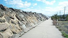
Unincorporated communities, localities and place names within Sea Bright include Low Moor,[35] Navesink Beach and Normandie.[36] Sea Bright–Monmouth Beach Seawall runs the length of the town.
The borough borders the Monmouth County municipalities of Highlands, Middletown Township, Monmouth Beach and Rumson.[37][38][39] Sea Bright is located on the barrier peninsula that separates the Atlantic Ocean from the Navesink and Shrewsbury rivers.
Demographics[]
| Historical population | |||
|---|---|---|---|
| Census | Pop. | %± | |
| 1900 | 1,198 | — | |
| 1910 | 1,220 | 1.8% | |
| 1920 | 856 | −29.8% | |
| 1930 | 899 | 5.0% | |
| 1940 | 779 | −13.3% | |
| 1950 | 999 | 28.2% | |
| 1960 | 1,138 | 13.9% | |
| 1970 | 1,339 | 17.7% | |
| 1980 | 1,812 | 35.3% | |
| 1990 | 1,693 | −6.6% | |
| 2000 | 1,818 | 7.4% | |
| 2010 | 1,412 | −22.3% | |
| 2019 (est.) | 1,338 | [10][40] | −5.2% |
| Population sources: 1900-1920[41] 1900-1910[42] 1910-1930[43] 1930-1990[44] 2000[45][46] 2010[7][8][9] | |||
Census 2010[]
The 2010 United States census counted 1,412 people, 792 households, and 325 families in the borough. The population density was 1,935.5 per square mile (747.3/km2). There were 1,211 housing units at an average density of 1,659.9 per square mile (640.9/km2). The racial makeup was 94.55% (1,335) White, 0.78% (11) Black or African American, 0.00% (0) Native American, 2.27% (32) Asian, 0.00% (0) Pacific Islander, 1.49% (21) from other races, and 0.92% (13) from two or more races. Hispanic or Latino of any race were 5.52% (78) of the population.[7]
Of the 792 households, 12.4% had children under the age of 18; 32.1% were married couples living together; 5.7% had a female householder with no husband present and 59.0% were non-families. Of all households, 48.7% were made up of individuals and 8.1% had someone living alone who was 65 years of age or older. The average household size was 1.78 and the average family size was 2.54.[7]
11.3% of the population were under the age of 18, 5.2% from 18 to 24, 30.1% from 25 to 44, 38.8% from 45 to 64, and 14.5% who were 65 years of age or older. The median age was 46.7 years. For every 100 females, the population had 106.7 males. For every 100 females ages 18 and older there were 107.3 males.[7]
The Census Bureau's 2006-2010 American Community Survey showed that (in 2010 inflation-adjusted dollars) median household income was $74,236 (with a margin of error of +/- $8,921) and the median family income was $102,679 (+/- $37,943). Males had a median income of $84,412 (+/- $45,724) versus $72,898 (+/- $10,443) for females. The per capita income for the borough was $82,535 (+/- $20,263). About 3.5% of families and 4.8% of the population were below the poverty line, including 6.3% of those under age 18 and 2.7% of those age 65 or over.[47]
Census 2000[]
As of the 2000 United States Census[15] there were 1,818 people, 1,003 households, and 402 families residing in the borough. The population density was 2,846.9 people per square mile (1,096.8/km2). There were 1,202 housing units at an average density of 1,882.3 per square mile (725.1/km2). The racial makeup of the borough was 94.39% White, 1.76% African American, 2.26% Asian, 0.88% from other races, and 0.72% from two or more races. Hispanic or Latino of any race were 4.51% of the population.[45][46]
There were 1,003 households, out of which 11.1% had children under the age of 18 living with them, 29.6% were married couples living together, 6.3% had a female householder with no husband present, and 59.9% were non-families. 45.4% of all households were made up of individuals, and 7.6% had someone living alone who was 65 years of age or older. The average household size was 1.81 and the average family size was 2.51.[45][46]
In the borough the population was spread out, with 11.2% under the age of 18, 5.3% from 18 to 24, 41.5% from 25 to 44, 31.2% from 45 to 64, and 10.8% who were 65 years of age or older. The median age was 40 years. For every 100 females, there were 109.7 males. For every 100 females age 18 and over, there were 109.5 males.[45][46]
The median income for a household in the borough was $65,563, and the median income for a family was $72,031. Males had a median income of $60,417 versus $41,100 for females. The per capita income for the borough was $45,066. About 5.3% of families and 7.6% of the population were below the poverty line, including 18.0% of those under age 18 and 3.7% of those age 65 or over.[45][46]

Parks and recreation[]
As of the summer of 2015, the borough added lifeguards and began charging visitors a daily admission at Anchorage Beach, an area that has been widely used by surfers, eliminating one of the limited number of free oceanfront beaches in the state.[48]
Government[]
Local government[]
Sea Bright is governed under the Borough form of New Jersey municipal government, which is used in 218 municipalities (of the 565) statewide, making it the most common form of government in New Jersey.[49] The governing body is comprised of the Mayor and the Borough Council, with all positions elected at-large on a partisan basis as part of the November general election. A Mayor is elected directly by the voters to a four-year term of office. The Borough Council is comprised of six members elected to serve three-year terms on a staggered basis, with two seats coming up for election each year in a three-year cycle.[5] The Borough form of government used by Sea Bright is a "weak mayor / strong council" government in which council members act as the legislative body with the mayor presiding at meetings and voting only in the event of a tie. The mayor can veto ordinances subject to an override by a two-thirds majority vote of the council. The mayor makes committee and liaison assignments for council members, and most appointments are made by the mayor with the advice and consent of the council.[50][51]
As of 2020, the Mayor of Sea Bright is Republican Brian P. Kelly, whose term of office ends December 31, 2023.[52] Members of the Sea Bright Borough Council are Council President Charles H. Rooney III (D, 2020), Kevin P. Birdsall (I, 2022), Samuel A. Catalano (D, 2022), William J. "Jack" Keeler (R, 2021), Marc A. Leckstein (D, 2021) and Jon Schwartz (I, 2020).[53][54][55][56][57][58]
Federal, state and county representation[]
Sea Bright is located in the 6th Congressional District[59] and is part of New Jersey's 13th state legislative district.[8][60][61] Prior to the 2011 reapportionment following the 2010 Census, Sea Bright had been in the 11th state legislative district.[62]
For the 117th United States Congress, New Jersey's Sixth Congressional District is represented by Frank Pallone (D, Long Branch).[63][64] New Jersey is represented in the United States Senate by Democrats Cory Booker (Newark, term ends 2027)[65] and Bob Menendez (Harrison, term ends 2025).[66][67]
For the 2018–2019 session (Senate, General Assembly), the 13th Legislative District of the New Jersey Legislature is represented in the State Senate by Declan O'Scanlon (R, Little Silver) and in the General Assembly by Gerard Scharfenberger (R, Middletown Township) and Serena DiMaso (R, Holmdel Township).[68][69]
Monmouth County is governed by a Board of Chosen Freeholders consisting of five members who are elected at-large to serve three year terms of office on a staggered basis, with either one or two seats up for election each year as part of the November general election. At an annual reorganization meeting held in the beginning of January, the board selects one of its members to serve as Director and another as Deputy Director.[70] As of 2020, Monmouth County's Freeholders are Freeholder Director Thomas A. Arnone (R, Neptune City, term as freeholder ends December 31, 2022; term as freeholder director ends 2021),[71] Freeholder Deputy Director Susan M. Kiley (R, Hazlet Township, term as freeholder ends December 31, 2021; term as deputy freeholder director ends 2021),[72] Lillian G. Burry (R, Colts Neck Township, 2020),[73] Nick DiRocco (R, Wall Township, 2022),[74] and Patrick G. Impreveduto (R, Holmdel Township, 2020)[75].
Constitutional officers elected on a countywide basis are County clerk Christine Giordano Hanlon (R, 2020; Ocean Township),[76][77] Sheriff Shaun Golden (R, 2022; Howell Township),[78][79] and Surrogate Rosemarie D. Peters (R, 2021; Middletown Township).[80][81]
Politics[]
As of March 23, 2011, there were a total of 1,095 registered voters in Sea Bright, of which 248 (22.6%) were registered as Democrats, 305 (27.9%) were registered as Republicans and 541 (49.4%) were registered as Unaffiliated. There was one voter registered to another parties.[82]
In the 2012 presidential election, Republican Mitt Romney received 57.7% of the vote (379 cast), ahead of Democrat Barack Obama with 41.1% (270 votes), and other candidates with 1.2% (8 votes), among the 659 ballots cast by the borough's 1,181 registered voters (2 ballots were spoiled), for a turnout of 55.8%.[83][84] In the 2008 presidential election, Republican John McCain received 53.6% of the vote (483 cast), ahead of Democrat Barack Obama with 43.2% (389 votes) and other candidates with 1.7% (15 votes), among the 901 ballots cast by the borough's 1,220 registered voters, for a turnout of 73.9%.[85] In the 2004 presidential election, Republican George W. Bush received 55.9% of the vote (519 ballots cast), outpolling Democrat John Kerry with 43.0% (399 votes) and other candidates with 1.2% (16 votes), among the 928 ballots cast by the borough's 1,282 registered voters, for a turnout percentage of 72.4.[86]
In the 2013 gubernatorial election, Republican Chris Christie received 84.1% of the vote (348 cast), ahead of Democrat Barbara Buono with 14.7% (61 votes), and other candidates with 1.2% (5 votes), among the 418 ballots cast by the borough's 1,068 registered voters (4 ballots were spoiled), for a turnout of 39.1%.[87][88] In the 2009 gubernatorial election, Republican Chris Christie received 66.2% of the vote (406 ballots cast), ahead of Democrat Jon Corzine with 26.8% (164 votes), Independent Chris Daggett with 5.5% (34 votes) and other candidates with 1.0% (6 votes), among the 613 ballots cast by the borough's 1,148 registered voters, yielding a 53.4% turnout.[89]
Education[]
Public school students in kindergarten through eighth grade are educated as part of the Oceanport School District after the former Sea Bright Board of Education was eliminated by the New Jersey Department of Education in 2009 as a non-operating district.[90] As of the 2018–19 school year, the district, comprised of two schools, had an enrollment of 599 students and 61.0 classroom teachers (on an FTE basis), for a student–teacher ratio of 9.8:1.[91] Schools in the district (with 2018–19 enrollment data from the National Center for Education Statistics[92]) are Wolf Hill Elementary School[93] with 342 students in pre-Kindergarten through 4th grade and Maple Place Middle School[94] with 253 students in grades 5 - 8.[95][96][97]
For ninth through twelfth grades, public school students attend Shore Regional High School, a regional high school that also serves students from the constituent districts of Monmouth Beach, Oceanport and West Long Branch.[98][99] The high school is located in West Long Branch and is part of the Shore Regional High School District. As of the 2018–19 school year, the high school had an enrollment of 649 students and 57.2 classroom teachers (on an FTE basis), for a student–teacher ratio of 11.3:1.[100] Seats on the high school district's nine-member board of education are allocated based on the population of the constituent municipalities, with one seat assigned to Sea Bright.[101]
Sea Bright high school students in public school also have the opportunity to attend the schools of the Monmouth County Vocational School District, including the five career academies.[102]
Transportation[]
Roads and highways[]

As of May 2010, the borough had a total of 6.37 miles (10.25 km) of roadways, of which 2.71 miles (4.36 km) were maintained by the municipality, 0.08 miles (0.13 km) by Monmouth County and 3.58 miles (5.76 km) by the New Jersey Department of Transportation.[103]

New Jersey Route 36 is the main highway through Sea Bright. To the south, it connects the borough to Monmouth Beach. Heading north, it crosses the Shrewsbury River to Highlands via the Highlands – Sea Bright Bridge, a fixed span which was built between 2008 and 2011 to replace a 1,240-foot (380 m) drawbridge built in 1932. Sea Bright can also be accessed from Rumson to the west via Rumson Road (County Route 520) over the Shrewsbury River Bridge.
Public transportation[]
NJ Transit provides local bus service between Sea Bright and Red Bank on the 835 route.[104]
Climate[]
According to the Köppen climate classification system, Sea Bright has a humid subtropical climate (Cfa). Cfa climates are characterized by all months having an average temperature > 32.0 °F (0.0 °C), at least four months with an average temperature ≥ 50.0 °F (10.0 °C), at least one month with an average temperature ≥ 71.6 °F (22.0 °C) and no significant precipitation difference between seasons. Although most summer days feature slight-to-moderate humidity and a cooling afternoon sea breeze in Sea Bright, episodes of heat and high humidity can occur with heat index values > 104 °F (40 °C). Since 1981, the highest air temperature was 99.8 °F (37.7 °C) on August 9, 2001, and the highest daily average mean dew point was 77.9 °F (25.5 °C) on July 19, 2019. The average wettest month is July which correlates with the peak in thunderstorm activity. Since 1981, the wettest calendar day was 5.63 inches (143 mm) on August 27, 2011. During the winter months, the average annual extreme minimum air temperature is 5.3 °F (−14.8 °C).[105] Since 1981, the coldest air temperature was −3.6 °F (−19.8 °C) on January 21, 1985. Episodes of extreme cold and wind can occur with wind chill values < −5 °F (−21 °C). The average seasonal (November-April) snowfall total is 18 to 24 inches (46 to 61 cm) and the average snowiest month is February which corresponds with the annual peak in nor'easter activity.
| hideClimate data for Sea Bright, 1981-2010 normals, extremes 1981-2019 | |||||||||||||
|---|---|---|---|---|---|---|---|---|---|---|---|---|---|
| Month | Jan | Feb | Mar | Apr | May | Jun | Jul | Aug | Sep | Oct | Nov | Dec | Year |
| Record high °F (°C) | 70.4 (21.3) |
77.9 (25.5) |
82.0 (27.8) |
89.0 (31.7) |
94.6 (34.8) |
96.0 (35.6) |
99.6 (37.6) |
99.8 (37.7) |
96.6 (35.9) |
92.6 (33.7) |
78.1 (25.6) |
74.4 (23.6) |
99.8 (37.7) |
| Average high °F (°C) | 39.5 (4.2) |
42.1 (5.6) |
48.7 (9.3) |
58.1 (14.5) |
67.8 (19.9) |
77.3 (25.2) |
82.4 (28.0) |
81.5 (27.5) |
75.4 (24.1) |
64.6 (18.1) |
54.7 (12.6) |
44.7 (7.1) |
61.5 (16.4) |
| Daily mean °F (°C) | 32.6 (0.3) |
34.8 (1.6) |
41.0 (5.0) |
50.3 (10.2) |
60.0 (15.6) |
69.6 (20.9) |
75.0 (23.9) |
74.2 (23.4) |
67.8 (19.9) |
56.7 (13.7) |
47.6 (8.7) |
38.0 (3.3) |
54.1 (12.3) |
| Average low °F (°C) | 25.6 (−3.6) |
27.5 (−2.5) |
33.2 (0.7) |
42.4 (5.8) |
52.1 (11.2) |
61.8 (16.6) |
67.6 (19.8) |
66.9 (19.4) |
60.2 (15.7) |
48.8 (9.3) |
40.4 (4.7) |
31.2 (−0.4) |
46.6 (8.1) |
| Record low °F (°C) | −3.6 (−19.8) |
2.2 (−16.6) |
7.7 (−13.5) |
18.7 (−7.4) |
38.8 (3.8) |
46.6 (8.1) |
50.6 (10.3) |
47.3 (8.5) |
41.0 (5.0) |
29.2 (−1.6) |
16.7 (−8.5) |
0.1 (−17.7) |
−3.6 (−19.8) |
| Average precipitation inches (mm) | 3.51 (89) |
2.86 (73) |
3.82 (97) |
4.13 (105) |
3.85 (98) |
3.76 (96) |
4.65 (118) |
4.43 (113) |
3.64 (92) |
3.88 (99) |
3.66 (93) |
3.91 (99) |
46.10 (1,171) |
| Average relative humidity (%) | 65.5 | 62.0 | 61.3 | 62.8 | 67.0 | 70.5 | 70.6 | 71.3 | 71.9 | 69.4 | 67.6 | 65.6 | 67.1 |
| Average dew point °F (°C) | 22.3 (−5.4) |
23.1 (−4.9) |
28.7 (−1.8) |
38.1 (3.4) |
49.0 (9.4) |
59.6 (15.3) |
64.8 (18.2) |
64.3 (17.9) |
58.4 (14.7) |
46.8 (8.2) |
37.4 (3.0) |
27.5 (−2.5) |
43.4 (6.3) |
| Source: PRISM[106] | |||||||||||||
| hideClimate data for Sandy Hook Buoy, 8 NW Sea Bright, NJ (Ocean Water Temperature) | |||||||||||||
|---|---|---|---|---|---|---|---|---|---|---|---|---|---|
| Month | Jan | Feb | Mar | Apr | May | Jun | Jul | Aug | Sep | Oct | Nov | Dec | Year |
| Daily mean °F (°C) | 37 (3) |
36 (2) |
40 (4) |
46 (8) |
55 (13) |
62 (17) |
69 (21) |
72 (22) |
68 (20) |
59 (15) |
51 (11) |
43 (6) |
53 (12) |
| Source: NOAA[107] | |||||||||||||
Ecology[]
According to the A. W. Kuchler U.S. potential natural vegetation types, Sea Bright would have a dominant vegetation type of Northern Cordgrass (73) with a dominant vegetation form of Coastal Prairie (20). [108] The plant hardiness zone is 7b with an average annual extreme minimum air temperature of 5.3 °F (−14.8 °C).[105] The average date of first spring leaf-out is March 23[109] and fall color typically peaks in early-November.
Notable people[]
People who were born in, residents of, or otherwise closely associated with Sea Bright include:
- Fred Alexander (1880–1969), top-ranked tennis player in the early 20th century.[110]
- James Waddell Alexander II (1888–1971), mathematician and topologist who was one of the first members of the Institute for Advanced Study (1933–1951), and also a professor at Princeton University (1920–1951).[111]
- Tal Farlow (1921–1998), jazz guitarist.[112]
- Lindley Miller Garrison (1864–1932), United States Secretary of War from 1913 to 1916 during the Administration of President Woodrow Wilson.[113]
- Jerry Gaskill (born 1957), rock musician who is the drummer for the progressive metal band King's X.[114]
- John J. McCook (1845–1911), Civil War officer, prominent New York attorney and railroad executive.[115]
- Mildred Mottahedeh (1908–2000), collector of ceramics, businessperson, and philanthropist who cofounded Mottahedeh & Company, a designer and supplier of luxury porcelain.[116]
- Melissa Stark (born 1973), television personality and sportscaster who works as a reporter for the NFL Network.[117]
- Martha Bayard Stevens (1831-1899), philanthropist influential in advancing complementary educational pursuits, who has been credited with suggesting the borough's name.[21]
- Juan Trippe (1899–1981), airline entrepreneur and founder of Pan Am.[118]
- Charles L. Walters (c. 1862–1894), politician who served for two years as mayor of Sea Bright and in the New Jersey General Assembly.[119]
References[]
- ^ Jump up to: a b c d e f 2019 Census Gazetteer Files: New Jersey Places, United States Census Bureau. Accessed July 1, 2020.
- ^ Jump up to: a b US Gazetteer files: 2010, 2000, and 1990, United States Census Bureau. Accessed September 4, 2014.
- ^ 2020 New Jersey Mayors Directory, New Jersey Department of Community Affairs. Accessed February 1, 2020.
- ^ Jump up to: a b Administrator, Sea Bright, New Jersey. Accessed March 4, 2020.
- ^ Jump up to: a b 2012 New Jersey Legislative District Data Book, Rutgers University Edward J. Bloustein School of Planning and Public Policy, March 2013, p. 58.
- ^ U.S. Geological Survey Geographic Names Information System: Borough of Sea Bright, Geographic Names Information System. Accessed March 14, 2013.
- ^ Jump up to: a b c d e f DP-1 - Profile of General Population and Housing Characteristics: 2010 for Sea Bright borough, Monmouth County, New Jersey Archived February 12, 2020, at archive.today, United States Census Bureau. Accessed August 1, 2012.
- ^ Jump up to: a b c d Municipalities Sorted by 2011-2020 Legislative District, New Jersey Department of State. Accessed February 1, 2020.
- ^ Jump up to: a b c Profile of General Demographic Characteristics: 2010 for Sea Bright borough, New Jersey Department of Labor and Workforce Development. Accessed August 1, 2012.
- ^ Jump up to: a b Annual Estimates of the Resident Population for Minor Civil Divisions in New Jersey: April 1, 2010 to July 1, 2019, United States Census Bureau. Accessed May 21, 2020.
- ^ Jump up to: a b GCT-PH1 Population, Housing Units, Area, and Density: 2010 - State -- County Subdivision from the 2010 Census Summary File 1 for New Jersey Archived May 26, 2015, at archive.today, United States Census Bureau. Accessed December 6, 2012.
- ^ Look Up a ZIP Code for Sea Bright, NJ, United States Postal Service. Accessed August 1, 2012.
- ^ Zip Codes, State of New Jersey. Accessed August 29, 2013.
- ^ Area Code Lookup - NPA NXX for Sea Bright, NJ, Area-Codes.com. Accessed August 29, 2013.
- ^ Jump up to: a b U.S. Census website , United States Census Bureau. Accessed September 4, 2014.
- ^ Geographic codes for New Jersey, Missouri Census Data Center. Accessed September 1, 2019.
- ^ US Board on Geographic Names, United States Geological Survey. Accessed September 4, 2014.
- ^ Table 7. Population for the Counties and Municipalities in New Jersey: 1990, 2000 and 2010, New Jersey Department of Labor and Workforce Development, February 2011. Accessed August 1, 2012.
- ^ Snyder, John P. The Story of New Jersey's Civil Boundaries: 1606-1968, Bureau of Geology and Topography; Trenton, New Jersey; 1969. p. 185. Accessed August 1, 2012.
- ^ Honeyman, Abraham Van Doren. Index-analysis of the Statutes of New Jersey, 1896-1909: Together with References to All Acts, and Parts of Acts, in the 'General Statutes' and Pamphlet Laws Expressly Repealed: and the Statutory Crimes of New Jersey During the Same Period, p. 255. New Jersey Law Journal Publishing Company, 1910. Accessed October 1, 2015.
- ^ Jump up to: a b c Sea Bright 2020 Recovery Plan, Borough of Sea Bright, December 2013. Accessed May 7, 2017. "Nestled along the grass-topped sand dunes, a fishing village, originally named 'Nauvoo' was the site of present-day Sea Bright. Often mistaken for a Native American name, Nauvoo is actually a Sephardic Hebrew word meaning 'beautiful and pleasant place.' The eventual naming of the community as 'Sea Bright' was actually attributed to a Mrs. Martha Stevens of Hoboken who frequented the area in the mid-1860s."
- ^ Leonard, William Joseph. Sea Bright, Rumson Road, Oceanic, Monmouth Beach, Atlantic Highlands, Leonardville Road, Navesink, Water Witch Club : concerning summer homes along the shores of Monmouth County, New Jersey., p. 19. The Sentinel, 1903. Accessed May 7, 2017. "Whence the name Sea Bright? It was bestowed by a woman, Mrs. Martha Stevens, of Castle Point, Hoboken. Mrs. Stevens was one of the first comers."
- ^ Hutchinson, Viola L. The Origin of New Jersey Place Names, New Jersey Public Library Commission, May 1945. Accessed October 1, 2015.
- ^ Gannett, Henry. The Origin of Certain Place Names in the United States, p. 278. United States Government Printing Office, 1905. Accessed October 1, 2015.
- ^ Larsen, Erik. "Wonder how your town got its name: Monmouth County", Asbury Park Press, May 6, 2016. Accessed May 9, 2017. "SEA BRIGHT (est. 1889): The official explanation is the borough is named after Sea Bright, England. However, there is no Sea Bright, England."
- ^ Borough of Sea Bright, New York/New Jersey Baykeeper. Accessed May 9, 2017. "During the early 1840s a small cluster of shacks was located on the barrier beach.... In 1842 the first hotel (Ocean House) able to accommodate 300 patrons was opened. This hotel catered to patrons in the area for fishing and sea bathing."
- ^ History, Sea Bright, New Jersey. Accessed May 2, 2017.
- ^ Jump up to: a b "Sea Bright Municipal Records"[permanent dead link], Monmouth County, New Jersey copy of article "My Home Town: Sea Bright," by Jim Bishop in the Red Bank Register, August 25, 1960. Accessed May 2, 2017. "Long ago, the Indians called it Nauvoo, which means bright sea. [The late Monmouth County historian, George H. Moss Jr., in his book Another Look at Nauvoo to the Hook (1990) stated that Nauvoo was not an Indian word but Sephardic Hebrew, meaning 'beautiful or pleasant place,' and that it might have been named by Mormon leader Joseph Smith who visited Monmouth County in 1839 and used the same name for the town he founded in Illinois.]"
- ^ Kimball, Stanley B. "Discovery: 'Nauvoo' Found in Seven States", Ensign (magazine), April 1973. Accessed August 1, 2012. "The name itself is derived from one or both of two Hebrew roots—nawaw and nawvaw (or a varient [sic] nawveh), both of which mean something becoming, pleasant, suitable, beautiful, a pasture, a place of rest and beauty.... The earliest non-Mormon use of Nauvoo is in reference to a small fishing village of about 50 men and boys in Monmouth County on the New Jersey shore (now a part of Sea Bright). Although direct evidence is thus far lacking, this Nauvoo was most likely the result of a missionary trip by Joseph Smith and Orson Pratt into Monmouth County from Philadelphia during January 1840."
- ^ Martin, Antoinette. "In the Region/New Jersey; 20 Million-Dollar Homes Planned in Sea Bright", The New York Times, March 21, 2004. Accessed May 2, 2017. "The name Nauvoo is believed to have been bestowed on the fishing village by the Mormon leader Joseph Smith, who visited Monmouth County on a preaching mission and meant for the name to reflect the Hebrew for 'a pleasant place.'"
- ^ Sheehan, Liz. "Public Hearing Scheduled on Replacement of Aging Sea Bright-Rumson Bridge", The Two River Times, April 28, 2016. Accessed May 10, 2017. "The existing bridge, also known as Monmouth County Bridge S-32, was built over the Shrewsbury River in 1950 and runs from Rumson Road in Rumson to Ocean Avenue in the borough.... According to the NY/NJ Baykeeper, the first bridge was constructed between the two towns in 1870 and was rebuilt several times."
- ^ Parker, Reuel B. "The Sea Bright 38", ProBoat.com, July 18, 2013. Accessed May 9, 2017. "The Sea Bright skiff is an American innovation that first appeared on the beaches of New Jersey in the early 19th century."
- ^ Mullen, Shannon. "Wall keeps beach clubs hidden oases", Asbury Park Press, September 13, 2007.Accessed August 1, 2012. "There are eight clubs in all, strung like macaroni on a child's necklace along a mile or so of coastline -- a greater concentration than you'll find in any other town on the Jersey Shore. From north to south there's Ship Ahoy, the Sands, the Surfrider, the Sea Bright Beach Club, Chapel Beach, the Tradewinds, Water's Edge and the Driftwood Cabana Club."
- ^ Visitors, Borough of Sea Bright. Accessed May 3, 2015.
- ^ Locality Search, State of New Jersey. Accessed March 8, 2015.
- ^ "NJDOT Graphic Information System Maps Salem" (PDF). New Jersey Department of Transportation. Retrieved March 29, 2020.
- ^ Areas touching Sea Bright, MapIt. Accessed March 4, 2020.
- ^ Regional Location Map, Monmouth County, New Jersey. Accessed March 4, 2020.
- ^ New Jersey Municipal Boundaries, New Jersey Department of Transportation. Accessed November 15, 2019.
- ^ Census Estimates for New Jersey April 1, 2010 to July 1, 2019, United States Census Bureau. Accessed May 21, 2020.
- ^ Compendium of censuses 1726-1905: together with the tabulated returns of 1905, New Jersey Department of State, 1906. Accessed October 22, 2013.
- ^ Thirteenth Census of the United States, 1910: Population by Counties and Minor Civil Divisions, 1910, 1900, 1890, United States Census Bureau, p. 338. Accessed August 1, 2012.
- ^ Fifteenth Census of the United States : 1930 - Population Volume I, United States Census Bureau, p. 717. Accessed August 1, 2012.
- ^ Table 6. New Jersey Resident Population by Municipality: 1930 - 1990, New Jersey Department of Labor and Workforce Development. Accessed June 28, 2015.
- ^ Jump up to: a b c d e Census 2000 Profiles of Demographic / Social / Economic / Housing Characteristics for Sea Bright borough, New Jersey, United States Census Bureau. Accessed August 1, 2012.
- ^ Jump up to: a b c d e DP-1: Profile of General Demographic Characteristics: 2000 - Census 2000 Summary File 1 (SF 1) 100-Percent Data for Sea Bright borough, Monmouth County, New Jersey Archived February 12, 2020, at archive.today, United States Census Bureau. Accessed August 1, 2012.
- ^ DP03: Selected Economic Characteristics from the 2006-2010 American Community Survey 5-Year Estimates for Sea Bright borough, Monmouth County, New Jersey Archived February 12, 2020, at archive.today, United States Census Bureau. Accessed August 1, 2012.
- ^ Spoto, MaryAnn. "Surfers fighting to save dwindling free beaches", NJ Advance Media for NJ.com, May 20, 2015. Accessed October 30, 2015. "A stretch of Sea Bright's shoreline that used to be among the few free beaches in New Jersey will start charging patrons for access starting this weekend when nearly all Shore towns' beach fees kick in for summer."
- ^ Inventory of Municipal Forms of Government in New Jersey, Rutgers University Center for Government Studies, July 1, 2011. Accessed November 18, 2019.
- ^ Cerra, Michael F. "Forms of Government: Everything You've Always Wanted to Know, But Were Afraid to Ask" Archived 2014-09-24 at the Wayback Machine, New Jersey State League of Municipalities. Accessed November 30, 2014.
- ^ "Forms of Municipal Government in New Jersey", p. 6. Rutgers University Center for Government Studies. Accessed June 3, 2015.
- ^ Mayor, Sea Bright, New Jersey. Accessed March 4, 2020.
- ^ Borough Council, Sea Bright, New Jersey. Accessed March 4, 2020. "The Council shall consist of six members elected at large by the voters of Sea Bright and shall each serve a term of three years, beginning on reorganization day in January next following his/her election."
- ^ 2020 Municipal Data Sheet, Sea Bright, New Jersey. Accessed May 21, 2020.
- ^ Monmouth County Directory 2018, Monmouth County, New Jersey. Accessed February 24, 2020.
- ^ General Election November 5, 2019 Official Results, Monmouth County, New Jersey Clerk, updated December 16, 2019. Accessed January 1, 2020.
- ^ General Election November 6, 2018 Official Results, Monmouth County, New Jersey Clerk, updated January 7, 2020. Accessed February 8, 2020.
- ^ General Election November 7, 2017 Official Results, Monmouth County, New Jersey Clerk, updated November 17, 2017. Accessed January 1, 2018.
- ^ Plan Components Report, New Jersey Redistricting Commission, December 23, 2011. Accessed February 1, 2020.
- ^ 2019 New Jersey Citizen's Guide to Government, New Jersey League of Women Voters. Accessed October 30, 2019.
- ^ Districts by Number for 2011-2020, New Jersey Legislature. Accessed January 6, 2013.
- ^ 2011 New Jersey Citizen's Guide to Government Archived June 4, 2013, at the Wayback Machine, p. 64, New Jersey League of Women Voters. Accessed May 22, 2015.
- ^ Directory of Representatives: New Jersey, United States House of Representatives. Accessed January 3, 2019.
- ^ Biography, Congressman Frank Pallone Jr. Accessed January 3, 2019. "Frank Pallone, Jr., was born in Long Branch, New Jersey, where he grew up and still resides."
- ^ [1], United States Senate. Accessed April 30, 2021. "He now owns a home and lives in Newark's Central Ward community."
- ^ Biography of Bob Menendez, United States Senate, January 26, 2015. "Menendez, who started his political career in Union City, moved in September from Paramus to one of Harrison's new apartment buildings near the town's PATH station.."
- ^ [2]. United States Senate. Accessed April 30, 2021. "Booker, Cory A. - (D - NJ) Class II; Menendez, Robert - (D - NJ) Class I"
- ^ Legislative Roster 2018-2019 Session, New Jersey Legislature. Accessed September 10 2020 .
- ^ District 13 Legislators, New Jersey Legislature. Accessed January 22, 2018.
- ^ Monmouth County Government, Monmouth County, New Jersey. Accessed February 18, 2018.
- ^ Freeholder Thomas A. Arnone, Monmouth County, New Jersey. Accessed May 18, 2020.
- ^ Freeholder Susan M. Kiley, Monmouth County, New Jersey. Accessed May 18, 2020.
- ^ Freeholder Lillian G. Burry, Monmouth County, New Jersey. Accessed May 18, 2020.
- ^ Freeholder John P. Curley, Monmouth County, New Jersey. Accessed May 18, 2020.
- ^ Freeholder Patrick Impreveduto, Monmouth County, New Jersey. Accessed February 18, 2018.
- ^ The Monmouth County Clerk, Monmouth County, New Jersey. Accessed May 18, 2020.
- ^ Members List: Clerks, Constitutional Officers Association of New Jersey. Accessed May 18, 2020.
- ^ About Sheriff Shaun Golden, Monmouth County Sheriff's Office. Accessed May 18, 2020.
- ^ Members List: Sheriffs, Constitutional Officers Association of New Jersey. Accessed May 18, 2020.
- ^ About the Surrogate, Monmouth County New Jersey. Accessed May 18, 2020.
- ^ Members List: Surrogates, Constitutional Officers Association of New Jersey. Accessed May 18, 2020.
- ^ Voter Registration Summary - Monmouth, New Jersey Department of State Division of Elections, March 23, 2011. Accessed December 6, 2012.
- ^ "Presidential General Election Results - November 6, 2012 - Monmouth County" (PDF). New Jersey Department of Elections. March 15, 2013. Retrieved December 24, 2014.
- ^ "Number of Registered Voters and Ballots Cast - November 6, 2012 - General Election Results - Monmouth County" (PDF). New Jersey Department of Elections. March 15, 2013. Retrieved December 24, 2014.
- ^ 2008 Presidential General Election Results: Monmouth County, New Jersey Department of State Division of Elections, December 23, 2008. Accessed December 6, 2012.
- ^ 2004 Presidential Election: Monmouth County, New Jersey Department of State Division of Elections, December 13, 2004. Accessed December 6, 2012.
- ^ "Governor - Monmouth County" (PDF). New Jersey Department of Elections. January 29, 2014. Retrieved December 24, 2014.
- ^ "Number of Registered Voters and Ballots Cast - November 5, 2013 - General Election Results - Monmouth County" (PDF). New Jersey Department of Elections. January 29, 2014. Retrieved December 24, 2014.
- ^ 2009 Governor: Monmouth County Archived October 17, 2012, at the Wayback Machine, New Jersey Department of State Division of Elections, December 31, 2009. Accessed December 6, 2012.
- ^ Letter to Sea Bright Borough School District, New Jersey Department of Education, dated June 30, 2009. Accessed January 28, 2017.
- ^ District information for Oceanport School District, National Center for Education Statistics. Accessed April 1, 2020.
- ^ School data for the Oceanport School District, National Center for Education Statistics. Accessed April 1, 2020.
- ^ Wolf Hill Elementary School, Oceanport School District. Accessed May 21, 2020.
- ^ Maple Place Middle School, Oceanport School District. Accessed May 21, 2020.
- ^ Directions to Our Buildings, Oceanport School District. Accessed May 21, 2020.
- ^ County School List N-R, Monmouth County, New Jersey. Accessed May 21, 2010.
- ^ New Jersey School Directory for the Oceanport School District, New Jersey Department of Education. Accessed December 29, 2016.
- ^ Shore Regional High School District 2015 Report Card Narrative, New Jersey Department of Education. Accessed June 2, 2016. "Shore Regional High School, located in West Long Branch, Monmouth County New Jersey, is a comprehensive secondary school that proudly serves the communities of Monmouth Beach, Oceanport, Sea Bright, and West Long Branch. The beautiful ten-acre campus is situated on the banks of Franklin Lake in the borough of West Long Branch."
- ^ Walter, Kenny. "SRHS $15.7M budget calls for flat tax levy; School taxes decrease for three of four sending towns", The Hub, April 4, 2013. Accessed January 28, 2017. "Three of the four sending districts that comprise the Shore Regional High School District — Oceanport, Monmouth Beach and West Long Branch — will pay less in taxes for the 2013-14 school year. Taxes will increase, however, for property owners in Sea Bright, which will pay a higher percentage of the regional school budget."
- ^ School data for Shore Regional High School, National Center for Education Statistics. Accessed April 1, 2020.
- ^ Board of Education, Shore Regional High School. Accessed May 21, 2020.
- ^ About, Monmouth County Vocational School District. Accessed August 29, 2013.
- ^ Monmouth County Mileage by Municipality and Jurisdiction, New Jersey Department of Transportation, May 2010. Accessed July 18, 2014.
- ^ Route 835, NJ Transit. Accessed March 8, 2015.
- ^ Jump up to: a b "USDA Interactive Plant Hardiness Map". United States Department of Agriculture. Retrieved July 5, 2020.
- ^ "PRISM Climate Group, Oregon State University". Retrieved July 1, 2020.
- ^ Water Temperature Table of All Coastal Regions, National Oceanic and Atmospheric Administration. Accessed March 18, 2020.
- ^ "U.S. Potential Natural Vegetation, Original Kuchler Types, v2.0 (Spatially Adjusted to Correct Geometric Distortions)". Retrieved July 5, 2020.
- ^ "Phenology Visualization Tool". Retrieved July 5, 2020.
- ^ Fred Alexander, International Tennis Hall of Fame. Accessed August 1, 2012. "Place of Birth: Seabright [sic], New Jersey".
- ^ Staff. A Community Of Scholars: The Institute for Advanced Study Faculty and Members 1930-1980, p. 43. Institute for Advanced Study, 1980. Accessed November 20, 2015. "Alexander, James Waddell M, Topology Born 1888 Seabright [sic], NJ."
- ^ Watrous, Peter. "Tal Farlow, 77, Jazz Guitarist Rooted in Bop", The New York Times, July 28, 1998. Accessed August 1, 2012. "Tal Farlow, one of jazz's best-known guitarists, died on Saturday at Memorial Sloan-Kettering Cancer Center in Manhattan. He was 77 and lived in Sea Bright, N.J., and Manhattan."
- ^ Staff. "Lindley M. Garrison Dies In 68th Year; Secretary of War in Wilson Cabinet Succumbs in Home in Seabright, N. J. WAS A TALENTED LAWYER Differed With President on Method of Strengthening Military Defense, and Resigned.", The New York Times, October 20, 1932. Accessed May 9, 2017. "SEA BRIGHT, N. J., Oct. 19. - Lindley M. Garrison, one of the leaders of the American bar who was Secretary of War in the Cabinet of President Woodrow Wilson from March 5, 1913, to Feb. 10, 1916, when he resigned, died yesterday at his home here, 38 Ocean Avenue."
- ^ Condrand, Ed. "King’s X drummer Jerry Gaskill talks road back to Asbury Park", Asbury Park Press, November 18, 2016. Accessed November 26, 2017. "Over the last few years, the Sea Bright resident has sported hospital gowns on a number of occasions, thanks to a pair of heart attacks."
- ^ Staff. "Col. John J. M'cook Of New York Dead; One of the Fighting McCooks and Well Known Lawyer --Declined Cabinet Place", Hartford Courant, September 18, 1911. Accessed August 1, 2012. "Sea Bright, N. J., Sept. 17.--Colonel John James McCook the well known New York lawyer and member of the Ohio family known as 'the Fighting McCooks,' died today at his summer home here."
- ^ "Mildred Root Mottahedeh, 91, Collector of Chinese Porcelain", The New York Times, February 23, 2000. Accessed December 14, 2020. "Born in Seabright, N.J., Mildred Root began collecting Japanese prints at 13 after moving to New York."
- ^ Staff. "Talking Family and Football with NFL Network's Melissa Stark", Living In Media. Accessed May 29, 2017. "As co-host of NFL GameDay First, a Sunday morning show on NFL Network from 7 to 9 a.m., Rumson's own Melissa Stark is on the forefront of delivering that NFL news to the nation.... LIM: When did you move to Monmouth County? MS: We moved here to Rumson in the summer of 2001."
- ^ Staff. "Juan Trippe, 81, Dies; U.S. Aviation Pioneer", The New York Times, April 4, 1981. Accessed August 1, 2012. "Juan Terry Trippe was born in Sea Bright, N.J., on June 27, 1899, to Charles White and Lucy Adeline Terry Trippe."
- ^ Staff. "Obituary Notes", The New York Times, June 21, 1894. Accessed May 29, 2017. "Assemblyman Charles L. Walters of the Second Assembly District of Monmouth County died yesterday afternoon at his home, in Seabright, N.J., aged thirty-four years."
External links[]
| Wikimedia Commons has media related to Sea Bright, New Jersey. |
- Borough of Sea Bright official website
- Sea Bright Library
- Oceanport School District
- Oceanport School District's 2015–16 School Report Card from the New Jersey Department of Education
- Oceanport School District, National Center for Education Statistics
| North Highlands |
Beaches of New Jersey | South Monmouth Beach |
| show Municipalities and communities of Monmouth County, New Jersey, United States |
|---|

| show Authority control |
|---|
- Sea Bright, New Jersey
- 1889 establishments in New Jersey
- Borough form of New Jersey government
- Boroughs in Monmouth County, New Jersey
- Jersey Shore communities in Monmouth County
- New Jersey District Factor Group none
- Populated places established in 1889