Arlington, Georgia
Arlington, Georgia | |
|---|---|
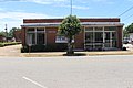
 City hall and police station | |
 Location in Calhoun County and the state of Georgia | |
 Arlington Location in Georgia | |
| Coordinates: 31°26′22″N 84°43′29″W / 31.43944°N 84.72472°WCoordinates: 31°26′22″N 84°43′29″W / 31.43944°N 84.72472°W | |
| Country | United States |
| State | Georgia |
| Counties | Calhoun, Early |
| Area | |
| • Total | 4.01 sq mi (10.38 km2) |
| • Land | 4.00 sq mi (10.35 km2) |
| • Water | 0.01 sq mi (0.03 km2) |
| Elevation | 299 ft (91 m) |
| Population (2010) | |
| • Total | 1,479 |
| • Estimate (2019)[2] | 1,326 |
| • Density | 331.75/sq mi (128.09/km2) |
| Time zone | UTC-5 (Eastern (EST)) |
| • Summer (DST) | UTC-4 (EDT) |
| ZIP codes | 31713, 39813 |
| Area code(s) | 229 |
| FIPS code | 13-02928[3] |
| GNIS feature ID | 0310614[4] |


Arlington is a city in Calhoun and Early counties, Georgia, United States. As of the 2010 census, the city had a population of 1,479.[5]
History[]
Arlington was founded in 1873, and was chartered in 1881.[6] Arlington served as county seat from 1923 to 1929.[7] The community was named after the Arlington House, the Virginia home of General Robert E. Lee.[7]
Geography[]
Arlington is located at 31°26′22″N 84°43′29″W / 31.43944°N 84.72472°W (31.439461, -84.724835).[8] It is located 46 miles northeast of Dothan, Alabama and 45 miles southwest of Albany.
According to the United States Census Bureau, the city has a total area of 4.1 square miles (10.7 km2), of which 0.012 square miles (0.03 km2), or 0.24%, is water.[9]
Demographics[]
| Historical population | |||
|---|---|---|---|
| Census | Pop. | %± | |
| 1880 | 250 | — | |
| 1890 | 417 | 66.8% | |
| 1900 | 755 | 81.1% | |
| 1910 | 1,308 | 73.2% | |
| 1920 | 1,331 | 1.8% | |
| 1930 | 1,232 | −7.4% | |
| 1940 | 1,337 | 8.5% | |
| 1950 | 1,382 | 3.4% | |
| 1960 | 1,462 | 5.8% | |
| 1970 | 1,698 | 16.1% | |
| 1980 | 1,572 | −7.4% | |
| 1990 | 1,513 | −3.8% | |
| 2000 | 1,602 | 5.9% | |
| 2010 | 1,479 | −7.7% | |
| 2019 (est.) | 1,326 | [2] | −10.3% |
| U.S. Decennial Census[10] | |||
As of the census[3] of 2000, there were 1,602 people, 573 households, and 394 families residing in the city. The population density was 400.9 people per square mile (154.6/km2). There were 695 housing units at an average density of 173.9 per square mile (67.1/km2). The racial makeup of the city was 29.03% White, 69.91% African American, 0.12% Native American, 0.19% Asian, 0.44% from other races, and 0.31% from two or more races. Hispanic or Latino of any race were 1.44% of the population.
There were 573 households, out of which 33.9% had children under the age of 18 living with them, 37.0% were married couples living together, 28.6% had a female householder with no husband present, and 31.2% were non-families. 28.1% of all households were made up of individuals, and 12.4% had someone living alone who was 65 years of age or older. The average household size was 2.80 and the average family size was 3.47.
In the city, the population was spread out, with 32.8% under the age of 18, 9.6% from 18 to 24, 27.7% from 25 to 44, 17.0% from 45 to 64, and 12.9% who were 65 years of age or older. The median age was 31 years. For every 100 females, there were 84.6 males. For every 100 females age 18 and over, there were 79.6 males.
The median income for a household in the city was $22,311, and the median income for a family was $25,188. Males had a median income of $22,096 versus $15,231 for females. The per capita income for the city was $11,985. About 30.1% of families and 34.4% of the population were below the poverty line, including 49.6% of those under age 18 and 28.9% of those age 65 or over.
Notable person[]
- James Earl Carter, Sr., farmer, businessman, legislator, father of President Jimmy Carter
Education[]
On Calhoun County's side of the Calhoun County School District unit, Calhoun County Elementary School (grades K-5) serves Calhoun County, including some students from Arlington, Edison, Leary, and Morgan. Calhoun County Middle/High is in Edison. On Early County's side, all schools belong to the Early County School District; elementary, middle, and high schools are in Blakely, including Early County High School.
Gallery[]
Arlington Post Office

References[]
- ^ "2019 U.S. Gazetteer Files". United States Census Bureau. Retrieved July 9, 2020.
- ^ Jump up to: a b "Population and Housing Unit Estimates". United States Census Bureau. May 24, 2020. Retrieved May 27, 2020.
- ^ Jump up to: a b "U.S. Census website". United States Census Bureau. Retrieved 2008-01-31.
- ^ "US Board on Geographic Names". United States Geological Survey. 2007-10-25. Retrieved 2008-01-31.
- ^ United States Census
- ^ Krakow, Kenneth K. (1975). Georgia Place-Names: Their History and Origins (PDF). Macon, GA: Winship Press. p. 7. ISBN 0-915430-00-2.
- ^ Jump up to: a b "Calhoun County". New Georgia Encyclopedia. Retrieved 1 April 2018.
- ^ "US Gazetteer files: 2010, 2000, and 1990". United States Census Bureau. 2011-02-12. Retrieved 2011-04-23.
- ^ "Geographic Identifiers: 2010 Demographic Profile Data (G001): Arlington city, Georgia". U.S. Census Bureau, American Factfinder. Archived from the original on February 12, 2020. Retrieved July 17, 2014.
- ^ "Census of Population and Housing". Census.gov. Retrieved June 4, 2015.
| show Municipalities and communities of Calhoun County, Georgia, United States |
|---|

| show Municipalities and communities of Early County, Georgia, United States |
|---|

| Authority control |
|
|---|
- Cities in Georgia (U.S. state)
- Cities in Calhoun County, Georgia
- Cities in Early County, Georgia
- Former county seats in Georgia (U.S. state)