Arnside and Silverdale
| Arnside and Silverdale | |
|---|---|
 | |
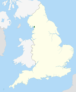 Location of the Arnside and Silverdale AONB in the UK | |
| Location | Cumbria, Lancashire, England |
| Area | 75 km2 (29 sq mi) |
| Established | 1972 |
Arnside and Silverdale is an Area of Outstanding Natural Beauty in England, on the border between Lancashire and Cumbria, adjoining Morecambe Bay. One of the smallest AONBs, it covers 29 square miles (75 km2) between the Kent Estuary, the River Keer and the A6 road. It was designated in 1972.
Description[]
The area is characterised by low hills of Carboniferous Limestone, including Arnside Knott (522 feet) and Warton Crag (535 feet), interspersed with grassland. Much of the area is covered by deciduous woodland, in which ash, oak, and hazel predominate. The coastal area contains large extents of salt marsh, although these are under threat from the shifting channel of the Kent Estuary. [1]
The Leighton Moss nature reserve, owned by the RSPB, is the largest area of reedbeds in North West England, and is an Important Bird Area.[1] The bittern, one of the resident species, has been adopted as the logo of the AONB. In addition, there are fifteen SSSIs in the area; one of these, Gait Barrows National Nature Reserve, is home to some rare species of butterfly including the high brown fritillary.
Arnside and Silverdale are the main villages in the area. Other settlements include Warton, Yealand Redmayne, Beetham and Storth.
Landscape Trust[]
The AONB is supported by the Landscape Trust, a registered charity with over 1000 members. Its activities include ownership and management of several nature reserves and the production of a journal Keer to Kent.[2]
References[]
- ^ BirdLife International (2015) Important Bird Areas factsheet: Leighton Moss. Downloaded from "Archived copy". Archived from the original on 10 July 2007. Retrieved 7 March 2014.CS1 maint: archived copy as title (link) on 08/01/2015
- ^ "The Landscape Trust". Arnside and Silverdale AONB. Retrieved 17 January 2019.
External links[]
- Official website
- "The Arnside/Silverdale AONB Landscape Trust, registered charity no. 702624". Charity Commission for England and Wales.
- Walks around Arnside & Silverdale
- Arnside Online

Coordinates: 54°10′35″N 2°47′29″W / 54.17639°N 2.79139°W

| show Authority control |
|---|
- Areas of Outstanding Natural Beauty in England
- Protected areas established in 1972
- Protected areas of Cumbria
- Protected areas of Lancashire
- Arnside