Beetham
| Beetham | |
|---|---|
 Early 20th century postcard of Beetham | |
 Beetham Location within Cumbria | |
| Population | 1,784 (2011)[1] |
| OS grid reference | SD4979 |
| Civil parish |
|
| District | |
| Shire county | |
| Region | |
| Country | England |
| Sovereign state | United Kingdom |
| Post town | CARNFORTH |
| Postcode district | LA7 |
| Dialling code | 01539 |
| Police | Cumbria |
| Fire | Cumbria |
| Ambulance | North West |
| UK Parliament | |

Beetham is a village and civil parish in Cumbria, England, situated on the border with Lancashire, 6 miles (10 km) north of Carnforth.[2] It is part of the Arnside and Silverdale Area of Outstanding Natural Beauty. In the 2001 census the parish had a population of 1,724,[3] increasing at the 2011 census to 1,784.[1]
History[]
Craven in the Domesday Book shows that up till 1066 Earl Tostig was lord of Beetham and the surrounding areas of Farleton, Preston Richard, Hincaster, Heversham and Levens in Cumbria plus Yealand Redmayne and Borwick in Lancashire. Beetham manor then amounted to 25 carucates (ca3000 acres/1250ha) of ploughland. The Norman conquest of England added it to the extensive lands of Roger de Poitou.
Demography[]
The parish had a population of 1,724 recorded in the 2001 census,[4] increasing to 1,784 at the 2011 Census.
Community[]
Points of interest include:
- The Church of St Michael and All Angels, parts of which date from the 12th century.
- The Heron Corn Mill, a working watermill and active arts and education center.
- The Heron Theatre, an 80-seat theatre housed in the listed 18th century grammar school .
- The Fairy Steps, a natural staircase in a limestone crag, in the woodland to the west of the village.
- A small shrine to Saint Lioba (or Leoba), built into a stone wall in the nearby hamlet of Slackhead.
Geography[]
The River Bela flows past the village and through the deer park of Dallam Tower, skirting Milnthorpe before it washes out into the Kent Estuary near Sandside.
Half a mile to the south-east, Beetham Hall is a 14th-century fortified manor house, now largely ruined, adjoining later buildings.[5]
To the north of the village is the Billerud paper factory employing 140 people and producing 45,000 tonnes/year, specialising in kraft paper for pharmaceutical and food packaging.[6]
Civil parish[]
The civil parish of Beetham includes the main villages of Beetham and Storth and the smaller communities of Carr Bank, Sandside, Hale, Slackhead, Farleton and Whasset.[7]
Gallery[]
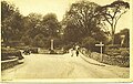
The main road into Beetham before the A6 road development

Footpath to Leighton Hall
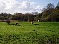
Highland cattle grazing


[]
| show Places adjacent to Beetham |
|---|
See also[]
References[]
- ^ Jump up to: a b UK Census (2011). "Local Area Report – Beetham Parish (E04002588)". Nomis. Office for National Statistics. Retrieved 26 April 2021.
- ^ AA Book of British Villages. Drive Publications Limited. 1980. p. 53. ISBN 9780340254875.
- ^ UK Census (2001). "Local Area Report – Beetham Parish (16UG005)". Nomis. Office for National Statistics. Retrieved 26 April 2021.
- ^ "Parish headcount" (PDF). Cumbria County Council. Retrieved 13 January 2009.
- ^ "Beetham Hall". britishlistedbuildings.co.uk. Retrieved 8 March 2011.
- ^ "Beetham, UK". Our production sites. BillerudKorsnäs. Retrieved 18 April 2013.
- ^ "Welcome". Beetham Parish Council. Retrieved 2 November 2014.
External links[]
| Wikimedia Commons has media related to Beetham. |
| show Authority control |
|---|
- Villages in Cumbria
- Civil parishes in Cumbria