Artibonite (department)
Artibonite
Latibonit | |
|---|---|
 Commune de Dessalines | |
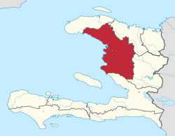 Artibonite in Haiti | |
| Country | |
| Capital | Gonaïves |
| Government | |
| • Type | Departmental Council |
| Area | |
| • department | 4,986.94 km2 (1,925.47 sq mi) |
| Population (2015)[1] | |
| • department | 1,727,524 |
| • Density | 350/km2 (900/sq mi) |
| • Urban | 739,787 |
| • Rural | 987,737 |
| Time zone | UTC-5 (Eastern) |
| ISO 3166 code | HT-AR |
| HDI (2017) | 0.469[2] low · 7th |
Artibonite (Haitian Creole: Latibonit) is one of the ten departments of Haiti. With an area of 4,887 km2 it is Haiti's largest department. As of 2015, its estimated population was 1,727,524.[3] The region is the country's main rice-growing area. The main cities are Gonaïves (the capital) and Saint-Marc. In February 2004 an insurgency tried unsuccessfully to declare Artibonite's independence.
The department has been in a state of an economic decline since insurgencies and coups have reduced the nation's stability. Since the election of President René Garcia Préval, the production of rice and other crops has been increasing.
Geography[]
A core geographic feature of this department is the Artibonite River, which runs through the southern half of the department, allowing for rice cultivation in the Artibonite Valley.
Etymology[]
The name L'Artibonite is derived from the Artibonite River.
Health[]
Population health in Haiti has suffered from political instability and natural disasters.[4] The Hôpital Albert Schweitzer Haiti is located in Deschapelles, Haiti. Established in 1956, it has grown to provide health care in the hospital and clinics to the Artibonite region with a budget of $6 million in 2015. In addition to founder Dr. Larry Mellon, notable figures in its history include Dr Harold May, Founder and President of FAMILY, Inc. (Fathers and Mothers, Infants, eLders, and Youth). [5] In the Verrettes commune, FAMILY seeks to promote sustainable development.[6] In addition, U. S. Tuskegee University has partnered with FAMILY to establish the FAMILY Tuskegee Institute of Haiti to develop academic and vocational training in the areas of forestry, agriculture and health care.
Historic Places and Landmarks[]
Several noteworthy events of the Haitian Revolution took place in the Artibonite Department.
- Gonaïves: the City of Independence
- Ravine-à-Couleuvre: site of the famous battle between Major General Toussaint Louverture and French troops commanded by Rochambeau.
- Petite Rivière de l'Artibonite: where Henry Christophe built his palace with 365 doors.
- Fort de La Crête-à-Pierrot: site of the Battle of Crête-à-Pierrot between Haitian rebels and French troops.
- Habitation Georges: site of Major-General Toussaint Louverture's arrest.
- Dessalines (formerly Marchand): Capital of the First Empire.
- Vieux Bac: near Grande-Saline where Toussaint Louverture defeated Colonel Brisbane in December 1794.
- Deschapelles, in the Artibonite Valley, is the location of the Hôpital Albert Schweitzer.
- Saint Marc, in the Artibonite Valley, is the Origin of soldiers who were sent to Savannah, Georgia USA in 1779 to fight for the Port of Savannah.
Demographics[]
The 2015 population of Artibonite was estimated at 1,727,524 (2015),[3] with 739,787 (43%) residing in urban areas and (57%) residing in rural areas.
| Year | Total Pop. | %± | Urban | Rural | Ratio |
|---|---|---|---|---|---|
| 2003[7] | 1,299,398 | ——— | 422,476 | 876,922 | 32:68 |
| 2009[8] | 1,571,020 | 20.9% | 607,757 | 963,263 | 39:61 |
| 2015[3] | 1,727,524 | 10.0% | 739,787 | 987,737 | 43:57 |
Administrative divisions[]
The Department of Artibonite is subdivided into five arrondissements, which are further subdivided into sixteen communes.

- Dessalines Arrondissement
- Desdunes
- Dessalines
- Grande Saline
- Petite Rivière de l'Artibonite
- Gonaïves Arrondissement
- Gros-Morne Arrondissement
- Anse-Rouge
- Gros-Morne
- Terre-Neuve
- Marmelade Arrondissement

References[]
- ^ "Estimated Pop Total 2015" (PDF). Archived from the original (PDF) on 2015-11-06. Retrieved 2017-06-20.
- ^ "Sub-national HDI - Area Database - Global Data Lab". hdi.globaldatalab.org. Retrieved 2018-09-13.
- ^ Jump up to: a b c "POPULATION TOTALE, POPULATION DE 18 ANS ET PLUS MÉNAGES ET DENSITÉS ESTIMÉS EN 2015" (PDF). IHSI. Archived from the original (PDF) on 2015-11-06. Retrieved 22 Mar 2017.
- ^ Daniels, Joe Parkin (August 2021). "Haiti's health woes intensify". The Lancet. 398 (10300): 567. doi:10.1016/S0140-6736(21)01851-1.
- ^ "Harold May, MD, MPH, Recognized for Commitment to Medicine, Public Health and Community Development". 24-7 Press Release Newswire. Retrieved 20 August 2021.
- ^ "FAMILY | Haiti". www.familysystem.net.
- ^ "Tableau 200: Répartition de la population par année d'âge selon le sexe et le milieu de résidence" (PDF). IHSI. Retrieved 22 Mar 2017.
- ^ "POPULATION TOTALE, POPULATION DE 18 ANS ET PLUS MENAGES ET DENSITES ESTIMES EN 2009" (PDF). IHSI. Archived from the original (PDF) on 2014-11-24. Retrieved 25 Mar 2017.
Coordinates: 19°27′00″N 72°41′00″W / 19.45°N 72.6833°W


| Authority control |
|
|---|
This article about a location in Haiti is a stub. You can help Wikipedia by . |
- Artibonite (department)
- Departments of Haiti
- Haiti geography stubs