Nord-Est (department)
Nord-Est
Nòdès | |
|---|---|
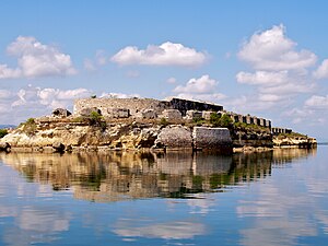
 Fort Saint Joseph | |
 Nord-Est in Haiti | |
| Country | |
| Capital | Fort-Liberté |
| Government | |
| • Type | Departmental Council |
| Area | |
| • Department | 1,622.93 km2 (626.62 sq mi) |
| Population (2015)[1] | |
| • Department | 393,967 |
| • Density | 240/km2 (630/sq mi) |
| • Urban | 190,926 |
| • Rural | 203,041 |
| Time zone | UTC-5 (Eastern) |
| ISO 3166 code | HT-NE |
| HDI (2017) | 0.472[2] low · 6th |
Nord-Est (Haitian Creole: Nòdès, English: North-East) is one of the ten departments of Haiti. It has an area of 1,623 km2 (627 sq mi), making it the smallest of all the departments. It had an estimated population of 393,967 as of 2015.[3] Its capital is Fort-Liberté. It was a part of the Nord department.
It is bordered to the north by the Atlantic Ocean, to the south by the Centre department, to the east by the Dominican Republic, and to the west by Nord. The Nord-Est forms part of the northern plains, a historic site of colonial plantations and a key area for the cultivation of chestnuts, the Armée Indigène of Toussaint Louverture, and anti-American rebels against the occupation of the 1930s.
Administrative divisions[]
The Department of Nord-Est is subdivided into four arrondissements, which are further subdivided into thirteen communes.
- Fort-Liberté Arrondissement
- Ouanaminthe Arrondissement
- Trou-du-Nord Arrondissement
- Vallières Arrondissement
References[]
- ^ http://www.ihsi.ht/pdf/projection/Estimat_PopTotal_18ans_Menag2015.pdf
- ^ "Sub-national HDI - Area Database - Global Data Lab". hdi.globaldatalab.org. Retrieved 2018-09-13.
- ^ http://www.geohive.com/cntry/haiti.aspx
Coordinates: 19°40′04″N 71°50′23″W / 19.6678°N 71.8397°W
- Nord-Est (department)
- Departments of Haiti
- Haiti geography stubs

