Ash Grove Township, Iroquois County, Illinois
Ash Grove Township | |
|---|---|
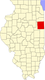
 Location in Iroquois County | |
 Iroquois County's location in Illinois | |
| Coordinates: 40°37′06″N 87°50′37″W / 40.61833°N 87.84361°WCoordinates: 40°37′06″N 87°50′37″W / 40.61833°N 87.84361°W | |
| Country | United States |
| State | Illinois |
| County | Iroquois |
| Established | November 6, 1855 |
| Area | |
| • Total | 61.09 sq mi (158.2 km2) |
| • Land | 61.03 sq mi (158.1 km2) |
| • Water | 0.06 sq mi (0.2 km2) 0.10% |
| Elevation | 669 ft (204 m) |
| Population (2010) | |
| • Estimate (2016)[1] | 700 |
| • Density | 12/sq mi (5/km2) |
| Time zone | UTC-6 (CST) |
| • Summer (DST) | UTC-5 (CDT) |
| ZIP codes | 60924, 60926, 60953, 60955 |
| FIPS code | 17-075-02453 |

Ash Grove Township is one of twenty-six townships in Iroquois County, Illinois, USA. As of the 2010 census, its population was 731 and it contained 316 housing units.[2]
History[]
The first settler in the area that became Ash Grove Township was Robert Roberts, who arrived in 1833.[3] The township was formed when township government was adopted by the county in 1855.[4] Its current borders were established on September 15, 1868, when Fountain Creek Township was formed from a portion of Ash Grove Township.[5]
Geography[]
According to the 2010 census, the township has a total area of 61.09 square miles (158.2 km2), of which 61.03 square miles (158.1 km2) (or 99.90%) is land and 0.06 square miles (0.16 km2) (or 0.10%) is water.[2]
Unincorporated towns[]
- at 40°36′11″N 87°51′59″W / 40.603091°N 87.866423°W
- at 40°39′38″N 87°47′17″W / 40.660592°N 87.788088°W
- at 40°39′35″N 87°50′45″W / 40.659758°N 87.845867°W
(This list is based on USGS data and may include former settlements.)
Cemeteries[]
The township contains these six cemeteries: Ash Grove, Cissna Park, Immanuel Lutheran, Saint John's Ash Grove, Saint Paul Lutheran and Schwer.
Major highways[]
Airports and landing strips[]
- Redeker Airport
Demographics[]
| Historical population | |||
|---|---|---|---|
| Census | Pop. | %± | |
| 2016 (est.) | 700 | [1] | |
| U.S. Decennial Census[6] | |||
School districts[]
- Cissna Park Community Unit School District 6
- Crescent Iroquois Community Unit School District 249
- Iroquois West Community Unit School District 10
- Paxton-Buckley-Loda Community Unit School District 10
Political districts[]
- Illinois' 15th congressional district
- State House District 105
- State Senate District 53
References[]
- "Ash Grove Township, Iroquois County, Illinois". Geographic Names Information System. United States Geological Survey. Retrieved 2010-01-17.
- United States Census Bureau 2007 TIGER/Line Shapefiles
- United States National Atlas
- ^ a b "Population and Housing Unit Estimates". Retrieved June 9, 2017.
- ^ a b "Population, Housing Units, Area, and Density: 2010 - County -- County Subdivision and Place -- 2010 Census Summary File 1". United States Census. Archived from the original on 2020-02-12. Retrieved 2013-05-28.
- ^ Dowling 1968, p. 25.
- ^ Dowling 1968, p. 21.
- ^ Dowling 1968, p. 59.
- ^ "Census of Population and Housing". Census.gov. Retrieved June 4, 2016.
Bibliography[]
- Dowling, John (1968). History of Iroquois County. Iroquois County Board of Supervisors. Retrieved 2010-10-15.
- Kern, J. W. (1907). Past and present of Iroquois County, Illinois. Chicago: The S. J. Clarke Publishing Company. Retrieved 2010-10-15.
- Beckwith, H. W. (1880). History of Iroquois County, Together with Historic Notes on the Northwest. Chicago: H. H. Hill and Company. Retrieved 2010-10-15.
External links[]
Places adjacent to Ash Grove Township, Iroquois County, Illinois | |
|---|---|
Municipalities and communities of Iroquois County, Illinois, United States | ||
|---|---|---|
| Cities | ||
| Villages | ||
| Townships | ||
| Unincorporated communities | ||
| Footnotes | ‡This populated place also has portions in an adjacent county or counties | |
| ||
- Townships in Iroquois County, Illinois
- Townships in Illinois