Chebanse, Illinois
Chebanse, Illinois | |
|---|---|
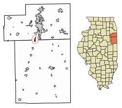 Location of Chebanse in Iroquois County, Illinois | |
 Location of Illinois in the United States | |
| Coordinates: 41°0′6″N 87°54′39″W / 41.00167°N 87.91083°WCoordinates: 41°0′6″N 87°54′39″W / 41.00167°N 87.91083°W | |
| Country | United States |
| State | Illinois |
| Counties | Iroquois, Kankakee |
| Townships | Chebanse, Otto |
| Area | |
| • Total | 1.19 sq mi (3.08 km2) |
| • Land | 1.19 sq mi (3.08 km2) |
| • Water | 0.00 sq mi (0.00 km2) |
| Elevation | 664 ft (202 m) |
| Population (2010) | |
| • Total | 1,062 |
| • Estimate (2019)[2] | 971 |
| • Density | 815.97/sq mi (315.17/km2) |
| Time zone | UTC-6 (CST) |
| • Summer (DST) | UTC-5 (CDT) |
| ZIP Code(s) | 60922 |
| Area code(s) | 815 |
| FIPS code | 17-12801 |
| Wikimedia Commons | Chebanse, Illinois |
| Website | www |
Chebanse is a village in Iroquois and Kankakee counties in the U.S. state of Illinois. The population was 1,062 at the 2010 census.[3] The Kankakee County portion of Chebanse is included in the Kankakee-Bradley, Illinois Metropolitan Statistical Area.
Geography[]
Chebanse is located at 41°00′06″N 87°54′39″W / 41.001582°N 87.910939°W,[4] on the border between Iroquois and Kankakee counties. Interstate 57 passes the eastern edge of the village, with access from Exit 302. I-57 leads north 9 miles (14 km) to Kankakee and south 65 miles (105 km) to Champaign. Chicago is 68 miles (109 km) north of Chebanse.
According to the 2010 census, the village has a total area of 1.19 square miles (3.1 km2), all land.[5]
Chebanse is partly located in Iroquois County, but a portion extends northward into Kankakee County, thus into the Chicago metropolitan area.
History[]
Chebanse was established in 1854 as the first stop on the Illinois Central Railroad south of Kankakee.
"Chebanse" derives from zhishibéns, meaning "the little duck" in the Potawatomi language.[6][7]
Demographics[]
| Historical population | |||
|---|---|---|---|
| Census | Pop. | %± | |
| 1880 | 723 | — | |
| 1890 | 616 | −14.8% | |
| 1900 | 555 | −9.9% | |
| 1910 | 590 | 6.3% | |
| 1920 | 541 | −8.3% | |
| 1930 | 523 | −3.3% | |
| 1940 | 603 | 15.3% | |
| 1950 | 739 | 22.6% | |
| 1960 | 995 | 34.6% | |
| 1970 | 1,185 | 19.1% | |
| 1980 | 1,191 | 0.5% | |
| 1990 | 1,082 | −9.2% | |
| 2000 | 1,148 | 6.1% | |
| 2010 | 1,062 | −7.5% | |
| 2019 (est.) | 971 | [2] | −8.6% |
| U.S. Decennial Census[8] | |||
As of the census[9] of 2000, there were 1,148 people, 440 households, and 326 families residing in the village. The population density was 2,625.4 people per square mile (1,007.4/km2). There were 450 housing units at an average density of 1,029.1 per square mile (394.9/km2). The racial makeup of the village was 98.61% White, 0.26% African American, 0.26% Native American, 0.09% Asian, 0.44% from other races, and 0.35% from two or more races. Hispanic or Latino of any race were 1.13% of the population.
There were 440 households, out of which 35.7% had children under the age of 18 living with them, 61.8% were married couples living together, 9.8% had a female householder with no husband present, and 25.9% were non-families. 22.7% of all households were made up of individuals, and 12.5% had someone living alone who was 65 years of age or older. The average household size was 2.59 and the average family size was 3.07.
In the village, the population was spread out, with 26.0% under the age of 18, 8.0% from 18 to 24, 29.1% from 25 to 44, 22.7% from 45 to 64, and 14.1% who were 65 years of age or older. The median age was 38 years. For every 100 females there were 90.4 males. For every 100 females age 18 and over, there were 89.9 males.
The median income for a household in the village was $50,066, and the median income for a family was $53,333. Males had a median income of $41,008 versus $21,607 for females. The per capita income for the village was $19,290. About 2.1% of families and 3.2% of the population were below the poverty line, including 3.7% of those under age 18 and 2.6% of those age 65 or over.
Notable people[]
- Harold Gray, creator of the Little Orphan Annie comic strip, grew up on a farm near Chebanse
References[]
- ^ "2019 U.S. Gazetteer Files". United States Census Bureau. Retrieved July 14, 2020.
- ^ a b "Population and Housing Unit Estimates". United States Census Bureau. May 24, 2020. Retrieved May 27, 2020.
- ^ "Geographic Identifiers: 2010 Census Summary File 1 (G001): Chebanse village, Illinois". American Factfinder. U.S. Census Bureau. Archived from the original on February 13, 2020. Retrieved March 28, 2018.
- ^ "US Gazetteer files: 2010, 2000, and 1990". United States Census Bureau. 2011-02-12. Retrieved 2011-04-23.
- ^ "Places: Illinois". 2010 Census Gazetteer Files. United States Census Bureau. Archived from the original on 2013-10-21. Retrieved 2012-10-13.
- ^ "The People of the Prairie", Charles Warwick, The Illinois Steward, vo. 16, no. 2, 2007
- ^ Illinois Central Magazine. Illinois Central Railroad Company. 1922. p. 45.
- ^ "Census of Population and Housing". Census.gov. Retrieved June 4, 2015.
- ^ "U.S. Census website". United States Census Bureau. Retrieved 2008-01-31.
External links[]
Municipalities and communities of Iroquois County, Illinois, United States | ||
|---|---|---|
| Cities | ||
| Villages | ||
| Townships | ||
| Unincorporated communities | ||
| Footnotes | ‡This populated place also has portions in an adjacent county or counties | |
| ||
Municipalities and communities of Kankakee County, Illinois, United States | ||
|---|---|---|
| Cities | ||
| Villages | ||
| Townships | ||
| Unincorporated communities | ||
| Footnotes | ‡This populated place also has portions in an adjacent county or counties. | |
| ||
| Major city |
|  |
|---|---|---|
| Cities (over 30,000 in 2010) |
| |
| Towns and villages (over 30,000 in 2010) |
| |
| Counties | ||
| Regions |
| |
| Sub-regions | ||
Illinois, United States | ||
- Villages in Iroquois County, Illinois
- Villages in Kankakee County, Illinois
- Populated places established in 1854
- 1854 establishments in Illinois