Ashland, Natchitoches Parish, Louisiana
Ashland, Louisiana | |
|---|---|
| Village of Ashland | |
 Ashland Village Hall is located next to the United States Post Office building | |
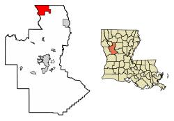 Location of Ashland in Natchitoches Parish, Louisiana. | |
| Coordinates: 32°06′59″N 93°06′53″W / 32.11639°N 93.11472°W | |
| Country | United States |
| State | Louisiana |
| Parish | Natchitoches |
| Incorporated | 1963 |
| Government | |
| • Mayor | Donna Holland Horn (No Party) Aldermen: |
| Area | |
| • Total | 27.15 sq mi (70.31 km2) |
| • Land | 26.99 sq mi (69.90 km2) |
| • Water | 0.16 sq mi (0.42 km2) |
| Elevation | 226 ft (69 m) |
| Population (2020) | |
| • Total | 194 |
| • Rank | NC: 7th |
| • Density | 7.19/sq mi (2.78/km2) |
| Time zone | UTC−6 (CST) |
| • Summer (DST) | UTC−5 (CDT) |
| Area code | 318 |
| FIPS code | 22-03145 |
| GNIS feature ID | 2407410 |

Ashland is a village in the northernmost portion of Natchitoches Parish, Louisiana, United States. A few residences and a convenience store to the north spill over into neighboring Bienville Parish. The population was 291 at the 2000 census but declined 9 percent to 269 in 2010. The median age was 45.7 years.[2] Ashland is part of the Natchitoches Micropolitan Statistical Area but is located nearly forty miles to the north of the parish seat of Natchitoches.
The Ashland mayor is Donna Holland Horn. The village council consists of two No Party members, Juanita Calhoun and Dorie Harp, and a Republican, Terry Chesser. The police chief is Fred Holland, a Democrat.[3] All of the Ashland town officials were unopposed for new terms in the primary election held on October 2, 2010.
On September 2, 2011, a forest fire destroyed ten houses between Ashland and Creston, but residents escaped personal injury. According to Louisiana Commissioner of Agriculture and Forestry , the blaze scorched several thousand acres and was propelled by past drought conditions combined with high winds coming from the aftermath of Tropical Storm Lee in the Gulf of Mexico.[4]
History[]
The regional railroad, the Louisiana and Arkansas Railway (1898–1992), owned by William Buchanan, William C. Edenborn, and later Harvey C. Couch,[5] came through Ashland in 1899. A turntable was constructed on land that was subdivided by Andrew R. Johnson, an Alabama native. Johnson named the community in 1901 after his former city of residence, Ashland in northern Wisconsin.[6] There was a railroad passenger and freight station, equipped with a platform for lifting cotton into the cars. Railroad cross ties were also manufactured in Ashland.[7]
Cotton and corn were the principal crops in Ashland at the turn of the 20th century. The pioneers of Ashland are described in a history penned by former circuit judge H. Welborn Ayres as "fiercely independent", having refused an offer of government grain assistance during the 1896-1898 drought. Joe A. Pullig (1849–1926) operated a general store, later in partnership with William McCain. Pullig's business was near the newly opened United States Post Office, which was managed by the postmaster D. F. "Dave" Williams. Mail at the time reached Ashland by the bayou at Lake Village five miles (8 km) to the west. The Carlile Hotel, long since demolished, was owned by Tom and Duck Carlile and located east of the railroad track.[7]
Given the decline in population and changing business practices, no businesses except the convenience store in Bienville Parish operate in the 21st century in Ashland. In the 1950s, there were half a dozen. The Ashland Baptist Church, Village Hall, Masonic lodge hall, and Post Office remain the principal entities. The lack of business in 1979 compelled Welborn Ayres to equate Ashland with "The Deserted Village" of the Oliver Goldsmith poem.[7]
In 2001, Ashland celebrated its centennial with a spring festival, still held during the last weekend of March.[6]
Ashland High School[]
Originally a one-room structure, Ashland High School operated from 1907 until its closing in 1981. Judge Welborn Ayres refers to it as "one of the foremost rural high schools in the state,"[7] having offered instruction even in the less-studied subjects of physics and medieval history. A. R. Johnson, who had once taught school in Arkansas, donated the land for the original public school. Later a banker and the mayor of Homer[7] in Claiborne Parish, Johnson also served in the Louisiana State Senate from 1916–1924, having represented Bienville and Claiborne parishes.[8]
A former Natchitoches Parish branch library, operated from the home of Eleanor Walker Bamburg (1915–2010), a librarian for forty years,[9] was located across from the high school and the former store of Alvah Hume Dupree (1901–1974). After it closed, a bookmobile began coming weekly to the village hall for the benefit of library patrons. Nearby also was a once popular horseback riding club arena.
Geography[]
According to the United States Census Bureau, the village has a total area of 27.1 square miles (70 km2), of which 27.1 square miles (70 km2) is land and 0.04 square miles (0.10 km2) (0.07%) is water.
Climate[]
Climate is characterized by relatively high temperatures and evenly distributed precipitation throughout the year. According to the Köppen Climate Classification system, Ashland has a humid subtropical climate, abbreviated "Cfa" on climate maps.[10]
| Climate data for Ashland, Louisiana | |||||||||||||
|---|---|---|---|---|---|---|---|---|---|---|---|---|---|
| Month | Jan | Feb | Mar | Apr | May | Jun | Jul | Aug | Sep | Oct | Nov | Dec | Year |
| Average high °C (°F) | 13 (56) |
16 (61) |
20 (68) |
24 (76) |
28 (83) |
32 (89) |
34 (93) |
34 (93) |
31 (87) |
26 (78) |
20 (68) |
15 (59) |
24 (76) |
| Average low °C (°F) | 1 (33) |
2 (36) |
6 (43) |
11 (52) |
16 (60) |
19 (67) |
21 (70) |
21 (69) |
17 (63) |
11 (51) |
6 (42) |
2 (35) |
11 (52) |
| Average precipitation mm (inches) | 120 (4.9) |
120 (4.8) |
120 (4.8) |
120 (4.6) |
130 (5.0) |
110 (4.2) |
110 (4.2) |
79 (3.1) |
91 (3.6) |
89 (3.5) |
110 (4.4) |
130 (5.2) |
1,330 (52.2) |
| Source: Weatherbase [11] | |||||||||||||
Demographics[]
| Historical population | |||
|---|---|---|---|
| Census | Pop. | %± | |
| 1970 | 211 | — | |
| 1980 | 289 | 37.0% | |
| 1990 | 289 | 0.0% | |
| 2000 | 291 | 0.7% | |
| 2010 | 269 | −7.6% | |
| 2020 | 194 | −27.9% | |
| U.S. Decennial Census[12] | |||
2020 census[]
| Race | Number | Percentage |
|---|---|---|
| White (non-Hispanic) | 161 | 82.99% |
| Black or African American (non-Hispanic) | 22 | 11.34% |
| Native American | 2 | 1.03% |
| Other/Mixed | 3 | 1.55% |
| Hispanic or Latino | 6 | 3.09% |
As of the 2020 United States census, there were 194 people, 77 households, and 57 families residing in the village.
2000 census[]
As of the census[14] of 2000, there were 291 people, 121 households, and 87 families residing in the village. The population density was 10.7 inhabitants per square mile (4.1/km2). There were 149 housing units at an average density of 5.5 per square mile (2.1/km2). The racial makeup of the village was 86.60% White, 10.31% African American, 2.41% Native American and 0.69% Asian. Hispanic or Latino of any race were 1.72% of the population.
There were 121 households, out of which 27.3% had children under the age of 18 living with them, 57.0% were married couples living together, 14.9% had a female householder with no husband present, and 27.3% were non-families. 25.6% of all households were made up of individuals, and 15.7% had someone living alone who was 65 years of age or older. The average household size was 2.40 and the average family size was 2.88.
In the village, the population was spread out, with 21.3% under the age of 18, 8.2% from 18 to 24, 26.5% from 25 to 44, 24.7% from 45 to 64, and 19.2% who were 65 years of age or older. The median age was 40 years. For every 100 females, there were 98.0 males. For every 100 females age 18 and over, there were 86.2 males.
The median income for a household in the village was $23,438, and the median income for a family was $31,875. Males had a median income of $27,083 versus $23,750 for females. The per capita income for the village was $12,652. About 33.7% of families and 32.0% of the population were below the poverty line, including 38.1% of those under the age of eighteen and 30.4% of those 65 or over.
Infrastructure[]
The boundaries of the community now extend well beyond the former village proper. Louisiana State Highways 153 and 155 intersect as they pass through Ashland. Highway 153 extends northward to Castor and southward to Campti, and Highway 155 proceeds westward toward Martin and Coushatta, the seat of neighboring Red River Parish.
Cemeteries[]
The village has two cemeteries, the larger Ramah Cemetery, and smaller Hathorn Cemetery.
References[]
- ^ "2020 U.S. Gazetteer Files". United States Census Bureau. Retrieved March 20, 2022.
- ^ "Ashland, LA". zip-codes.com. Retrieved July 5, 2012.
- ^ "Louisiana election returns, September 30, 2006". sos.louisiana.gov. Archived from the original on 4 November 2010. Retrieved October 5, 2010.
- ^ "Natchitoches wildfire leaves residents wondering what comes next, September 3, 2011". . Retrieved September 4, 2011.[permanent dead link]
- ^ James R. Fair, The Louisiana and Arkansas Railway: The Story of a Regional Line. Northern Illinois University Press, 1997, 158 pp. 1997. ISBN 0-87580-219-2.
- ^ a b "Ashland". explorenatchitoches.com. Retrieved May 15, 2010.
- ^ a b c d e H. Welborn Ayres, "History of Ashland, Louisiana", 13-page manuscript, Report to the Ramah Cemetery Board, 1979
- ^ "Membership of the Louisiana State Senate, 1880-2012" (PDF). legis.state.la.us. Archived from the original (PDF) on February 24, 2012. Retrieved May 25, 2010.
- ^ "Eleanor Sylvia Walker Bamburg obituary". meaningfulfunerals.net. Retrieved January 17, 2011.
- ^ Climate Summary for closest city on record
- ^ "Weatherbase.com". Weatherbase. 2013. Retrieved on May 30, 2013.
- ^ "Census of Population and Housing". Census.gov. Retrieved June 4, 2016.
- ^ "Explore Census Data". data.census.gov. Retrieved 2021-12-29.
- ^ "U.S. Census website". United States Census Bureau. Retrieved 2008-01-31.
Municipalities and communities of Natchitoches Parish, Louisiana, United States | ||
|---|---|---|
Parish seat: Natchitoches | ||
| City |  | |
| Town | ||
| Villages | ||
| CDPs | ||
| Other communities | ||
| Footnotes | ‡This populated place also has portions in an adjacent county or counties | |
| ||
- Villages in Natchitoches Parish, Louisiana
- Villages in Bienville Parish, Louisiana
- Villages in Louisiana
- 1963 establishments in Louisiana
- Populated places in Ark-La-Tex