Auburn, Illinois
Auburn | |
|---|---|
City | |
| Nickname(s): The Redbud City | |
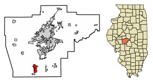 Location of Auburn in Sangamon County, Illinois. | |
 Location of Illinois in the United States | |
 Auburn Location in Illinois | |
| Coordinates: 39°35′20″N 89°44′45″W / 39.58889°N 89.74583°WCoordinates: 39°35′20″N 89°44′45″W / 39.58889°N 89.74583°W | |
| Country | United States |
| State | Illinois |
| County | Sangamon |
| Government | |
| • Mayor | Tom Berola |
| Area | |
| • Total | 4.16 sq mi (10.77 km2) |
| • Land | 4.16 sq mi (10.77 km2) |
| • Water | 0.00 sq mi (0.00 km2) |
| Elevation | 628 ft (191 m) |
| Population (2010) | |
| • Total | 4,771 |
| • Estimate (2019)[2] | 4,623 |
| • Density | 1,111.30/sq mi (429.07/km2) |
| Time zone | UTC-6 (CST) |
| • Summer (DST) | UTC-5 (CDT) |
| ZIP Code(s) | 62615 |
| Area code(s) | 217 |
| FIPS code | 17-02921 |
| Wikimedia Commons | Auburn, Illinois |
| Website | http://www.auburnillinois.us/ |


Auburn is a city in Sangamon County, Illinois, United States. The population was 4,771 at the 2010 census, and 4,681 in 2018. It is part of the Springfield, Illinois Metropolitan Statistical Area.
Geography[]
Auburn is located at 39°35′20″N 89°44′45″W / 39.58889°N 89.74583°W (39.588969, -89.745962).[3]
According to the 2010 census, Auburn has a total area of 4.08 square miles (10.57 km2), all land.[4]
Demographics[]
| Historical population | |||
|---|---|---|---|
| Census | Pop. | %± | |
| 1880 | 288 | — | |
| 1890 | 874 | 203.5% | |
| 1900 | 1,281 | 46.6% | |
| 1910 | 1,814 | 41.6% | |
| 1920 | 2,660 | 46.6% | |
| 1930 | 2,242 | −15.7% | |
| 1940 | 1,952 | −12.9% | |
| 1950 | 1,963 | 0.6% | |
| 1960 | 2,209 | 12.5% | |
| 1970 | 2,594 | 17.4% | |
| 1980 | 3,616 | 39.4% | |
| 1990 | 3,724 | 3.0% | |
| 2000 | 4,317 | 15.9% | |
| 2010 | 4,771 | 10.5% | |
| 2019 (est.) | 4,623 | [2] | −3.1% |
| U.S. Decennial Census[5] | |||
At the 2000 census there were 4,317 people in 1,618 households, including 1,187 families, in the city. The population density was 1,368.0 people per square mile (527.5/km2). There were 1,753 housing units at an average density of 555.5 per square mile (214.2/km2). The racial makeup of the city was 98.36% White, 0.30% African American, 0.16% Native American, 0.28% Asian, 0.30% from other races, and 0.60% from two or more races. Hispanic or Latino of any race were 0.76%.[6]
Of the 1,618 households 42.0% had children under the age of 18 living with them, 56.6% were married couples living together, 13.2% had a female householder with no husband present, and 26.6% were non-families. 22.9% of households were one person and 9.7% were one person aged 65 or older. The average household size was 2.63 and the average family size was 3.09.
The age distribution was 30.4% under the age of 18, 7.5% from 18 to 24, 33.1% from 25 to 44, 17.5% from 45 to 64, and 11.5% 65 or older. The median age was 33 years. For every 100 females, there were 88.2 males. For every 100 females age 18 and over, there were 82.4 males.
The median household income was $43,250 and the median family income was $49,200. Males had a median income of $34,339 versus $24,167 for females. The per capita income for the city was $18,368. About 4.8% of families and 5.5% of the population were below the poverty line, including 8.0% of those under age 18 and 4.5% of those age 65 or over.
Notable people[]
- Dutch Leonard, MLB pitcher for 20 years, was born in Auburn.
References[]
- ^ "2019 U.S. Gazetteer Files". United States Census Bureau. Retrieved July 14, 2020.
- ^ Jump up to: a b "Population and Housing Unit Estimates". United States Census Bureau. May 24, 2020. Retrieved May 27, 2020.
- ^ "US Gazetteer files: 2010, 2000, and 1990". United States Census Bureau. 2011-02-12. Retrieved 2011-04-23.
- ^ "G001 - Geographic Identifiers - 2010 Census Summary File 1". United States Census Bureau. Archived from the original on 2020-02-13. Retrieved 2015-12-25.
- ^ "Census of Population and Housing". Census.gov. Retrieved June 4, 2015.
- ^ "U.S. Census website". United States Census Bureau. Retrieved 2008-01-31.
| show Municipalities and communities of Sangamon County, Illinois, United States |
|---|
| show Authority control |
|---|
- Cities in Illinois
- Cities in Sangamon County, Illinois
- Cities in Springfield metropolitan area, Illinois