Auburn, Nebraska
Auburn, Nebraska | |
|---|---|
 Central Avenue: U.S. Highway 136 | |
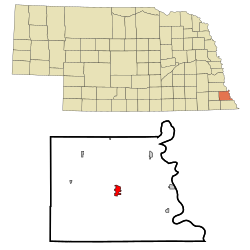 Location of Auburn, Nebraska | |
| Coordinates: 40°23′18″N 95°50′32″W / 40.38833°N 95.84222°WCoordinates: 40°23′18″N 95°50′32″W / 40.38833°N 95.84222°W | |
| Country | United States |
| State | Nebraska |
| County | Nemaha |
| Area | |
| • Total | 2.18 sq mi (5.65 km2) |
| • Land | 2.18 sq mi (5.65 km2) |
| • Water | 0.00 sq mi (0.00 km2) |
| Elevation | 984 ft (300 m) |
| Population | |
| • Total | 3,460 |
| • Estimate (2019)[3] | 3,324 |
| • Density | 1,524.07/sq mi (588.46/km2) |
| Time zone | UTC−6 (Central (CST)) |
| • Summer (DST) | UTC−5 (CDT) |
| ZIP code | 68305 |
| Area code(s) | 402 |
| FIPS code | 31-02655 |
| GNIS feature ID | 0827116[4] |
| Website | auburn.ne.gov |

Auburn is a city in Nemaha County, Nebraska, United States, and its county seat.[5] The population was 3,460 at the 2010 census.
History[]
Auburn is an incorporation of two towns. Calvert and Sheridan combined to form Auburn in 1882,[6] in part to have the voting power to wrestle the county seat away from Brownville, Nebraska, a village located nine miles east. The incorporation was successful, and in 1883, Auburn was named the county seat.[7] The city is named after Auburn, New York.[8]
The only person to be elected to the United States Congress as a member of the Prohibitionist Party, Charles Hiram Randall, was born in Auburn on July 23, 1865.
From 1910 to 1913, Auburn was home to the Auburn Athletics, a Class D level minor league baseball team. The Auburn Athletics played as members of the Missouri-Iowa-Nebraska-Kansas League for the duration of the league. The Auburn Athletics played home games at the Legion Memorial Park. Still in use today, Legion Memorial Park is designated as a National Historic Park site. The address is 1015 J Street.[9][10][11][12][13]
Geography and climate[]
Auburn is located at 40°23′18″N 95°50′32″W / 40.38833°N 95.84222°W (40.388278, -95.842246).[14] According to the United States Census Bureau, the city has a total area of 2.18 square miles (5.65 km2), all land.[15]
| hideClimate data for Auburn, Nebraska (1981–2010), extremes 1899-present | |||||||||||||
|---|---|---|---|---|---|---|---|---|---|---|---|---|---|
| Month | Jan | Feb | Mar | Apr | May | Jun | Jul | Aug | Sep | Oct | Nov | Dec | Year |
| Record high °F (°C) | 70 (21) |
83 (28) |
96 (36) |
100 (38) |
105 (41) |
109 (43) |
112 (44) |
113 (45) |
108 (42) |
98 (37) |
84 (29) |
78 (26) |
113 (45) |
| Mean maximum °F (°C) | 58 (14) |
64 (18) |
78 (26) |
88 (31) |
91 (33) |
95 (35) |
100 (38) |
99 (37) |
95 (35) |
87 (31) |
73 (23) |
60 (16) |
101 (38) |
| Average high °F (°C) | 35.5 (1.9) |
40.6 (4.8) |
53.3 (11.8) |
65.8 (18.8) |
75.6 (24.2) |
84.4 (29.1) |
88.3 (31.3) |
86.9 (30.5) |
79.9 (26.6) |
67.2 (19.6) |
51.4 (10.8) |
37.7 (3.2) |
63.9 (17.7) |
| Average low °F (°C) | 15.3 (−9.3) |
19.8 (−6.8) |
30.3 (−0.9) |
41.3 (5.2) |
52.6 (11.4) |
62.3 (16.8) |
66.6 (19.2) |
64.2 (17.9) |
54.5 (12.5) |
42.6 (5.9) |
30.0 (−1.1) |
18.2 (−7.7) |
41.5 (5.3) |
| Mean minimum °F (°C) | −7 (−22) |
−3 (−19) |
9 (−13) |
23 (−5) |
36 (2) |
48 (9) |
53 (12) |
50 (10) |
35 (2) |
23 (−5) |
12 (−11) |
−4 (−20) |
−14 (−26) |
| Record low °F (°C) | −27 (−33) |
−35 (−37) |
−21 (−29) |
7 (−14) |
22 (−6) |
39 (4) |
43 (6) |
38 (3) |
21 (−6) |
−4 (−20) |
−5 (−21) |
−27 (−33) |
−35 (−37) |
| Average precipitation inches (mm) | 0.74 (19) |
1.09 (28) |
2.77 (70) |
2.85 (72) |
4.52 (115) |
4.24 (108) |
4.08 (104) |
3.61 (92) |
3.07 (78) |
2.27 (58) |
1.82 (46) |
1.11 (28) |
31.67 (804) |
| Average snowfall inches (cm) | 7.1 (18) |
7.5 (19) |
4.9 (12) |
1.4 (3.6) |
0.0 (0.0) |
0.0 (0.0) |
0.0 (0.0) |
0.0 (0.0) |
0.0 (0.0) |
0.6 (1.5) |
2.3 (5.8) |
7.3 (19) |
31.1 (79) |
| Source: NOAA[16] | |||||||||||||
Demographics[]
| Historical population | |||
|---|---|---|---|
| Census | Pop. | %± | |
| 1890 | 1,537 | — | |
| 1900 | 2,664 | 73.3% | |
| 1910 | 2,729 | 2.4% | |
| 1920 | 2,863 | 4.9% | |
| 1930 | 3,068 | 7.2% | |
| 1940 | 3,639 | 18.6% | |
| 1950 | 3,422 | −6.0% | |
| 1960 | 3,229 | −5.6% | |
| 1970 | 3,650 | 13.0% | |
| 1980 | 3,482 | −4.6% | |
| 1990 | 3,443 | −1.1% | |
| 2000 | 3,350 | −2.7% | |
| 2010 | 3,460 | 3.3% | |
| 2019 (est.) | 3,324 | [3] | −3.9% |
| U.S. Decennial Census[17] 2012 Estimate[18] | |||
2010 census[]
As of the census[2] of 2010, there were 3,460 people, 1,487 households, and 910 families residing in the city. The population density was 1,587.2 inhabitants per square mile (612.8/km2). There were 1,721 housing units at an average density of 789.4 per square mile (304.8/km2). The racial makeup of the city was 97.3% White, 0.5% African American, 0.2% Native American, 0.7% Asian, 0.3% from other races, and 1.0% from two or more races. Hispanic or Latino of any race were 1.9% of the population.
There were 1,487 households, of which 28.7% had children under the age of 18 living with them, 48.6% were married couples living together, 9.5% had a female householder with no husband present, 3.1% had a male householder with no wife present, and 38.8% were non-families. 33.9% of all households were made up of individuals, and 16.9% had someone living alone who was 65 years of age or older. The average household size was 2.26 and the average family size was 2.87.
The median age in the city was 42.1 years. 24.1% of residents were under the age of 18; 7.2% were between the ages of 18 and 24; 22.4% were from 25 to 44; 26.7% were from 45 to 64; and 19.7% were 65 years of age or older. The gender makeup of the city was 46.9% male and 53.1% female.
2000 census[]
As of the census of 2000, there were 3,350 people, 1,479 households, and 924 families residing in the city. The population density was 2,184.1 people per square mile (845.4/km2). There were 1,642 housing units at an average density of 1,070.5 per square mile (414.4/km2). The racial makeup of the city was 97.19% White, 0.36% African American, 0.27% Native American, 1.04% Asian, 0.03% Pacific Islander, 0.30% from other races, and 0.81% from two or more races. Hispanic or Latino of any race were 0.81% of the population.
There were 1,479 households, out of which 29.1% had children under the age of 18 living with them, 50.4% were married couples living together, 9.5% had a female householder with no husband present, and 37.5% were non-families. 33.3% of all households were made up of individuals, and 18.8% had someone living alone who was 65 years of age or older. The average household size was 2.24 and the average family size was 2.86.
In the city, the population was spread out, with 24.3% under the age of 18, 7.3% from 18 to 24, 26.4% from 25 to 44, 22.5% from 45 to 64, and 19.4% who were 65 years of age or older. The median age was 40 years. For every 100 females, there were 88.8 males. For every 100 females age 18 and over, there were 86.0 males.
In 2000, the median household income was $34,207 and the median family income was $46,563. Males had a median income of $35,719 compared with $18,246 for females. The per capita income for the city was $18,523. About 7.2% of families and 13.2% of the population were below the poverty line, including 16.0% of those under age 18 and 14.4% of those age 65 or over.
Notable people[]
- Chad Kelsay, professional American football player
- Neal Obermeyer, editorial cartoonist
- Charles Hiram Randall, U.S. Representative from California
References[]
- ^ "2019 U.S. Gazetteer Files". United States Census Bureau. Retrieved July 26, 2020.
- ^ Jump up to: a b "U.S. Census website". United States Census Bureau. Retrieved 2012-06-24.
- ^ Jump up to: a b "Population and Housing Unit Estimates". United States Census Bureau. May 24, 2020. Retrieved May 27, 2020.
- ^ "US Board on Geographic Names". United States Geological Survey. 2007-10-25. Retrieved 2008-01-31.
- ^ "Find a County". National Association of Counties. Archived from the original on May 31, 2011. Retrieved 2011-06-07.
- ^ Boye, Alan (2007). The Complete Roadside Guide to Nebraska. University of Nebraska Press. p. 5. ISBN 978-0803233782.
- ^ "Auburn, Nemaha County". Center for Advanced Land Management Information Technologies. University of Nebraska. Retrieved 20 August 2014.
- ^ Federal Writers' Project (1938). Origin of Nebraska place names. Lincoln, NE: Works Progress Administration. p. 6.
- ^ "MINK League Auburn Nebraska Athletics". www.nebaseballhistory.com.
- ^ "Legion Memorial Park". VisitNebraska.com.
- ^ "Quality of Life".
- ^ "Auburn Athletics - BR Bullpen". www.baseball-reference.com.
- ^ "1910 Missouri-Iowa-Nebraska-Kansas League". Baseball-Reference.com.
- ^ "US Gazetteer files: 2010, 2000, and 1990". United States Census Bureau. 2011-02-12. Retrieved 2011-04-23.
- ^ "US Gazetteer files 2010". United States Census Bureau. Archived from the original on January 12, 2012. Retrieved 2012-06-24.
- ^ "NOWData - NOAA Online Weather Data". National Oceanic and Atmospheric Administration. Retrieved May 6, 2013.
- ^ United States Census Bureau. "Census of Population and Housing". Retrieved October 18, 2013.
- ^ "Annual Estimates of the Resident Population: April 1, 2010 to July 1, 2012". Archived from the original on October 19, 2013. Retrieved October 18, 2013.
External links[]
| show Municipalities and communities of Nemaha County, Nebraska, United States |
|---|
| Authority control |
|
|---|
- Cities in Nebraska
- Cities in Nemaha County, Nebraska
- County seats in Nebraska
- Populated places established in 1882
- 1882 establishments in Nebraska