Aunat
Aunat | |
|---|---|
 A general view of Aunat | |
 Coat of arms | |
show Location of Aunat | |
 Aunat | |
| Coordinates: 42°47′41″N 2°05′46″E / 42.7947°N 2.0961°ECoordinates: 42°47′41″N 2°05′46″E / 42.7947°N 2.0961°E | |
| Country | France |
| Region | Occitanie |
| Department | Aude |
| Arrondissement | Limoux |
| Canton | La Haute-Vallée de l'Aude |
| Intercommunality | |
| Government | |
| • Mayor (2020–2026) | Christophe Piquemal[1] |
| Area 1 | 10.62 km2 (4.10 sq mi) |
| Population (Jan. 2018)[2] | 65 |
| • Density | 6.1/km2 (16/sq mi) |
| Time zone | UTC+01:00 (CET) |
| • Summer (DST) | UTC+02:00 (CEST) |
| INSEE/Postal code | 11019 /11140 |
| Elevation | 593–1,200 m (1,946–3,937 ft) (avg. 936 m or 3,071 ft) |
| 1 French Land Register data, which excludes lakes, ponds, glaciers > 1 km2 (0.386 sq mi or 247 acres) and river estuaries. | |


Aunat (French pronunciation: [onat] (![]() listen)) is a commune in the Aude department in the Occitanie region of southern France.
listen)) is a commune in the Aude department in the Occitanie region of southern France.
The inhabitants of the commune are known as Aunatois or Aunatoises.[3]
Geography[]
Aunat is located some 60 km west by north-west of Perpignan and 25 km east by north-east of Ax-les-Thermes. Access to the commune is by the D20 road from Rodome in the west which passes through the village and continues east to Bessède-de-Sault. The D29 road comes from Fontanès-de-Sault in the south and passes through the length of the commune and the village before continuing north-west to join the D107 north-east of Belfort-sur-Rebenty. The commune is mostly rugged and forested but with farmland in the valley around the village.[4]
The Ruisseau du Mouillou rises in the north-east of the commune and flows west gathering several tributaries from the north including the Ruisseau du Bernet and the Ruisseau de Valmajou before joining the Ruisseau de Romanis on the western border of the commune.[4]
Neighbouring communes and villages[]
| show Places adjacent to Aunat |
|---|
Heraldry[]
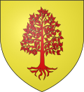 |
Blazon: Or, an alder tree eradicated of Gules.
|
Administration[]
This list is incomplete; you can help by . (April 2021) |
List of Successive Mayors[5]
| From | To | Name |
|---|---|---|
| 2001 | 2008 | Lucien Faure |
| 2008 | 2014 | Jean Séguéla |
| 2014 | 2020 | Henri Vaquer |
| 2020 | 2026 | Christophe Piquemal |
Demography[]
In 2017 the commune had 67 inhabitants.
|
| ||||||||||||||||||||||||||||||||||||||||||||||||||||||||||||||||||||||||||||||||||||||||||||||||||||||||||||||||||
| Source: EHESS[6] and INSEE[7] | |||||||||||||||||||||||||||||||||||||||||||||||||||||||||||||||||||||||||||||||||||||||||||||||||||||||||||||||||||
Notable people linked to the commune[]
The paternal side of Edgar Faure originated from this commune for many generations before 1850.
See also[]
- Communes of the Aude department
References[]
- ^ "Répertoire national des élus: les maires". data.gouv.fr, Plateforme ouverte des données publiques françaises (in French). 2 December 2020.
- ^ "Populations légales 2018". INSEE. 28 December 2020.
- ^ Inhabitants of Aude (in French)
- ^ Jump up to: a b c Google Maps
- ^ List of Mayors of France (in French)
- ^ Des villages de Cassini aux communes d'aujourd'hui: Commune data sheet Aunat, EHESS. (in French)
- ^ Population en historique depuis 1968, INSEE
External links[]
- Aunat on the old IGN website (in French)
- Aunat on Géoportail, National Geographic Institute (IGN) website (in French)
- Aunat on the 1750 Cassini Map
| Wikimedia Commons has media related to Aunat. |
| show Communes of the Aude department |
|---|
- Communes of Aude