Aurora, Nebraska
Aurora, Nebraska | |
|---|---|
City | |
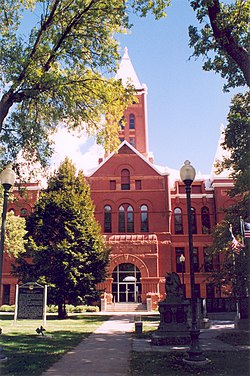 Hamilton County courthouse in Aurora | |
 Location of Aurora, Nebraska | |
| Coordinates: 40°52′0″N 98°0′13″W / 40.86667°N 98.00361°WCoordinates: 40°52′0″N 98°0′13″W / 40.86667°N 98.00361°W | |
| Country | United States |
| State | Nebraska |
| County | Hamilton |
| Incorporated | July 3, 1877 |
| Government | |
| • Type | Council/Mayor |
| • Mayor | Marlin Seeman |
| Area | |
| • Total | 3.05 sq mi (7.91 km2) |
| • Land | 3.04 sq mi (7.89 km2) |
| • Water | 0.01 sq mi (0.02 km2) |
| Elevation | 1,791 ft (546 m) |
| Population | |
| • Total | 4,479 |
| • Estimate (2019)[3] | 4,547 |
| • Density | 1,493.27/sq mi (576.59/km2) |
| Time zone | UTC-6 (Central (CST)) |
| • Summer (DST) | UTC-5 (CDT) |
| ZIP code | 68818 |
| Area code(s) | 402 |
| FIPS code | 31-02690 |
| GNIS feature ID | 0827118[4] |
| Website | http://www.cityofaurora.org/ |

Aurora is a city in Hamilton County, Nebraska, United States. The population was 4,479 at the 2010 census. It is the county seat of Hamilton County.[5]
History[]
In 1861, David Millspaw became the first permanent settler in the area of what was to become Aurora. Hamilton County was formed in 1870.[6]
Aurora was laid out as a town in 1871 by David Stone who named it after his former hometown of Aurora, Illinois.[7][8] The county seat was transferred from Orville City (an extinct town) to Aurora in 1876.[7]
Geography[]
Aurora is located at 40°52′00″N 98°00′13″W / 40.866716°N 98.003537°W (40.866716, −98.003537).[9] According to the United States Census Bureau, the city has a total area of 2.91 square miles (7.54 km2), of which 2.90 square miles (7.51 km2) is land and 0.01 square miles (0.03 km2) is water.[10] The average precipitation per year in Hamilton County during the years 1971 to 2000 was between 26 and 30 inches (660 and 760 mm).[11]
Demographics[]
| Historical population | |||
|---|---|---|---|
| Census | Pop. | %± | |
| 1890 | 1,862 | — | |
| 1900 | 1,921 | 3.2% | |
| 1910 | 2,630 | 36.9% | |
| 1920 | 2,962 | 12.6% | |
| 1930 | 2,715 | −8.3% | |
| 1940 | 2,419 | −10.9% | |
| 1950 | 2,455 | 1.5% | |
| 1960 | 2,576 | 4.9% | |
| 1970 | 3,180 | 23.4% | |
| 1980 | 3,717 | 16.9% | |
| 1990 | 3,810 | 2.5% | |
| 2000 | 4,225 | 10.9% | |
| 2010 | 4,479 | 6.0% | |
| 2019 (est.) | 4,547 | [3] | 1.5% |
| U.S. Decennial Census[12] 2012 Estimate[13] | |||
2010 census[]
At the 2010 census,[2] there were 4,479 people, 1,781 households and 1,199 families in the city. The population density was 1,544.5 inhabitants per square mile (596.3/km2). There were 1,939 housing units at an average density of 668.6 per square mile (258.1/km2). The racial makeup of the city was 97.7% White, 0.4% African American, 0.2% Native American, 0.2% Asian, 0.7% from other races, and 0.8% from two or more races. Hispanic or Latino of any race were 2.4% of the population.
There were 1,781 households, of which 33.7% had children under the age of 18 living with them, 55.7% were married couples living together, 8.5% had a female householder with no husband present, 3.1% had a male householder with no wife present, and 32.7% were non-families. 29.1% of all households were made up of individuals, and 15.3% had someone living alone who was 65 years of age or older. The average household size was 2.45 and the average family size was 3.00.
The median age in the city was 40.4 years. 26.5% of residents were under the age of 18; 5.7% were between the ages of 18 and 24; 23.3% were from 25 to 44; 25.7% were from 45 to 64; and 18.7% were 65 years of age or older. The gender makeup of the city was 48.4% male and 51.6% female.
2000 census[]
At the 2000 census, there were 4,225 people, 1,662 households and 1,163 families residing in the city. The population density was 2,243.0 per square mile (867.7/km2). There were 1,798 housing units at an average density of 954.5 per square mile (369.3/km2). The racial makeup of the city was 97.92% White, 0.19% African American, 0.05% Native American, 0.43% Asian, 0.57% from other races, and 0.85% from two or more races. Hispanic or Latino of any race were 1.56% of the population.
There were 1,662 households, of which 34.9% had children under the age of 18 living with them, 59.3% were married couples living together, 7.8% had a female householder with no husband present, and 30.0% were non-families. 27.1% of all households were made up of individuals, and 14.1% had someone living alone who was 65 years of age or older. The average household size was 2.45 and the average family size was 2.98.
27.4% of the population were under the age of 18, 6.2% from 18 to 24, 25.7% from 25 to 44, 20.9% from 45 to 64, and 19.7% who were 65 years of age or older. The median age was 39 years. For every 100 females, there were 90.8 males. For every 100 females age 18 and over, there were 84.6 males.
The median household income was $37,690 and the median family income was $43,884. Males had a median income of $29,162 compared with $20,484 for females. The per capita income for the city was $17,309. About 6.1% of families and 6.2% of the population were below the poverty line, including 7.4% of those under age 18 and 5.4% of those age 65 or over.
Education[]
Public schools[]
Aurora is served by Aurora Public Schools
- (grades 9 though 12)[14]
- Aurora Middle School (grades 6 through 8)
- Aurora Elementary School (grades PreK through 5)
Media[]
Radio[]
- KRGY 97.3FM
Newspaper[]
- Aurora News-Register
Notable people[]
- Silas Reynolds Barton — U.S. Representative from Nebraska
- Harold Eugene Edgerton — inventor of the strobe light
- Eugene Jerome Hainer — U.S. Representative from Nebraska
- Bob Kremer — Nebraska state senator
- Tom Kropp - Professional basketball player
- Clarence Mitchell — Major League Baseball player[15][16]
- Terese Nielsen — freelance fantasy artist
- Ron Spencer — artist for Magic: The Gathering
- Harry Scott Smith - entomologist and educator
- William Ledyard Stark — populist politician
- Marion Van Berg - thoroughbred trainer in Racing Hall of Fame
References[]
- ^ "2019 U.S. Gazetteer Files". United States Census Bureau. Retrieved July 26, 2020.
- ^ Jump up to: a b "U.S. Census website". United States Census Bureau. Retrieved June 24, 2012.
- ^ Jump up to: a b "Population and Housing Unit Estimates". United States Census Bureau. May 24, 2020. Retrieved May 27, 2020.
- ^ "US Board on Geographic Names". United States Geological Survey. October 25, 2007. Retrieved January 31, 2008.
- ^ "Find a County". National Association of Counties. Archived from the original on May 31, 2011. Retrieved 2011-06-07.
- ^ Nebraska State Historical Society (June 4, 2004). "The Hamilton County Courthouse". Retrieved September 11, 2009.
- ^ Jump up to: a b "Aurora, Hamilton County". Center for Advanced Land Management Information Technologies. University of Nebraska. Retrieved August 10, 2014.
- ^ Fitzpatrick, Lillian L. (1960). Nebraska Place-Names. University of Nebraska Press. p. 71. ISBN 0-8032-5060-6.
- ^ "US Gazetteer files: 2010, 2000, and 1990". United States Census Bureau. February 12, 2011. Retrieved April 23, 2011.
- ^ "US Gazetteer files 2010". United States Census Bureau. Archived from the original on January 12, 2012. Retrieved 2012-06-24.
- ^ PRISM Group and Oregon Climate Service, Oregon State University (2006). "Average Annual Precipitation, 1971–2000, Nebraska". Archived from the original on June 23, 2010. Retrieved July 16, 2010.
- ^ United States Census Bureau. "Census of Population and Housing". Retrieved October 18, 2013.
- ^ "Annual Estimates of the Resident Population: April 1, 2010 to July 1, 2012". Archived from the original on October 19, 2013. Retrieved October 18, 2013.
- ^ https://ahs.aurorahuskies.org/
- ^ "Clarence Mitchell Baseball Field Aurora, Nebraska". Retrieved October 16, 2010.
- ^ "Clarence Mitchell Stats". Baseball Almanac. Retrieved September 15, 2009.
External links[]
| hide Municipalities and communities of Hamilton County, Nebraska, United States | ||
|---|---|---|
| City | ||
| Villages | ||
| CDP | ||
| ||
| Authority control |
|
|---|
- Cities in Nebraska
- Cities in Hamilton County, Nebraska
- County seats in Nebraska