Hamilton County, Nebraska
Hamilton County | |
|---|---|
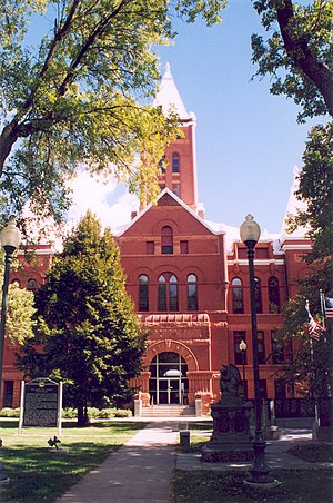 Hamilton County courthouse in Aurora | |
 Location within the U.S. state of Nebraska | |
 Nebraska's location within the U.S. | |
| Coordinates: 40°53′N 98°01′W / 40.88°N 98.02°W | |
| Country | |
| State | |
| Founded | 1867 (created) 1870 (organized) |
| Named for | Alexander Hamilton |
| Seat | Aurora |
| Largest city | Aurora |
| Area | |
| • Total | 547 sq mi (1,420 km2) |
| • Land | 544 sq mi (1,410 km2) |
| • Water | 4.1 sq mi (11 km2) 0.8%% |
| Population | |
| • Estimate (2018) | 9,280 |
| • Density | 16.9/sq mi (6.5/km2) |
| Time zone | UTC−6 (Central) |
| • Summer (DST) | UTC−5 (CDT) |
| Congressional district | 3rd |
| Website | www |
Hamilton County is a county in the U.S. state Nebraska. As of the 2010 United States Census, the population was 9,124.[1] Its county seat is Aurora.[2] The county was named for Alexander Hamilton, the first Secretary of the Treasury in the new United States government.
Hamilton County is included in the Grand Island, NE Metropolitan Statistical Area.
In the Nebraska license plate system, Hamilton County is represented by the prefix 28 (it had the 28th-largest number of vehicles registered in the county when the license plate system was established in 1922).
History[]
The first permanent settlers arrived in Hamilton County in 1866.[3] Hamilton County was created in 1867,[4] and was organized in 1870.[5][6] It was named for Alexander Hamilton.[7]
Geography[]
The Platte River flows northeastward along the northwest side of Hamilton County, forming the northwestern boundary line with Merrick County.
According to the U.S. Census Bureau, the county has a total area of 547 square miles (1,420 km2), of which 543 square miles (1,410 km2) is land and 4.1 square miles (11 km2) (0.8%) is water.[8]
Major highways[]
Adjacent counties[]
- Polk County – northeast
- York County – east
- Clay County – south
- Adams County – southwest
- Hall County – west
- Merrick County – north
Protected areas[]
- Gadwall State Wildlife Management Area[9]
- Nelson Federal Waterfowl Production Area[10]
- Pintail State Wildlife Management Area[11]
- Rainwater Basin Wildlife Management District[12]
- Springer Federal Waterfowl Production Area[13]
- Troester Federal Waterfowl Production Area[14]
- Deep Well State Wildlife Management Area[15]
Demographics[]
| Historical population | |||
|---|---|---|---|
| Census | Pop. | %± | |
| 1870 | 130 | — | |
| 1880 | 8,267 | 6,259.2% | |
| 1890 | 14,096 | 70.5% | |
| 1900 | 13,330 | −5.4% | |
| 1910 | 13,459 | 1.0% | |
| 1920 | 13,237 | −1.6% | |
| 1930 | 12,159 | −8.1% | |
| 1940 | 9,982 | −17.9% | |
| 1950 | 8,778 | −12.1% | |
| 1960 | 8,714 | −0.7% | |
| 1970 | 8,867 | 1.8% | |
| 1980 | 9,301 | 4.9% | |
| 1990 | 8,862 | −4.7% | |
| 2000 | 9,403 | 6.1% | |
| 2010 | 9,124 | −3.0% | |
| 2018 (est.) | 9,280 | [16] | 1.7% |
| US Decennial Census[17] 1790-1960[18] 1900-1990[19] 1990-2000[20] 2010-2013[1] | |||
As of the 2000 United States Census,[21] there were 9,403 people, 3,503 households, and 2,676 families residing in the county. The population density was 17 people per square mile (7/km2). There were 3,850 housing units at an average density of 7 per square mile (3/km2). The racial makeup of the county was 98.43% White, 0.18% Black or African American, 0.12% Native American, 0.22% Asian, 0.49% from other races, and 0.56% from two or more races. 1.14% of the population were Hispanic or Latino of any race.
There were 3,503 households, out of which 37.30% had children under the age of 18 living with them, 67.40% were married couples living together, 5.90% had a female householder with no husband present, and 23.60% were non-families. 21.10% of all households were made up of individuals, and 10.10% had someone living alone who was 65 years of age or older. The average household size was 2.64 and the average family size was 3.07.
The county population contained 29.10% under the age of 18, 5.90% from 18 to 24, 26.50% from 25 to 44, 23.20% from 45 to 64, and 15.30% who were 65 years of age or older. The median age was 38 years. For every 100 females there were 99.40 males. For every 100 females age 18 and over, there were 96.10 males.
The median income for a household in the county was $40,277, and the median income for a family was $45,659. Males had a median income of $29,238 versus $20,308 for females. The per capita income for the county was $17,590. About 5.90% of families and 7.50% of the population were below the poverty line, including 9.80% of those under age 18 and 5.40% of those age 65 or over.
Communities[]
City[]
- Aurora (county seat)
Villages[]
Census-designated place[]
Politics[]
Hamilton County voters have long been reliably Republican. In only one national election since 1916 has the county selected the Democratic Party candidate.
| Year | Republican | Democratic | Third Parties |
|---|---|---|---|
| 2020 | 77.4% 4,309 | 20.1% 1,118 | 2.5% 139 |
| 2016 | 75.6% 3,783 | 17.6% 878 | 6.9% 343 |
| 2012 | 73.9% 3,600 | 23.5% 1,146 | 2.6% 125 |
| 2008 | 70.6% 3,389 | 27.8% 1,332 | 1.6% 78 |
| 2004 | 77.8% 3,785 | 20.8% 1,012 | 1.4% 69 |
| 2000 | 72.4% 3,251 | 23.7% 1,066 | 3.9% 174 |
| 1996 | 61.4% 2,623 | 27.4% 1,172 | 11.2% 479 |
| 1992 | 51.7% 2,388 | 21.5% 994 | 26.7% 1,235 |
| 1988 | 69.7% 3,022 | 29.7% 1,289 | 0.5% 23 |
| 1984 | 79.8% 3,418 | 19.7% 842 | 0.6% 25 |
| 1980 | 74.9% 3,200 | 18.2% 778 | 6.9% 293 |
| 1976 | 65.5% 2,737 | 32.0% 1,337 | 2.6% 107 |
| 1972 | 76.6% 2,960 | 23.5% 907 | |
| 1968 | 70.9% 2,592 | 25.1% 918 | 3.9% 144 |
| 1964 | 52.7% 2,105 | 47.3% 1,886 | |
| 1960 | 72.7% 3,249 | 27.4% 1,223 | |
| 1956 | 75.0% 3,217 | 25.1% 1,075 | |
| 1952 | 76.0% 3,579 | 24.0% 1,130 | |
| 1948 | 61.5% 2,406 | 38.5% 1,509 | |
| 1944 | 69.7% 3,057 | 30.3% 1,330 | |
| 1940 | 66.4% 3,286 | 33.6% 1,666 | |
| 1936 | 50.4% 2,748 | 48.7% 2,653 | 0.9% 48 |
| 1932 | 39.7% 2,003 | 58.8% 2,969 | 1.6% 79 |
| 1928 | 68.8% 3,634 | 30.4% 1,606 | 0.8% 44 |
| 1924 | 56.1% 2,935 | 29.5% 1,545 | 14.3% 750 |
| 1920 | 66.9% 2,950 | 30.8% 1,356 | 2.4% 104 |
| 1916 | 43.2% 1,444 | 54.3% 1,816 | 2.6% 86 |
| 1912 | 14.6% 450 | 46.4% 1,433 | 39.0% 1,205 |
| 1908 | 47.4% 1,633 | 48.3% 1,664 | 4.4% 151 |
| 1904 | 61.4% 1,845 | 18.3% 551 | 20.3% 610 |
| 1900 | 47.9% 1,524 | 49.3% 1,571 | 2.8% 90 |
See also[]
- National Register of Historic Places listings in Hamilton County, Nebraska
References[]
- ^ a b "State & County QuickFacts". US Census Bureau. Archived from the original on June 7, 2011. Retrieved September 20, 2013.
- ^ "Find a County". National Association of Counties. Retrieved 7 June 2011.
- ^ Burr, George L. (1921). History of Hamilton and Clay Counties, Nebraska, Vol. 1. S.J. Clarke Pub. Co. p. 116.
- ^ Fitzpatrick, Lilian Linder (1925). Nebraska Place-Names. Lincoln: University of Nebraska Studies in Language, Literature, and Criticism. p. 70. Retrieved December 15, 2014.
- ^ "Hamilton County Nebraska Historic Buildings Survey" (PDF). Nebraska State Historical Society. July 2009. Retrieved December 15, 2014.
- ^ Andreas, A. T. (1882). "Andreas' History of the State of Nebraska". The Kansas Collection. Archived from the original on 2003-05-08. Retrieved December 15, 2014.
- ^ "Archived copy". Archived from the original on 19 August 2008. Retrieved 9 March 2010.CS1 maint: archived copy as title (link) Retrieved on March 15, 2008.
- ^ "2010 Census Gazetteer Files". United States Census Bureau. August 22, 2012. Archived from the original on November 13, 2013. Retrieved December 8, 2014.
- ^ Gadwall State Wildlife Management Area, Aurora NE Google Maps (accessed 21 January 2019)
- ^ Nelson Federal Waterfowl Production Area, Aurora NE Google Maps (accessed 21 January 2019)
- ^ Pintail State Wildlife Management Area, Aurora NE Google Maps (accessed 21 January 2019)
- ^ Rainwater Basin Wildlife Management District, Aurora NE Google Maps (accessed 21 January 2019)
- ^ Springer Federal Waterfowl Production Area, Aurota NE Google Maps (accessed 21 January 2019)
- ^ Troester Federal Waterfowl Production Area, Aurora NE Google Maps (accessed 21 January 2019)
- ^ Deep Well State Wildlife Management Area, Phillips NE Google Maps (accessed 21 January 2019)
- ^ "Population and Housing Unit Estimates". Retrieved December 26, 2019.
- ^ "US Decennial Census". US Census Bureau. Retrieved December 8, 2014.
- ^ "Historical Census Browser". University of Virginia Library. Retrieved December 8, 2014.
- ^ "Population of Counties by Decennial Census: 1900 to 1990". US Census Bureau. Retrieved December 8, 2014.
- ^ "Census 2000 PHC-T-4. Ranking Tables for Counties: 1990 and 2000" (PDF). US Census Bureau. Retrieved December 8, 2014.
- ^ "U.S. Census website". US Census Bureau. Retrieved 31 January 2008.
- ^ Election Results
External links[]
Places adjacent to Hamilton County, Nebraska | ||||||||||
|---|---|---|---|---|---|---|---|---|---|---|
| ||||||||||
Municipalities and communities of Hamilton County, Nebraska, United States | ||
|---|---|---|
| City | ||
| Villages | ||
| CDP | ||
| ||
Lincoln (capital) | ||
| Topics |
| |
| Society | ||
| Regions | ||
| Largest cities | ||
| Counties |
| |

Authority control | |
|---|---|
| General | |
| National libraries | |
- Nebraska counties
- Hamilton County, Nebraska
- 1870 establishments in Nebraska
- Populated places established in 1870